TopoQuest Logo
Do you find TopoQuest useful?
Help keep TopoQuest running and adding new maps/features by donating!
Bitcoin:  19c7KJd3qBynnjoSw5npx9KScwjBe4ifkT
Litecoin:  LXs6TkuXGGXo1vDsWCkWVdjQX94eUKd6ui
Home View Maps Find Maps Find Places Resources & Links


Grouse Mountain, New Mexico Topographic Map

USGS Map Title: Grouse Mountain, NM
USGS Map MRC: 33108C6
DRG (GeoTIFF) Download: o33108c6.tif


Neighboring USGS Topographic Map Quads:


  Mogollon, NM  
33108D7
 

  Bearwallow Mountain, NM  
33108D6
 

  Negrito Mountain, NM  
33108D5
 

  Holt Mountain, NM  
33108C7
 

  Grouse Mountain, NM  
33108C6
 

  Mogollon Baldy Peak, NM  
33108C5
 

  Moon Ranch, NM  
33108B7
 

  Rice Ranch, NM  
33108B6
 

  Shelley Peak, NM  
33108B5


Map MRC Location:

N34°
W109°
N34°
W108°
H8 H7 H6 H5 H4 H3 H2 H1
G8 G7 G6 G5 G4 G3 G2 G1
F8 F7 F6 F5 F4 F3 F2 F1
E8 E7 E6 E5 E4 E3 E2 E1
D8 D7 D6 D5 D4 D3 D2 D1
C8 C7 C6 C5 C4 C3 C2 C1
B8 B7 B6 B5 B4 B3 B2 B1
A8 A7 A6 A5 A4 A3 A2 A1
N33°
W109°
N33°
W108°

Grouse Mountain, NM USGS 1:24K Topographic Map Preview:
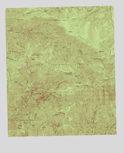
Grouse Mountain, NM USGS Topographic Map
Click on map above to begin viewing in our Map Viewer.

This topographic map contains these locations and features:
Feature Name Type Latitude Longitude GNIS ID View Map
Apache CabinLocaleN33.2984°W108.6598°903211View Map
Apache SpringSpringN33.2984°W108.6592°912694View Map
Bead SpringSpringN33.3628°W108.6737°903617View Map
Black MountainSummitN33.2978°W108.6709°903878View Map
Black Mountain SpringSpringN33.3007°W108.6651°903887View Map
Bursum Recreation SiteLocaleN33.3690°W108.6767°912680View Map
California ParkFlatN33.2884°W108.6895°904304View Map
Camp CreekStreamN33.2978°W108.7287°904315View Map
Camp Creek SaddleGapN33.3123°W108.7431°912683View Map
Center BaldySummitN33.3031°W108.6387°904896View Map
Cold SpringSpringN33.3687°W108.6862°912685View Map
Deer Trail TunnelMineN33.2667°W108.7339°917302View Map
Deloche Trail ProspectsMineN33.3334°W108.7339°917303View Map
Dog CanyonValleyN33.2623°W108.7278°905795View Map
Dog SpringSpringN33.2641°W108.7302°905802View Map
East Fork TrailTrailN33.3278°W108.7362°905972View Map
Gold BarMineN33.2667°W108.7173°916809View Map
Golden Link CabinLocaleN33.2912°W108.7131°906622View Map
Golden Link TrailTrailN33.2895°W108.6806°906623View Map
Grouse MountainSummitN33.3290°W108.7162°906751View Map
Hanging Rock TrailTrailN33.2748°W108.7251°906821View Map
Hobo SpringSpringN33.2923°W108.6267°912692View Map
Hummingbird SaddleGapN33.3306°W108.6439°907166View Map
Hummingbird SpringSpringN33.3299°W108.6454°912693View Map
Indian PeakSummitN33.3106°W108.6781°912686View Map
Kings CrownSummitN33.2609°W108.7370°907557View Map
Kirkpatrick ProspectMineN33.3084°W108.7131°917482View Map
Lipsey CanyonValleyN33.3395°W108.6937°907980View Map
Maverick ProspectMineN33.2503°W108.7292°917229View Map
Mountain View ClaimMineN33.2834°W108.7339°917232View Map
Nabours SpringSpringN33.3247°W108.7211°909005View Map
New Eureka AditMineN33.2626°W108.7334°917233View Map
Packsaddle CanyonValleyN33.2684°W108.7195°909427View Map
Pilgrim Camp ProspectsMineN33.2667°W108.7339°917236View Map
Quartz Number One ProspectMineN33.2915°W108.7262°917240View Map
Quartz Number ProspectMineN33.2906°W108.7284°916776View Map
Queens CrownSummitN33.2581°W108.7384°909927View Map
Rain Creek Divide TrailTrailN33.2734°W108.6437°909963View Map
Rainstorm CanyonValleyN33.2640°W108.7259°909966View Map
Rainstorm Gulch WorkingMineN33.2667°W108.7214°916778View Map
Redstone ParkFlatN33.3353°W108.6853°910102View Map
Regal AditMineN33.2612°W108.7301°917050View Map
Rock SpringSpringN33.3117°W108.7431°912688View Map
Royal Gorge ClaimMineN33.2917°W108.7173°917258View Map
Sacaton MountainSummitN33.2720°W108.6881°910501View Map
Sacaton Mountain TrailTrailN33.2820°W108.6731°910502View Map
Sandy PointCapeN33.3737°W108.6859°910764View Map
Silver Creek DivideGapN33.3709°W108.7062°911067View Map
Silver Drip TrailTrailN33.2820°W108.7101°911071View Map
Simmons SaddleGapN33.2703°W108.6962°911085View Map
Skeleton Ridge TrailTrailN33.3323°W108.7423°911114View Map
Spider CreekStreamN33.2887°W108.7264°911303View Map
Spider SaddleGapN33.3287°W108.7320°912684View Map
Spruce CreekStreamN33.2887°W108.7209°911349View Map
Spruce Creek CabinLocaleN33.2945°W108.7223°911350View Map
Spruce Creek SaddleGapN33.3081°W108.6689°912687View Map
Spruce Creek WorkingsMineN33.3001°W108.6839°917035View Map
Uncle John MineMineN33.2501°W108.7006°917301View Map
Upper Big Dry Creek ProspectsMineN33.2834°W108.6839°917259View Map
Upper Little Dry Creek WorkingMineN33.2626°W108.7298°917487View Map
West BaldySummitN33.2587°W108.7117°912219View Map
Western Big Dry Creek PropertyMineN33.2834°W108.7173°917043View Map
Whitewater BaldySummitN33.3237°W108.6417°912345View Map
Willow MountainSummitN33.3508°W108.6777°912412View Map
Windy GapGapN33.2715°W108.7259°912460View Map
Windy PointSummitN33.2776°W108.7095°912464View Map
Winn CanyonValleyN33.3526°W108.7445°912466View Map

Note: Coordinates in the location and feature list above are referenced to NAD83 datum.


Copyright (C) 2008-2025 Ryan Niemi / Sunset Dynamics ... All Rights Reserved