TopoQuest Logo
Do you find TopoQuest useful?
Help keep TopoQuest running and adding new maps/features by donating!
Bitcoin:  19c7KJd3qBynnjoSw5npx9KScwjBe4ifkT
Litecoin:  LXs6TkuXGGXo1vDsWCkWVdjQX94eUKd6ui
Home View Maps Find Maps Find Places Resources & Links


Bearwallow Mountain, New Mexico Topographic Map

USGS Map Title: Bearwallow Mountain, NM
USGS Map MRC: 33108D6
DRG (GeoTIFF) Download: o33108d6.tif


Neighboring USGS Topographic Map Quads:


  O Block Canyon, NM  
33108E7
 

  Sign Camp Mountain, NM  
33108E6
 

  Telephone Canyon, NM  
33108E5
 

  Mogollon, NM  
33108D7
 

  Bearwallow Mountain, NM  
33108D6
 

  Negrito Mountain, NM  
33108D5
 

  Holt Mountain, NM  
33108C7
 

  Grouse Mountain, NM  
33108C6
 

  Mogollon Baldy Peak, NM  
33108C5


Map MRC Location:

N34°
W109°
N34°
W108°
H8 H7 H6 H5 H4 H3 H2 H1
G8 G7 G6 G5 G4 G3 G2 G1
F8 F7 F6 F5 F4 F3 F2 F1
E8 E7 E6 E5 E4 E3 E2 E1
D8 D7 D6 D5 D4 D3 D2 D1
C8 C7 C6 C5 C4 C3 C2 C1
B8 B7 B6 B5 B4 B3 B2 B1
A8 A7 A6 A5 A4 A3 A2 A1
N33°
W109°
N33°
W108°

Bearwallow Mountain, NM USGS 1:24K Topographic Map Preview:
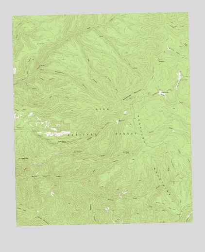
Bearwallow Mountain, NM USGS Topographic Map
Click on map above to begin viewing in our Map Viewer.

This topographic map contains these locations and features:
Feature Name Type Latitude Longitude GNIS ID View Map
Bear CanyonValleyN33.4009°W108.7112°903623View Map
Bear Canyon SpringSpringN33.4171°W108.6695°903645View Map
Bearwallow CreekStreamN33.4045°W108.7264°903700View Map
Bearwallow LookoutLocaleN33.4495°W108.6684°912689View Map
Bearwallow MountainSummitN33.4495°W108.6687°923556View Map
Bearwallow ParkParkN33.4365°W108.6767°903701View Map
Bill Lewis CienegaFlatN33.4473°W108.6331°903824View Map
Bill Lewis TankReservoirN33.4598°W108.6330°903825View Map
BS CanyonValleyN33.4881°W108.7056°903479View Map
BS Canyon TrailTrailN33.4576°W108.6795°903480View Map
Bull Pasture TankReservoirN33.4962°W108.6852°912691View Map
Cooney PeakSummitN33.4151°W108.7464°905309View Map
Corner MountainSummitN33.4717°W108.6481°905346View Map
Corner Mountain TrailTrailN33.4690°W108.6498°905347View Map
Corral CanyonValleyN33.4617°W108.7426°905365View Map
D-K WellWellN33.4851°W108.7134°905575View Map
Gooseberry CanyonValleyN33.4681°W108.7326°906653View Map
Hogwallow Pit TankReservoirN33.4802°W108.6410°912690View Map
Indian TankReservoirN33.4153°W108.6335°912699View Map
Lost Lake CanyonValleyN33.4623°W108.7387°908246View Map
Lost Lake Mountain TankReservoirN33.4832°W108.7338°908248View Map
Mineral Creek TrailTrailN33.3853°W108.6437°908789View Map
North Fork Mineral CreekStreamN33.3912°W108.6595°909146View Map
Old Waterman PlaceLocaleN33.4315°W108.7384°909348View Map
Savage CanyonValleyN33.4656°W108.7345°910827View Map
South Fork Mineral CreekStreamN33.3912°W108.6595°911236View Map
Spring MountainSummitN33.3798°W108.7356°911336View Map
Stub TrailTrailN33.4723°W108.6717°911454View Map
Trailer CabinLocaleN33.4048°W108.7317°912700View Map
Turkey CienegaFlatN33.4526°W108.6462°911865View Map
Turkey SpringSpringN33.4244°W108.7144°911895View Map
Whitetail CanyonValleyN33.3926°W108.6956°912336View Map

Note: Coordinates in the location and feature list above are referenced to NAD83 datum.


Copyright (C) 2008-2025 Ryan Niemi / Sunset Dynamics ... All Rights Reserved