TopoQuest Logo
Do you find TopoQuest useful?
Help keep TopoQuest running and adding new maps/features by donating!
Bitcoin:  19c7KJd3qBynnjoSw5npx9KScwjBe4ifkT
Litecoin:  LXs6TkuXGGXo1vDsWCkWVdjQX94eUKd6ui
Home View Maps Find Maps Find Places Resources & Links


Shelley Peak, New Mexico Topographic Map

USGS Map Title: Shelley Peak, NM
USGS Map MRC: 33108B5
DRG (GeoTIFF) Download: o33108b5.tif


Neighboring USGS Topographic Map Quads:


  Grouse Mountain, NM  
33108C6
 

  Mogollon Baldy Peak, NM  
33108C5
 

  Lilley Mountain, NM  
33108C4
 

  Rice Ranch, NM  
33108B6
 

  Shelley Peak, NM  
33108B5
 

  Diablo Range, NM  
33108B4
 

  Buckhorn, NM  
33108A6
 

  Canteen Canyon, NM  
33108A5
 

  Canyon Hill, NM  
33108A4


Map MRC Location:

N34°
W109°
N34°
W108°
H8 H7 H6 H5 H4 H3 H2 H1
G8 G7 G6 G5 G4 G3 G2 G1
F8 F7 F6 F5 F4 F3 F2 F1
E8 E7 E6 E5 E4 E3 E2 E1
D8 D7 D6 D5 D4 D3 D2 D1
C8 C7 C6 C5 C4 C3 C2 C1
B8 B7 B6 B5 B4 B3 B2 B1
A8 A7 A6 A5 A4 A3 A2 A1
N33°
W109°
N33°
W108°

Shelley Peak, NM USGS 1:24K Topographic Map Preview:
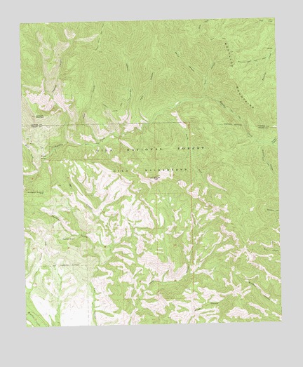
Shelley Peak, NM USGS Topographic Map
Click on map above to begin viewing in our Map Viewer.

This topographic map contains these locations and features:
Feature Name Type Latitude Longitude GNIS ID View Map
Buds HoleBasinN33.1948°W108.6153°904158View Map
Corral CanyonValleyN33.2251°W108.5359°905364View Map
Deadman CanyonValleyN33.1501°W108.5895°920583View Map
Deadman TankReservoirN33.1611°W108.6073°905647View Map
Gobbler CanyonValleyN33.2042°W108.5764°906598View Map
Judy CanyonValleyN33.2073°W108.5634°907478View Map
Lookout CanyonValleyN33.2006°W108.6037°908175View Map
Lookout Canyon TrailTrailN33.2442°W108.5862°908176View Map
Lookout MountainSummitN33.2117°W108.6189°908179View Map
Mogollon Creek TrailTrailN33.1615°W108.6148°908823View Map
Mogollon MountainsRangeN33.2253°W108.5214°920650View Map
Seventy Four Mountain ProspectMineN33.1709°W108.6214°921060View Map
Seventyfour Mountain TankReservoirN33.1802°W108.6155°910965View Map
Shelley PeakSummitN33.1851°W108.5617°911000View Map
South Fork Mogollow CreekStreamN33.2115°W108.5584°911237View Map
Tepee CanyonValleyN33.2001°W108.5884°911610View Map
Trail CanyonValleyN33.2178°W108.5362°911776View Map
Turnbo CanyonValleyN33.1981°W108.5034°911913View Map
West Fork Mogollon CreekStreamN33.1901°W108.6184°912236View Map
West Fork TrailTrailN33.1987°W108.6139°912244View Map
Woodrow CanyonValleyN33.1984°W108.5076°912492View Map

Note: Coordinates in the location and feature list above are referenced to NAD83 datum.


Copyright (C) 2008-2024 Ryan Niemi / Sunset Dynamics ... All Rights Reserved