TopoQuest Logo
Do you find TopoQuest useful?
Help keep TopoQuest running and adding new maps/features by donating!
Bitcoin:  19c7KJd3qBynnjoSw5npx9KScwjBe4ifkT
Litecoin:  LXs6TkuXGGXo1vDsWCkWVdjQX94eUKd6ui
Home View Maps Find Maps Find Places Resources & Links


Guilford, Maine Topographic Map

USGS Map Title: Guilford, ME
USGS Map MRC: 45069B4
DRG (GeoTIFF) Download: o45069b4.tif


Neighboring USGS Topographic Map Quads:


  Monson West, ME  
45069C5
 

  Monson East, ME  
45069C4
 

  Sebec Lake West, ME  
45069C3
 

  Whetstone Pond, ME  
45069B5
 

  Guilford, ME  
45069B4
 

  Sangerville, ME  
45069B3
 

  Wellington, ME  
45069A5
 

  Cambridge, ME  
45069A4
 

  Dexter, ME  
45069A3


Map MRC Location:

N46°
W70°
N46°
W69°
H8 H7 H6 H5 H4 H3 H2 H1
G8 G7 G6 G5 G4 G3 G2 G1
F8 F7 F6 F5 F4 F3 F2 F1
E8 E7 E6 E5 E4 E3 E2 E1
D8 D7 D6 D5 D4 D3 D2 D1
C8 C7 C6 C5 C4 C3 C2 C1
B8 B7 B6 B5 B4 B3 B2 B1
A8 A7 A6 A5 A4 A3 A2 A1
N45°
W70°
N45°
W69°

Guilford, ME USGS 1:24K Topographic Map Preview:
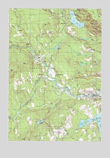
Guilford, ME USGS Topographic Map
Click on map above to begin viewing in our Map Viewer.

This topographic map contains these locations and features:
Feature Name Type Latitude Longitude GNIS ID View Map
Abbot Grade SchoolSchoolN45.1864°W69.4545°1910000View Map
Abbot Post OfficePost OfficeN45.1861°W69.4541°1910003View Map
Abbot VillagePopulated PlaceN45.1864°W69.4520°561044View Map
Abbot Village CemeteryCemeteryN45.1906°W69.4514°1910002View Map
Abbot Village StationLocaleN45.1856°W69.4331°561045View Map
Alder BrookStreamN45.1739°W69.4170°561128View Map
Bennett PondLakeN45.1429°W69.4569°562061View Map
Blanchard CemeteryCemeteryN45.1954°W69.4454°2727209View Map
Brewster BrookStreamN45.1320°W69.4195°562940View Map
Brown BrookStreamN45.1820°W69.4353°563029View Map
Brown HillSummitN45.1912°W69.4975°563052View Map
Campbell HillSummitN45.1264°W69.4760°563436View Map
Carlton StreamStreamN45.1498°W69.4853°563573View Map
Carroll L McKusick School (historical)SchoolN45.1366°W69.4295°1910029View Map
Edes BrookStreamN45.2176°W69.4281°565783View Map
Edes CornerPopulated PlaceN45.2114°W69.3875°579286View Map
Elmwood CemeteryCemeteryN45.1668°W69.3922°1910058View Map
Fairbrother BogSwampN45.2051°W69.4025°565991View Map
Faunce HillSummitN45.2347°W69.4485°566081View Map
First Davis PondReservoirN45.2387°W69.4179°566173View Map
First Davis Pond DamDamN45.2387°W69.4179°1774109View Map
French HillSummitN45.1542°W69.4145°566566View Map
French's CemeteryCemeteryN45.1507°W69.4136°2736954View Map
Gales BrookStreamN45.1720°W69.4181°566663View Map
Glass HillSummitN45.1996°W69.3784°566825View Map
Greenleaf PondLakeN45.2133°W69.4351°567299View Map
GuilfordPopulated PlaceN45.1689°W69.3845°567367View Map
Guilford Assembly of God ChurchChurchN45.1720°W69.3864°1910075View Map
Guilford Census Designated PlaceCensusN45.1734°W69.3928°2377915View Map
Guilford Fire DepartmentBuildingN45.1693°W69.3868°2553027View Map
Guilford Industries DamDamN45.1684°W69.3852°1773799View Map
Guilford Memorial LibraryBuildingN45.1697°W69.3833°1910079View Map
Guilford Post OfficePost OfficeN45.1668°W69.3846°1910080View Map
Guilford Primary School (historical)SchoolN45.1727°W69.3856°1910081View Map
Guilford Seaplane BaseAirportN45.1476°W69.3850°582157View Map
Harlow PondLakeN45.1442°W69.3906°567643View Map
Harrington SchoolSchoolN45.1714°W69.4248°567683View Map
Harvey Memorial LibraryBuildingN45.1285°W69.4385°2738467View Map
Howard BrookStreamN45.2159°W69.4320°568376View Map
Kingsbury StreamStreamN45.1803°W69.4359°569214View Map
Ladd BrookStreamN45.2123°W69.4373°569294View Map
Lawn CemeteryCemeteryN45.1653°W69.3973°1910102View Map
Lowell BrookStreamN45.1681°W69.4656°570456View Map
Manhanock PondReservoirN45.1433°W69.3780°570696View Map
McKusick CemeteryCemeteryN45.1285°W69.4646°2736958View Map
Monson JunctionPopulated PlaceN45.2153°W69.4714°579530View Map
MoosehornPopulated PlaceN45.2287°W69.4859°579536View Map
North GuilfordPopulated PlaceN45.2348°W69.4209°572343View Map
Oak HillSummitN45.2360°W69.3849°572595View Map
Old CemeteryCemeteryN45.1902°W69.4538°2727313View Map
ParkmanPopulated PlaceN45.1337°W69.4331°572997View Map
Parkman Baptist ChurchChurchN45.1326°W69.4342°1910147View Map
Parkman Corner CemeteryCemeteryN45.1325°W69.4348°1910149View Map
Pease SchoolSchoolN45.1426°W69.4864°573121View Map
Pingree Center StreamStreamN45.1373°W69.4028°573424View Map
Piscataquis Community Elementary SchoolSchoolN45.1744°W69.3785°2738228View Map
Piscataquis Community High SchoolSchoolN45.1720°W69.3780°2738072View Map
Piscataquis Community Secondary SchoolSchoolN45.1720°W69.3778°1910155View Map
Piscataquis River ReservoirReservoirN45.1684°W69.3852°1773800View Map
Pond SchoolSchoolN45.1553°W69.3945°573615View Map
Robinson BogLakeN45.1976°W69.3997°574316View Map
Second Davis PondLakeN45.2385°W69.4095°575189View Map
Town of AbbotCivilN45.1938°W69.4758°582314View Map
United Methodist ChurchChurchN45.1701°W69.3870°1910202View Map
Upper AbbotPopulated PlaceN45.2051°W69.4637°579785View Map
Walker HillSummitN45.1976°W69.4756°577794View Map

Note: Coordinates in the location and feature list above are referenced to NAD83 datum.


Copyright (C) 2008-2025 Ryan Niemi / Sunset Dynamics ... All Rights Reserved