TopoQuest Logo
Do you find TopoQuest useful?
Help keep TopoQuest running and adding new maps/features by donating!
Bitcoin:  19c7KJd3qBynnjoSw5npx9KScwjBe4ifkT
Litecoin:  LXs6TkuXGGXo1vDsWCkWVdjQX94eUKd6ui
Home View Maps Find Maps Find Places Resources & Links


Dexter, Maine Topographic Map

USGS Map Title: Dexter, ME
USGS Map MRC: 45069A3
DRG (GeoTIFF) Download: o45069a3.tif


Neighboring USGS Topographic Map Quads:


  Guilford, ME  
45069B4
 

  Sangerville, ME  
45069B3
 

  Dover-Foxcroft, ME  
45069B2
 

  Cambridge, ME  
45069A4
 

  Dexter, ME  
45069A3
 

  Garland, ME  
45069A2
 

  Hartland, ME  
44069H4
 

  Corinna, ME  
44069H3
 

  Stetson, ME  
44069H2


Map MRC Location:

N46°
W70°
N46°
W69°
H8 H7 H6 H5 H4 H3 H2 H1
G8 G7 G6 G5 G4 G3 G2 G1
F8 F7 F6 F5 F4 F3 F2 F1
E8 E7 E6 E5 E4 E3 E2 E1
D8 D7 D6 D5 D4 D3 D2 D1
C8 C7 C6 C5 C4 C3 C2 C1
B8 B7 B6 B5 B4 B3 B2 B1
A8 A7 A6 A5 A4 A3 A2 A1
N45°
W70°
N45°
W69°

Dexter, ME USGS 1:24K Topographic Map Preview:
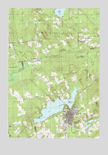
Dexter, ME USGS Topographic Map
Click on map above to begin viewing in our Map Viewer.

This topographic map contains these locations and features:
Feature Name Type Latitude Longitude GNIS ID View Map
Abbot Memorial LibraryBuildingN45.0245°W69.2893°1913294View Map
Alder BrookStreamN45.0842°W69.2903°561127View Map
Bailey CemeteryCemeteryN45.1051°W69.2729°2736943View Map
Bean HillSummitN45.1018°W69.3258°561782View Map
Brown BogSwampN45.1112°W69.3300°563026View Map
Center PondLakeN45.1239°W69.3022°563765View Map
Chandler HillSummitN45.0372°W69.3558°563825View Map
DexterPopulated PlaceN45.0239°W69.2898°565079View Map
Dexter Ambulance ServiceBuildingN45.0123°W69.2860°2666805View Map
Dexter Census Designated PlaceCensusN45.0164°W69.2946°2377902View Map
Dexter Christian AcademySchoolN45.0142°W69.2946°2738192View Map
Dexter Historical Society MuseumBuildingN45.0248°W69.2889°1913450View Map
Dexter Middle School (historical)SchoolN45.0286°W69.2943°1913451View Map
Dexter Municipal Golf CourseLocaleN45.0167°W69.3009°1913452View Map
Dexter Police DepartmentBuildingN45.0245°W69.2901°2735825View Map
Dexter Post OfficePost OfficeN45.0239°W69.2893°1913453View Map
Dexter Primary School (historical)SchoolN45.0286°W69.2949°1913454View Map
Dexter Regional High SchoolSchoolN45.0261°W69.2968°1913455View Map
Dexter Universalist ChurchChurchN45.0242°W69.2895°1913456View Map
Dexter Volunteer Fire DepartmentBuildingN45.0294°W69.2876°2552773View Map
Echo LakeReservoirN45.0170°W69.2599°573859View Map
Fay Scott BogSwampN45.0045°W69.2848°566084View Map
French Mills BrookStreamN45.0845°W69.2903°566571View Map
Frenchs Mills CemeteryCemeteryN45.0949°W69.2959°2736955View Map
Gilman CemeteryCemeteryN45.0944°W69.2684°2727305View Map
Gilman CornerPopulated PlaceN45.0964°W69.2692°579333View Map
Goff BrookStreamN45.0734°W69.3423°566866View Map
Grey BogSwampN45.1176°W69.2570°567323View Map
Hersey HillSummitN45.0341°W69.2520°567977View Map
Jackman CornerPopulated PlaceN45.0948°W69.3359°1910086View Map
Jackman Corner CemeteryCemeteryN45.0945°W69.3395°2727308View Map
Jackman Corner SchoolSchoolN45.0945°W69.3350°568723View Map
Lake WassookeagReservoirN45.0301°W69.3089°577881View Map
Lily PondLakeN45.0612°W69.2654°569581View Map
Lougee BogSwampN45.1170°W69.2806°570430View Map
Morrel FieldAirportN45.0898°W69.2638°2442709View Map
Mount Pleasant CemeteryCemeteryN45.0205°W69.2796°571779View Map
North DexterPopulated PlaceN45.0762°W69.3342°572327View Map
Puffers Pond DamDamN45.0078°W69.2682°1774189View Map
Ridge View Community SchoolSchoolN45.0118°W69.2740°2738225View Map
Snow BrookStreamN45.0612°W69.3698°575676View Map
Spooners MillPopulated PlaceN45.0076°W69.2670°576068View Map
Storer CemeteryCemeteryN45.0367°W69.3145°576414View Map
Town of DexterCivilN45.0389°W69.2819°582442View Map
Tri County Technical Center SchoolSchoolN45.0259°W69.2972°2738075View Map
Tri-County Regional Technical CenterSchoolN45.0259°W69.2967°1913935View Map
Wassookeag CampLocaleN45.0217°W69.3156°577880View Map
Wassookeag Lake DamDamN45.0258°W69.2899°1774171View Map
Wilderness Community ChurchChurchN45.0237°W69.2884°1913988View Map
Witherell IslandIslandN45.0334°W69.2887°578630View Map

Note: Coordinates in the location and feature list above are referenced to NAD83 datum.


Copyright (C) 2008-2025 Ryan Niemi / Sunset Dynamics ... All Rights Reserved