TopoQuest Logo
Do you find TopoQuest useful?
Help keep TopoQuest running and adding new maps/features by donating!
Bitcoin:  19c7KJd3qBynnjoSw5npx9KScwjBe4ifkT
Litecoin:  LXs6TkuXGGXo1vDsWCkWVdjQX94eUKd6ui
Home View Maps Find Maps Find Places Resources & Links


Hales Grove, California Topographic Map

USGS Map Title: Hales Grove, CA
USGS Map MRC: 39123G7
DRG (GeoTIFF) Download: o39123g7.tif


Neighboring USGS Topographic Map Quads:


  Bear Harbor, CA  
39123H8
 

  Piercy, CA  
39123H7
 

  Noble Butte, CA  
39123H6
 

  Mistake Point, CA  
39123G8
 

  Hales Grove, CA  
39123G7
 

  Leggett, CA  
39123G6


  Westport, CA  
39123F7
 

  Lincoln Ridge, CA  
39123F6


Map MRC Location:

N40°
W124°
N40°
W123°
H8 H7 H6 H5 H4 H3 H2 H1
G8 G7 G6 G5 G4 G3 G2 G1
F8 F7 F6 F5 F4 F3 F2 F1
E8 E7 E6 E5 E4 E3 E2 E1
D8 D7 D6 D5 D4 D3 D2 D1
C8 C7 C6 C5 C4 C3 C2 C1
B8 B7 B6 B5 B4 B3 B2 B1
A8 A7 A6 A5 A4 A3 A2 A1
N39°
W124°
N39°
W123°

Hales Grove, CA USGS 1:24K Topographic Map Preview:
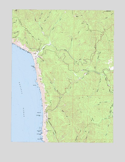
Hales Grove, CA USGS Topographic Map
Click on map above to begin viewing in our Map Viewer.

This topographic map contains these locations and features:
Feature Name Type Latitude Longitude GNIS ID View Map
Bear CreekStreamN39.7863°W123.7514°218811View Map
Bear CreekStreamN39.8629°W123.8434°218825View Map
DeVilbiss RanchLocaleN39.7721°W123.8309°222089View Map
Double Cone RockIslandN39.7749°W123.8403°222545View Map
Dunn CreekStreamN39.7927°W123.8161°222733View Map
Dutchmans FlatFlatN39.8146°W123.7856°222783View Map
Hales GrovePopulated PlaceN39.8177°W123.7822°1658697View Map
Honky Tonk Picnic AreaParkN39.7577°W123.8206°225523View Map
Hotel GulchValleyN39.8343°W123.8434°225682View Map
Julias CreekStreamN39.8354°W123.8072°226371View Map
Little Bear CreekStreamN39.8624°W123.8425°227189View Map
Middle CreekStreamN39.8152°W123.7631°228580View Map
Middle Fork Cottaneva CreekStreamN39.7827°W123.8206°228592View Map
Middle RockIslandN39.7777°W123.8392°228619View Map
Mule CreekStreamN39.8165°W123.7647°229300View Map
North Fork Cottaneva CreekStreamN39.7827°W123.8206°229655View Map
Redwood CreekStreamN39.7788°W123.7531°231426View Map
Sea Lion RockIslandN39.7602°W123.8403°253831View Map
Shady DellValleyN39.8318°W123.8456°232839View Map
Shoreline RockIslandN39.8213°W123.8484°233048View Map
Soldier CreekStreamN39.8485°W123.8311°234860View Map
Soldier Frank HillSummitN39.7604°W123.8325°234864View Map
Soldier Frank PointCapeN39.7571°W123.8381°234865View Map
South Fork Mule CreekStreamN39.8171°W123.7750°235031View Map
South Fork Redwood CreekStreamN39.7738°W123.7578°235046View Map
South Fork Usal CreekStreamN39.8415°W123.8297°235062View Map
Timber RidgeRidgeN39.8582°W123.8606°236363View Map
UsalLocaleN39.8354°W123.8436°236938View Map
Usal CampgroundLocaleN39.8346°W123.8442°1724142View Map
Usal CreekStreamN39.8324°W123.8520°236939View Map
Usal RockIslandN39.8038°W123.8453°236940View Map
Williams PointCapeN39.7524°W123.8375°237851View Map

Note: Coordinates in the location and feature list above are referenced to NAD83 datum.


Copyright (C) 2008-2025 Ryan Niemi / Sunset Dynamics ... All Rights Reserved