TopoQuest Logo
Do you find TopoQuest useful?
Help keep TopoQuest running and adding new maps/features by donating!
Bitcoin:  19c7KJd3qBynnjoSw5npx9KScwjBe4ifkT
Litecoin:  LXs6TkuXGGXo1vDsWCkWVdjQX94eUKd6ui
Home View Maps Find Maps Find Places Resources & Links


Leggett, California Topographic Map

USGS Map Title: Leggett, CA
USGS Map MRC: 39123G6
DRG (GeoTIFF) Download: o39123g6.tif


Neighboring USGS Topographic Map Quads:


  Piercy, CA  
39123H7
 

  Noble Butte, CA  
39123H6
 

  Bell Springs, CA  
39123H5
 

  Hales Grove, CA  
39123G7
 

  Leggett, CA  
39123G6
 

  Tan Oak Park, CA  
39123G5
 

  Westport, CA  
39123F7
 

  Lincoln Ridge, CA  
39123F6
 

  Cahto Peak, CA  
39123F5


Map MRC Location:

N40°
W124°
N40°
W123°
H8 H7 H6 H5 H4 H3 H2 H1
G8 G7 G6 G5 G4 G3 G2 G1
F8 F7 F6 F5 F4 F3 F2 F1
E8 E7 E6 E5 E4 E3 E2 E1
D8 D7 D6 D5 D4 D3 D2 D1
C8 C7 C6 C5 C4 C3 C2 C1
B8 B7 B6 B5 B4 B3 B2 B1
A8 A7 A6 A5 A4 A3 A2 A1
N39°
W124°
N39°
W123°

Leggett, CA USGS 1:24K Topographic Map Preview:
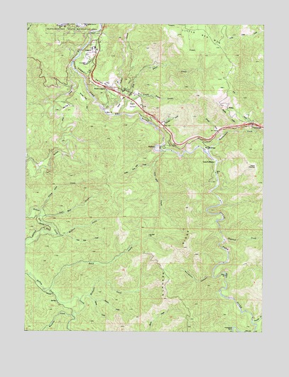
Leggett, CA USGS Topographic Map
Click on map above to begin viewing in our Map Viewer.

This topographic map contains these locations and features:
Feature Name Type Latitude Longitude GNIS ID View Map
Big BendBendN39.8243°W123.6817°219131View Map
Big Dann CreekStreamN39.8385°W123.7009°219175View Map
Big FlatFlatN39.8415°W123.7281°219184View Map
Bond CreekStreamN39.7665°W123.7384°219628View Map
Camp Saint MichaelLocaleN39.8190°W123.6514°220485View Map
Cedar CreekStreamN39.8388°W123.7084°220768View Map
Cedar FlatFlatN39.8429°W123.7011°220775View Map
Chandelier TreeLocaleN39.8582°W123.7192°220904View Map
CummingsPopulated PlaceN39.8332°W123.6320°1658357View Map
Dann ValleyFlatN39.8418°W123.6967°222010View Map
Doctors CreekStreamN39.7643°W123.7175°222447View Map
Elkhorn RidgeRidgeN39.7799°W123.6736°233845View Map
Elkhorn Ridge WildernessReserveN39.7840°W123.6524°2760100View Map
Grizzly CreekStreamN39.8333°W123.6831°2426754View Map
Hogshed CreekStreamN39.7879°W123.6461°225433View Map
Hollow Tree CreekStreamN39.8577°W123.7275°225456View Map
Horseshoe BendBendN39.7507°W123.6403°234037View Map
Islam John CreekStreamN39.7993°W123.7436°226003View Map
Laytonville-Leggett DivisionCivilN39.7874°W123.6795°1935163View Map
LeggettPopulated PlaceN39.8657°W123.7142°227007View Map
Leggett Census Designated PlaceCensusN39.8635°W123.7252°2628750View Map
Leggett Post OfficePost OfficeN39.8652°W123.7150°2760064View Map
Leggett ValleyBasinN39.8532°W123.7170°227009View Map
Leggett Valley Elementary SchoolSchoolN39.8641°W123.7169°1724102View Map
Leggett Valley High SchoolSchoolN39.8651°W123.7167°1724103View Map
Leggett Valley Volunteer Fire DepartmentBuildingN39.8500°W123.7138°2621930View Map
Little Dann CreekStreamN39.8429°W123.6986°227241View Map
Little Low Gap CreekStreamN39.8179°W123.6834°227299View Map
Little Red MountainSummitN39.8704°W123.6711°1658979View Map
Lookout TrailTrailN39.8699°W123.7331°1724108View Map
Lost Man CreekStreamN39.7968°W123.7436°227712View Map
Lost Pipe CreekStreamN39.7888°W123.7292°227717View Map
Low GapGapN39.7888°W123.6861°227744View Map
Low Gap CreekStreamN39.8232°W123.6786°227747View Map
Lynch CreekStreamN39.7640°W123.7172°227859View Map
Measly CreekStreamN39.8315°W123.6397°228473View Map
Michaels CreekStreamN39.7627°W123.7225°228565View Map
Pedro OpeningGapN39.8168°W123.6300°230463View Map
Rattlesnake CreekStreamN39.8232°W123.6564°231259View Map
Redwood Continuation High SchoolSchoolN39.8647°W123.7172°2516093View Map
Rock CreekStreamN39.8740°W123.7231°231716View Map
South LeggettPopulated PlaceN39.8485°W123.7075°1659824View Map
Squaw CreekStreamN39.8302°W123.6472°235301View Map
Surveyors CanyonValleyN39.7727°W123.6517°235831View Map
Tenmile CreekStreamN39.7549°W123.6311°236107View Map
The HermitageLocaleN39.8243°W123.6570°236177View Map
Underwood ParkPopulated PlaceN39.8599°W123.7170°1660073View Map
Waldron CreekStreamN39.7563°W123.7256°237165View Map
Walters CreekStreamN39.7890°W123.7334°237214View Map
Wilson CreekStreamN39.8321°W123.6300°237960View Map
Winkie FlatFlatN39.8446°W123.7214°238043View Map

Note: Coordinates in the location and feature list above are referenced to NAD83 datum.


Copyright (C) 2008-2025 Ryan Niemi / Sunset Dynamics ... All Rights Reserved