TopoQuest Logo
Do you find TopoQuest useful?
Help keep TopoQuest running and adding new maps/features by donating!
Bitcoin:  19c7KJd3qBynnjoSw5npx9KScwjBe4ifkT
Litecoin:  LXs6TkuXGGXo1vDsWCkWVdjQX94eUKd6ui
Home View Maps Find Maps Find Places Resources & Links


Haleyville West, Alabama Topographic Map

USGS Map Title: Haleyville West, AL
USGS Map MRC: 34087B6
DRG (GeoTIFF) Download: o34087b6.tif


Neighboring USGS Topographic Map Quads:


  Hackleburg, AL  
34087C7
 

  Phil Campbell, AL  
34087C6
 

  Kinlock Spring, AL  
34087C5
 

  Hamilton NE, AL  
34087B7
 

  Haleyville West, AL  
34087B6
 

  Haleyville East, AL  
34087B5
 

  Brilliant, AL  
34087A7
 

  Gold Mine, AL  
34087A6
 

  Lynn, AL  
34087A5


Map MRC Location:

N35°
W88°
N35°
W87°
H8 H7 H6 H5 H4 H3 H2 H1
G8 G7 G6 G5 G4 G3 G2 G1
F8 F7 F6 F5 F4 F3 F2 F1
E8 E7 E6 E5 E4 E3 E2 E1
D8 D7 D6 D5 D4 D3 D2 D1
C8 C7 C6 C5 C4 C3 C2 C1
B8 B7 B6 B5 B4 B3 B2 B1
A8 A7 A6 A5 A4 A3 A2 A1
N34°
W88°
N34°
W87°

Haleyville West, AL USGS 1:24K Topographic Map Preview:
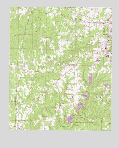
Haleyville West, AL USGS Topographic Map
Click on map above to begin viewing in our Map Viewer.

This topographic map contains these locations and features:
Feature Name Type Latitude Longitude GNIS ID View Map
Agape ChurchChurchN34.2118°W87.6359°154426View Map
Bear Creek DivisionCivilN34.2143°W87.7122°165877View Map
Burnett CemeteryCemeteryN34.2300°W87.6369°2701907View Map
Chastine CoveFlatN34.1290°W87.6795°115978View Map
Cherry Hill ChurchChurchN34.2195°W87.6734°116008View Map
Clifty CreekStreamN34.1948°W87.6875°116269View Map
Community ChurchChurchN34.2154°W87.6800°137956View Map
Cooks School (historical)SchoolN34.1793°W87.7353°137957View Map
Craft Pour-OffStreamN34.1640°W87.6528°116801View Map
Craft SchoolSchoolN34.1876°W87.6684°116802View Map
Donaldson BranchStreamN34.2493°W87.6770°117368View Map
Faith ChurchChurchN34.2293°W87.6542°154425View Map
Fellow Flat School (historical)SchoolN34.2257°W87.6578°137967View Map
GoddardPopulated PlaceN34.2462°W87.7036°156411View Map
Good Forty BranchStreamN34.2254°W87.7131°119105View Map
Grace ChurchChurchN34.2023°W87.6456°137981View Map
Haleyville Colored School (historical)SchoolN34.2267°W87.6267°2680081View Map
Hobson CreekStreamN34.1323°W87.7353°157984View Map
Hoggle CemeteryCemeteryN34.1720°W87.6264°120203View Map
Hoggle ChurchChurchN34.1729°W87.6278°140178View Map
Hoggle RidgeRidgeN34.1529°W87.6400°120204View Map
Hoggle Ridge CemeteryCemeteryN34.1722°W87.6275°2701771View Map
Ireland CemeteryCemeteryN34.2187°W87.7064°137995View Map
Ireland Methodist Memorial ChurchChurchN34.2182°W87.7061°151861View Map
Kelly Mill CreekStreamN34.2101°W87.6861°121125View Map
Kilpactrick Dairy DamDamN34.2468°W87.6484°131989View Map
Kilpactrick Dairy LakeReservoirN34.2468°W87.6484°131990View Map
Kimbrough Cove CreekStreamN34.1393°W87.6578°121200View Map
McCollough School (historical)SchoolN34.2437°W87.7250°138010View Map
Miller CemeteryCemeteryN34.2155°W87.6314°2701829View Map
Moore CreekStreamN34.2040°W87.6864°123011View Map
Mulberry BranchStreamN34.1890°W87.7131°123572View Map
New Hope Baptist ChurchChurchN34.1909°W87.6689°152649View Map
New Hope CemeteryCemeteryN34.1912°W87.6706°138029View Map
Northside ChurchChurchN34.2437°W87.6722°138035View Map
Old Ireland CemeteryCemeteryN34.1981°W87.7025°124214View Map
Pebble Post Office (historical)Post OfficeN34.2158°W87.6311°167175View Map
Pleasant Ridge ChurchChurchN34.1540°W87.7472°125041View Map
Raven Den BranchStreamN34.2254°W87.7120°125450View Map
Sabbath Day ChurchChurchN34.1918°W87.6681°154427View Map
Sims CemeteryCemeteryN34.1631°W87.7395°126883View Map
South HaleyvillePopulated PlaceN34.2112°W87.6350°127125View Map
South Haleyville Baptist ChurchChurchN34.2151°W87.6331°140182View Map
South Haleyville Church of ChristChurchN34.2162°W87.6336°140183View Map
South Haleyville Grammar School (historical)SchoolN34.2159°W87.6336°140184View Map
ThornhillPopulated PlaceN34.1579°W87.6672°154510View Map
Thornhill CemeteryCemeteryN34.1545°W87.6714°138076View Map
Thornhill Church of ChristChurchN34.1545°W87.6714°153687View Map
Trinity CemeteryCemeteryN34.2187°W87.7139°138079View Map
Trinity Missionary Baptist ChurchChurchN34.2187°W87.7122°153721View Map
Union Grove CemeteryCemeteryN34.2487°W87.6514°138081View Map
Union Grove ChurchChurchN34.2482°W87.6511°153782View Map
Whitehouse Church of ChristChurchN34.1259°W87.7347°138087View Map
Winston Post Office (historical)Post OfficeN34.2144°W87.6306°167162View Map
WJBB-AM (Haleyville)TowerN34.2334°W87.6256°161061View Map
WJBB-FM (Haleyville)TowerN34.2334°W87.6256°161213View Map
Wylie BranchStreamN34.1643°W87.7228°129260View Map

Note: Coordinates in the location and feature list above are referenced to NAD83 datum.


Copyright (C) 2008-2024 Ryan Niemi / Sunset Dynamics ... All Rights Reserved