TopoQuest Logo
Do you find TopoQuest useful?
Help keep TopoQuest running and adding new maps/features by donating!
Bitcoin:  19c7KJd3qBynnjoSw5npx9KScwjBe4ifkT
Litecoin:  LXs6TkuXGGXo1vDsWCkWVdjQX94eUKd6ui
Home View Maps Find Maps Find Places Resources & Links


Half Rock, Missouri Topographic Map

USGS Map Title: Half Rock, MO
USGS Map MRC: 40093C4
DRG (GeoTIFF) Download: o40093c4.tif


Neighboring USGS Topographic Map Quads:


  Princeton, MO  
40093D5
 

  Ravanna, MO  
40093D4
 

  Lucerne, MO  
40093D3
 

  Mill Grove, MO  
40093C5
 

  Half Rock, MO  
40093C4
 

  Harris, MO  
40093C3
 

  Spickard, MO  
40093B5
 

  Galt, MO  
40093B4
 

  Osgood, MO  
40093B3


Map MRC Location:

N41°
W94°
N41°
W93°
H8 H7 H6 H5 H4 H3 H2 H1
G8 G7 G6 G5 G4 G3 G2 G1
F8 F7 F6 F5 F4 F3 F2 F1
E8 E7 E6 E5 E4 E3 E2 E1
D8 D7 D6 D5 D4 D3 D2 D1
C8 C7 C6 C5 C4 C3 C2 C1
B8 B7 B6 B5 B4 B3 B2 B1
A8 A7 A6 A5 A4 A3 A2 A1
N40°
W94°
N40°
W93°

Half Rock, MO USGS 1:24K Topographic Map Preview:
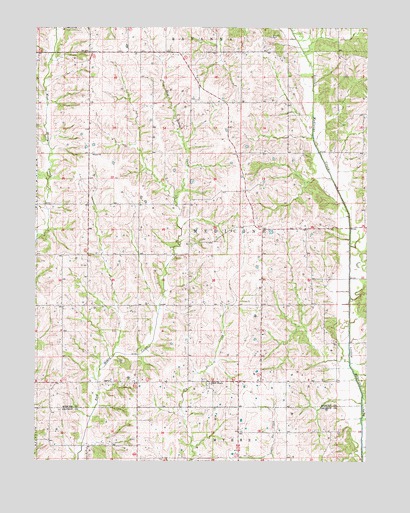
Half Rock, MO USGS Topographic Map
Click on map above to begin viewing in our Map Viewer.

This topographic map contains these locations and features:
Feature Name Type Latitude Longitude GNIS ID View Map
Barnes CemeteryCemeteryN40.2792°W93.4669°1782123View Map
Bellview School (historical)SchoolN40.3075°W93.4805°734020View Map
Boatman School (historical)SchoolN40.3142°W93.4424°734024View Map
Brantley CemeteryCemeteryN40.3722°W93.4127°714642View Map
Brantley School (historical)SchoolN40.3531°W93.4105°734023View Map
Burkeholder School (historical)SchoolN40.2508°W93.4377°746921View Map
Farmers Valley School (historical)SchoolN40.2545°W93.4799°746920View Map
Half RockPopulated PlaceN40.2731°W93.4358°740898View Map
Half Rock CemeteryCemeteryN40.2700°W93.4322°1782124View Map
Hammond Brothers LakeReservoirN40.3306°W93.4413°761880View Map
Hammond Brothers Lake DamDamN40.3300°W93.4419°761879View Map
Hunter ChurchChurchN40.3745°W93.4888°720014View Map
Lyons School (historical)SchoolN40.2811°W93.4430°734022View Map
Pilot Knob School (historical)SchoolN40.2806°W93.4908°734021View Map
Prairie School (historical)SchoolN40.3172°W93.4019°734025View Map
Rhoades School (historical)SchoolN40.2731°W93.4136°734026View Map
Smith School (historical)SchoolN40.3686°W93.4508°734018View Map
TopsyPopulated PlaceN40.3531°W93.4799°734027View Map
Topsy ChurchChurchN40.3381°W93.4794°727715View Map
Topsy School (historical)SchoolN40.3381°W93.4808°734019View Map
Township of MedicineCivilN40.3168°W93.4334°767011View Map
White Oak CemeteryCemeteryN40.2675°W93.3758°1782125View Map

Note: Coordinates in the location and feature list above are referenced to NAD83 datum.


Copyright (C) 2008-2025 Ryan Niemi / Sunset Dynamics ... All Rights Reserved