TopoQuest Logo
Do you find TopoQuest useful?
Help keep TopoQuest running and adding new maps/features by donating!
Bitcoin:  19c7KJd3qBynnjoSw5npx9KScwjBe4ifkT
Litecoin:  LXs6TkuXGGXo1vDsWCkWVdjQX94eUKd6ui
Home View Maps Find Maps Find Places Resources & Links


Halls Creek, Tennessee Topographic Map

USGS Map Title: Halls Creek, TN
USGS Map MRC: 36087B7
DRG (GeoTIFF) Download: o36087b7.tif


Neighboring USGS Topographic Map Quads:


  McKinnon, TN  
36087C8
 

  Stewart, TN  
36087C7
 

  Erin, TN  
36087C6
 

  Harmon Creek, TN  
36087B8
 

  Halls Creek, TN  
36087B7
 

  Woolworth, TN  
36087B6
 

  Johnsonville, TN  
36087A8
 

  Waverly, TN  
36087A7
 

  McEwen, TN  
36087A6


Map MRC Location:

N37°
W88°
N37°
W87°
H8 H7 H6 H5 H4 H3 H2 H1
G8 G7 G6 G5 G4 G3 G2 G1
F8 F7 F6 F5 F4 F3 F2 F1
E8 E7 E6 E5 E4 E3 E2 E1
D8 D7 D6 D5 D4 D3 D2 D1
C8 C7 C6 C5 C4 C3 C2 C1
B8 B7 B6 B5 B4 B3 B2 B1
A8 A7 A6 A5 A4 A3 A2 A1
N36°
W88°
N36°
W87°

Halls Creek, TN USGS 1:24K Topographic Map Preview:
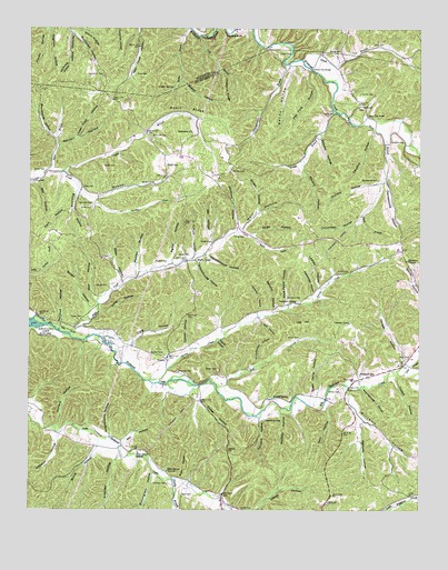
Halls Creek, TN USGS Topographic Map
Click on map above to begin viewing in our Map Viewer.

This topographic map contains these locations and features:
Feature Name Type Latitude Longitude GNIS ID View Map
Anderson HollowValleyN36.1390°W87.8466°1275719View Map
Averitt CemeteryCemeteryN36.2331°W87.7695°1276009View Map
Bascom ChurchChurchN36.1609°W87.8272°1304985View Map
Beecham CemeteryCemeteryN36.2226°W87.8364°1276862View Map
Bell HollowValleyN36.1749°W87.8017°1276935View Map
Bell HollowValleyN36.2097°W87.8734°1276936View Map
BelleviewPopulated PlaceN36.2106°W87.8161°1310632View Map
Belleview ChurchChurchN36.2231°W87.8234°1276964View Map
Belleview School (historical)SchoolN36.2209°W87.8261°1316913View Map
Betsy HollowValleyN36.2403°W87.7906°1277185View Map
Black BranchStreamN36.2251°W87.7697°1277547View Map
Blair HollowValleyN36.1794°W87.8535°1277647View Map
Bloodworth HollowValleyN36.2215°W87.8667°1305291View Map
Brister HollowValleyN36.2365°W87.8270°1278412View Map
Brister SpringSpringN36.2346°W87.8292°1278413View Map
Broad HollowValleyN36.1770°W87.8560°1278432View Map
Brown CemeteryCemeteryN36.1698°W87.7884°1278555View Map
Brown CemeteryCemeteryN36.2437°W87.7759°1278556View Map
Browning HollowValleyN36.2070°W87.8598°1278614View Map
Brush HollowValleyN36.2022°W87.8024°1278690View Map
Buchanan CemeteryCemeteryN36.2378°W87.8520°1278777View Map
Buchanan HollowValleyN36.2485°W87.8609°1278783View Map
Burningham HollowValleyN36.1345°W87.8349°1279081View Map
Burns HollowValleyN36.1410°W87.8534°1279093View Map
Caroline HollowValleyN36.2234°W87.7649°1279695View Map
Carter CemeteryCemeteryN36.2128°W87.8739°1279803View Map
Chase Tripp HollowValleyN36.2217°W87.8597°1280288View Map
Chestnut RidgeRidgeN36.2337°W87.8134°1280414View Map
Churchhouse HollowValleyN36.1909°W87.8189°1280552View Map
Coalpit HollowValleyN36.1597°W87.7576°1280814View Map
Cold BranchStreamN36.2476°W87.8214°1280883View Map
Colley CemeteryCemeteryN36.2087°W87.8581°1306042View Map
Collier CemeteryCemeteryN36.1870°W87.7764°1280977View Map
Collier HillSummitN36.1392°W87.8075°1280980View Map
Collier HollowValleyN36.1531°W87.8199°1280982View Map
Collins FordCrossingN36.2395°W87.7850°1310639View Map
Collins Ford BridgeBridgeN36.2395°W87.7850°1281006View Map
Commissioner District 1CivilN36.1526°W87.8461°2464248View Map
ConcordPopulated PlaceN36.2301°W87.7686°1314877View Map
Craig HollowValleyN36.1679°W87.8428°1281545View Map
Cucumber HollowValleyN36.2008°W87.7692°1281804View Map
Cullum HollowValleyN36.1922°W87.8226°1306221View Map
Damesworth CemeteryCemeteryN36.2106°W87.7636°1281997View Map
Damesworth HollowValleyN36.2113°W87.7611°1281998View Map
Deadhorse HollowValleyN36.1809°W87.7846°1282255View Map
Deal HollowValleyN36.2478°W87.8260°1647125View Map
Deer CreekStreamN36.1603°W87.7550°1282295View Map
Duffle CemeteryCemeteryN36.2039°W87.8556°1283077View Map
Durham CemeteryCemeteryN36.2045°W87.8595°1283228View Map
Durham HillSummitN36.2070°W87.8053°1310644View Map
Elizabeth SchoolSchoolN36.1601°W87.7686°1283632View Map
Ellis Grove ChurchChurchN36.1348°W87.8306°1306419View Map
Ellis Grove SchoolSchoolN36.1398°W87.8400°1283687View Map
Flat Ford HollowValleyN36.2396°W87.7866°1284388View Map
Florida HollowValleyN36.2496°W87.8693°1284505View Map
Fortner CemeteryCemeteryN36.1559°W87.7753°1284680View Map
Fortner CemeteryCemeteryN36.1251°W87.8064°1284682View Map
Gander BranchStreamN36.2289°W87.7778°1285127View Map
Gin HollowValleyN36.1938°W87.8177°1285448View Map
Graveyard HollowValleyN36.1800°W87.7871°1310650View Map
Graveyard HollowValleyN36.1746°W87.8586°1310651View Map
Grice CemeteryCemeteryN36.1962°W87.8097°1286255View Map
Grice Ford BridgeBridgeN36.2270°W87.7667°1286256View Map
Gwin CemeteryCemeteryN36.1287°W87.8259°1286469View Map
Gwin HollowValleyN36.1513°W87.7801°1286470View Map
Halls CreekStreamN36.1706°W87.8625°1286608View Map
Halls CreekPopulated PlaceN36.1901°W87.8220°1315179View Map
Halls Creek ChurchChurchN36.1912°W87.8186°1316943View Map
Halls Creek School (historical)SchoolN36.1892°W87.8203°1316944View Map
Ham HollowValleyN36.2029°W87.8612°1286619View Map
Havener HollowValleyN36.1766°W87.8014°1287158View Map
Hemby BranchStreamN36.1331°W87.8286°1287361View Map
Holloway HollowValleyN36.1499°W87.7899°1310654View Map
Humphreys County Fire Department District 5BuildingN36.2123°W87.8653°2654223View Map
Ivy HillSummitN36.1734°W87.7878°1289125View Map
Ivy HollowValleyN36.1769°W87.7921°1310657View Map
Johnson PondLakeN36.1736°W87.7726°1289649View Map
Kennedy HollowValleyN36.1481°W87.7687°1290077View Map
Kinghthouse HollowValleyN36.1446°W87.8491°1290240View Map
Knight CemeteryCemeteryN36.1948°W87.8167°1290363View Map
Knight CemeteryCemeteryN36.2145°W87.8317°1290365View Map
Knight SpringSpringN36.1542°W87.7965°1290373View Map
Lashley HollowValleyN36.1827°W87.7820°1290659View Map
Latimer CemeteryCemeteryN36.1831°W87.8497°1290674View Map
Littleton HollowValleyN36.1446°W87.8655°1291721View Map
Lloyd CemeteryCemeteryN36.2456°W87.7656°1291747View Map
Long HollowValleyN36.1767°W87.8522°1291957View Map
Madden CemeteryCemeteryN36.1892°W87.8350°1292466View Map
Madden HollowValleyN36.1506°W87.7948°1292467View Map
Madden HollowValleyN36.1873°W87.8409°1292468View Map
Mays Patch HollowValleyN36.1781°W87.7933°1293035View Map
McCloud HollowValleyN36.1734°W87.8648°1293164View Map
McKeel CemeteryCemeteryN36.1653°W87.8317°1293348View Map
Meetinghouse HollowValleyN36.1565°W87.7682°1293547View Map
Miller CemeteryCemeteryN36.2378°W87.8411°1293928View Map
Mooney HollowValleyN36.2058°W87.8546°1294231View Map
Morgan HollowValleyN36.1635°W87.7547°1294372View Map
Moriah Church (historical)ChurchN36.1598°W87.7686°1316969View Map
Moss HollowValleyN36.1968°W87.8040°1294504View Map
Nix HollowValleyN36.1419°W87.8452°1295771View Map
Orchard HollowValleyN36.1466°W87.8658°1296472View Map
Orchard HollowValleyN36.2102°W87.7627°1296473View Map
Parker CemeteryCemeteryN36.1614°W87.8142°1296813View Map
Parker CemeteryCemeteryN36.1917°W87.8275°1296814View Map
Parker HollowValleyN36.1906°W87.8289°1296831View Map
Pennywinkle BranchStreamN36.2409°W87.7942°1297163View Map
Pleasan Hill Church (historical)ChurchN36.1928°W87.7561°1316983View Map
Rattlesnake HollowValleyN36.1761°W87.7952°1310669View Map
Resin RidgeRidgeN36.2289°W87.8250°1299230View Map
Rush HollowValleyN36.1335°W87.8267°1300266View Map
Rushing BluffCliffN36.2489°W87.8131°1300274View Map
Sawmill HollowValleyN36.1769°W87.7972°1300836View Map
Scholes HollowValleyN36.2224°W87.7818°1300882View Map
Schoolhouse HollowValleyN36.1637°W87.8011°1300899View Map
Schoolhouse HollowValleyN36.1898°W87.8227°1300900View Map
Scurlock CemeteryCemeteryN36.1314°W87.8306°1300986View Map
Shaver HollowValleyN36.1692°W87.8142°1301289View Map
Shiloh BranchStreamN36.2384°W87.7839°1270073View Map
Shiloh HollowValleyN36.2403°W87.7774°1647375View Map
South Fork Turkey CreekStreamN36.2131°W87.8645°1310674View Map
Spring CreekStreamN36.1584°W87.8361°1271071View Map
Spring HollowValleyN36.1788°W87.7893°1310675View Map
Stillhouse HollowValleyN36.2410°W87.8623°1271421View Map
Stockard CemeteryCemeteryN36.2214°W87.7595°1271454View Map
Sugar Camp HollowValleyN36.1550°W87.7828°1271651View Map
Sugar Camp HollowValleyN36.1753°W87.7980°1310677View Map
Sullivans Mill (historical)LocaleN36.1728°W87.8695°1316997View Map
Summers CemeteryCemeteryN36.1798°W87.7881°1271836View Map
Summers SpringSpringN36.1790°W87.7896°1271840View Map
Sykes BranchStreamN36.2128°W87.8692°1272012View Map
Tanyard HollowValleyN36.1482°W87.8016°1272113View Map
Tanyard SpringSpringN36.1482°W87.7999°1272118View Map
Traylor BranchStreamN36.2128°W87.8647°1304157View Map
Traylor CemeteryCemeteryN36.2145°W87.8522°1272850View Map
Traylor CemeteryCemeteryN36.2434°W87.7959°1272851View Map
TrinityPopulated PlaceN36.1637°W87.8309°1314422View Map
Triplett CemeteryCemeteryN36.2278°W87.7775°1304174View Map
Turner CemeteryCemeteryN36.1748°W87.8611°1273074View Map
Turner HollowValleyN36.1678°W87.8239°1273084View Map
Union GapGapN36.1473°W87.8347°1310679View Map
Warden CemeteryCemeteryN36.2128°W87.8109°1273798View Map
Warden HollowValleyN36.2193°W87.8656°1273799View Map
Waverly HollowValleyN36.2145°W87.7884°1273951View Map
Webb HollowValleyN36.1851°W87.8452°1274032View Map
Well HollowValleyN36.1980°W87.8067°1274091View Map
Whitford HollowValleyN36.1986°W87.8086°1304563View Map
Williams HollowValleyN36.1565°W87.7737°1304606View Map
Wolf CreekStreamN36.1573°W87.8147°1274947View Map
WSM AirportAirportN36.1412°W87.8620°1301401View Map

Note: Coordinates in the location and feature list above are referenced to NAD83 datum.


Copyright (C) 2008-2024 Ryan Niemi / Sunset Dynamics ... All Rights Reserved