TopoQuest Logo
Do you find TopoQuest useful?
Help keep TopoQuest running and adding new maps/features by donating!
Bitcoin:  19c7KJd3qBynnjoSw5npx9KScwjBe4ifkT
Litecoin:  LXs6TkuXGGXo1vDsWCkWVdjQX94eUKd6ui
Home View Maps Find Maps Find Places Resources & Links


Hamburg, Virginia Topographic Map

USGS Map Title: Hamburg, VA
USGS Map MRC: 38078F5
DRG (GeoTIFF) Download: o38078f5.tif


Neighboring USGS Topographic Map Quads:


  Conicville, VA  
38078G6
 

  Edinburg, VA  
38078G5
 

  Rileyville, VA  
38078G4
 

  New Market, VA  
38078F6
 

  Hamburg, VA  
38078F5
 

  Luray, VA  
38078F4
 

  Tenth Legion, VA  
38078E6
 

  Stanley, VA  
38078E5
 

  Big Meadows, VA  
38078E4


Map MRC Location:

N39°
W79°
N39°
W78°
H8 H7 H6 H5 H4 H3 H2 H1
G8 G7 G6 G5 G4 G3 G2 G1
F8 F7 F6 F5 F4 F3 F2 F1
E8 E7 E6 E5 E4 E3 E2 E1
D8 D7 D6 D5 D4 D3 D2 D1
C8 C7 C6 C5 C4 C3 C2 C1
B8 B7 B6 B5 B4 B3 B2 B1
A8 A7 A6 A5 A4 A3 A2 A1
N38°
W79°
N38°
W78°

Hamburg, VA USGS 1:24K Topographic Map Preview:
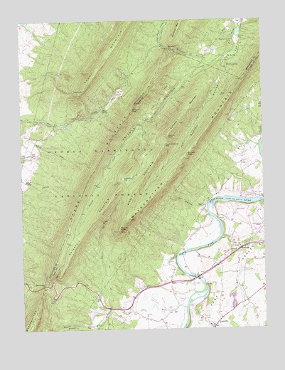
Hamburg, VA USGS Topographic Map
Click on map above to begin viewing in our Map Viewer.

This topographic map contains these locations and features:
Feature Name Type Latitude Longitude GNIS ID View Map
Big RunStreamN38.6340°W78.5406°1481778View Map
Big SpringSpringN38.7352°W78.5173°1481789View Map
Browns HollowValleyN38.6261°W78.5876°1482044View Map
Browns RunStreamN38.6332°W78.5800°1482046View Map
Burners GapGapN38.6962°W78.5383°1482175View Map
Camp Roosevelt Recreation AreaParkN38.7315°W78.5167°1482274View Map
Caroline Furnace CampLocaleN38.7404°W78.5156°1482328View Map
Catback MountainSummitN38.7121°W78.5395°1495358View Map
Crisman HollowValleyN38.7340°W78.5249°1482838View Map
Duncan HollowValleyN38.7335°W78.5190°1483164View Map
Duncan Hollow TrailTrailN38.7012°W78.5397°1483165View Map
Duncan KnobSummitN38.7029°W78.5481°1483167View Map
Egypt Bend EstatesPopulated PlaceN38.6793°W78.5081°1500375View Map
Furnace CemeteryCemeteryN38.7423°W78.5106°1483565View Map
Gap Creek TrailTrailN38.7032°W78.5536°1482373View Map
Gap TrailTrailN38.6946°W78.5611°1488532View Map
Georges RunStreamN38.6332°W78.5825°1488499View Map
HamburgPopulated PlaceN38.6582°W78.5145°1483910View Map
Hiden SpringSpringN38.7136°W78.5821°1484076View Map
IntersectionsPopulated PlaceN38.6337°W78.5803°1500388View Map
Jawbone GapGapN38.7137°W78.5661°1484401View Map
Kerns MountainSummitN38.6851°W78.5897°1484565View Map
LeaksvillePopulated PlaceN38.6265°W78.5261°1484750View Map
Lick Bottom HollowValleyN38.6749°W78.5298°1484800View Map
Lions Tale TrailTrailN38.7229°W78.5411°1488535View Map
Little Fort ValleyValleyN38.7396°W78.5514°1484907View Map
Luray Caverns Golf CourseLocaleN38.6729°W78.5117°1500392View Map
Massanutten MountainRangeN38.6687°W78.5717°1485214View Map
Massanutten Visitor CenterBuildingN38.6426°W78.6097°1488534View Map
Middle MountainSummitN38.6837°W78.5628°1495937View Map
Mill CreekStreamN38.6618°W78.5217°1485431View Map
Mill Creek ChurchChurchN38.6565°W78.5178°1485438View Map
Mooreland GapGapN38.7390°W78.5475°1485546View Map
Mount Carmel Christian AcademySchoolN38.6577°W78.5098°2497722View Map
Mountain RunStreamN38.7323°W78.5245°1485683View Map
New Market GapGapN38.6429°W78.6122°1485851View Map
New Market Gap Picnic AreaLocaleN38.6368°W78.6092°1488533View Map
New Market Gap Recreation SiteParkN38.6648°W78.5025°1488530View Map
Peach Orchard GapGapN38.6996°W78.5497°1486102View Map
SalemPopulated PlaceN38.6443°W78.5478°1496182View Map
Scothorn GapGapN38.6860°W78.5708°1486968View Map
Scothorn Gap TrailTrailN38.6887°W78.5633°1486969View Map
Shenandoah ForestPopulated PlaceN38.6612°W78.5497°1500425View Map
Story Book TrailTrailN38.6557°W78.5886°1488531View Map
Strickler KnobSummitN38.6657°W78.5736°1496274View Map
The KnobSummitN38.7221°W78.5908°1496306View Map
Waterfall MountainSummitN38.6818°W78.5733°1496377View Map
White HousePopulated PlaceN38.6468°W78.5328°1500438View Map
Whitehouse LandingPopulated PlaceN38.6462°W78.5347°1488323View Map
Woods ChapelChurchN38.6957°W78.6183°1488479View Map
Woods Chapel CemeteryCemeteryN38.6954°W78.6186°1673944View Map
Yellow CliffsCliffN38.6293°W78.6170°1488500View Map

Note: Coordinates in the location and feature list above are referenced to NAD83 datum.


Copyright (C) 2008-2025 Ryan Niemi / Sunset Dynamics ... All Rights Reserved