TopoQuest Logo
Do you find TopoQuest useful?
Help keep TopoQuest running and adding new maps/features by donating!
Bitcoin:  19c7KJd3qBynnjoSw5npx9KScwjBe4ifkT
Litecoin:  LXs6TkuXGGXo1vDsWCkWVdjQX94eUKd6ui
Home View Maps Find Maps Find Places Resources & Links


Tenth Legion, Virginia Topographic Map

USGS Map Title: Tenth Legion, VA
USGS Map MRC: 38078E6
DRG (GeoTIFF) Download: o38078e6.tif


Neighboring USGS Topographic Map Quads:


  Timberville, VA  
38078F7
 

  New Market, VA  
38078F6
 

  Hamburg, VA  
38078F5
 

  Broadway, VA  
38078E7
 

  Tenth Legion, VA  
38078E6
 

  Stanley, VA  
38078E5
 

  Harrisonburg, VA  
38078D7
 

  Elkton West, VA  
38078D6
 

  Elkton East, VA  
38078D5


Map MRC Location:

N39°
W79°
N39°
W78°
H8 H7 H6 H5 H4 H3 H2 H1
G8 G7 G6 G5 G4 G3 G2 G1
F8 F7 F6 F5 F4 F3 F2 F1
E8 E7 E6 E5 E4 E3 E2 E1
D8 D7 D6 D5 D4 D3 D2 D1
C8 C7 C6 C5 C4 C3 C2 C1
B8 B7 B6 B5 B4 B3 B2 B1
A8 A7 A6 A5 A4 A3 A2 A1
N38°
W79°
N38°
W78°

Tenth Legion, VA USGS 1:24K Topographic Map Preview:
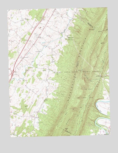
Tenth Legion, VA USGS Topographic Map
Click on map above to begin viewing in our Map Viewer.

This topographic map contains these locations and features:
Feature Name Type Latitude Longitude GNIS ID View Map
ArktonPopulated PlaceN38.5732°W78.6953°1499059View Map
AthlonePopulated PlaceN38.5360°W78.7061°1499067View Map
Bethlehem ChurchChurchN38.5773°W78.7325°1481675View Map
Big MountainSummitN38.5907°W78.6397°1481756View Map
Bird KnobSummitN38.6029°W78.6431°1481812View Map
Camp Fair HavenLocaleN38.5135°W78.7153°1482257View Map
Catherine FurnacePopulated PlaceN38.5576°W78.6356°1499223View Map
Concord ChurchChurchN38.6154°W78.7261°1482681View Map
Endless CavernsLocaleN38.5948°W78.6756°1483308View Map
Endless Caverns CampgroundsLocaleN38.5946°W78.6709°1779321View Map
Fairview ChurchChurchN38.5987°W78.7009°1483335View Map
Interchange 257CrossingN38.5632°W78.7447°1779327View Map
Koontz HollowValleyN38.5368°W78.6505°1484633View Map
Lincoln HillSummitN38.5646°W78.7272°1484849View Map
Lokey HollowValleyN38.5455°W78.6450°1485031View Map
MauzyPopulated PlaceN38.5643°W78.7422°1499715View Map
Morgan KnobSummitN38.5068°W78.6814°1499765View Map
Morgan RunStreamN38.5235°W78.6572°1485553View Map
Mountain Valley ChurchChurchN38.5240°W78.7147°1485694View Map
OakwoodPopulated PlaceN38.5187°W78.7178°1499816View Map
Phillips HillSummitN38.5298°W78.7314°1499860View Map
Pitt SpringSpringN38.5637°W78.6586°1486281View Map
Pitt Spring RunStreamN38.5546°W78.6370°1486282View Map
Rinaca CemeteryCemeteryN38.5040°W78.6420°1500413View Map
Roaring RunStreamN38.5573°W78.6353°1486661View Map
Roaring Run GapGapN38.5907°W78.6325°1486664View Map
Roark HillSummitN38.5640°W78.7042°1499972View Map
Saint Pauls ChurchChurchN38.6140°W78.7314°1486881View Map
Short Horse MountainSummitN38.5985°W78.6250°1500100View Map
Tenth LegionPopulated PlaceN38.5773°W78.7314°1500211View Map
Third MountainSummitN38.5070°W78.6812°1500217View Map
Trinity ChurchChurchN38.5001°W78.6395°1487988View Map
Turkey RidgeRidgeN38.5412°W78.6859°1488031View Map
War BranchStreamN38.5860°W78.7061°1488185View Map
WHSV-TV (Harrisonburg)TowerN38.6015°W78.6322°1502749View Map
WSVA-TVTowerN38.6012°W78.6325°1488607View Map

Note: Coordinates in the location and feature list above are referenced to NAD83 datum.


Copyright (C) 2008-2025 Ryan Niemi / Sunset Dynamics ... All Rights Reserved