TopoQuest Logo
Do you find TopoQuest useful?
Help keep TopoQuest running and adding new maps/features by donating!
Bitcoin:  19c7KJd3qBynnjoSw5npx9KScwjBe4ifkT
Litecoin:  LXs6TkuXGGXo1vDsWCkWVdjQX94eUKd6ui
Home View Maps Find Maps Find Places Resources & Links


Hamilton East, Michigan Topographic Map

USGS Map Title: Hamilton East, MI
USGS Map MRC: 42085F8
DRG (GeoTIFF) Download: o42085f8.tif


Neighboring USGS Topographic Map Quads:


  Holland East, MI  
42086G1
 

  Hudsonville West, MI  
42085G8
 

  Hudsonville East, MI  
42085G7
 

  Hamilton West, MI  
42086F1
 

  Hamilton East, MI  
42085F8
 

  Burnips, MI  
42085F7
 

  Fennville, MI  
42086E1
 

  Millgrove, MI  
42085E8
 

  Allegan, MI  
42085E7


Map MRC Location:

N43°
W86°
N43°
W85°
H8 H7 H6 H5 H4 H3 H2 H1
G8 G7 G6 G5 G4 G3 G2 G1
F8 F7 F6 F5 F4 F3 F2 F1
E8 E7 E6 E5 E4 E3 E2 E1
D8 D7 D6 D5 D4 D3 D2 D1
C8 C7 C6 C5 C4 C3 C2 C1
B8 B7 B6 B5 B4 B3 B2 B1
A8 A7 A6 A5 A4 A3 A2 A1
N42°
W86°
N42°
W85°

Hamilton East, MI USGS 1:24K Topographic Map Preview:
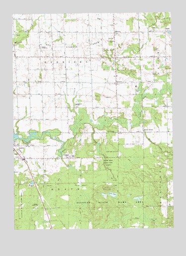
Hamilton East, MI USGS Topographic Map
Click on map above to begin viewing in our Map Viewer.

This topographic map contains these locations and features:
Feature Name Type Latitude Longitude GNIS ID View Map
Bakers FieldAirportN42.7320°W85.9062°1623818View Map
Beach HillSummitN42.6486°W85.9283°2105419View Map
Beaver MeadowFlatN42.6508°W85.9483°2105421View Map
BentheimPopulated PlaceN42.7095°W85.9189°621128View Map
Bentheim CemeteryCemeteryN42.7136°W85.9200°2574050View Map
Bentheim ChapelChurchN42.7047°W85.9033°2105424View Map
Bentheim Elementary SchoolSchoolN42.7136°W85.9183°2574234View Map
Bentheim Post Office (historical)Post OfficeN42.7094°W85.9189°2573934View Map
Bentheim Reformed ChurchChurchN42.7089°W85.9181°2574233View Map
Black CreekStreamN42.7009°W85.8989°621487View Map
Brookside SchoolSchoolN42.6659°W85.9673°622048View Map
Busscher Landing Strip (historical)AirportN42.7306°W85.9769°2105426View Map
Diamond SpringsPopulated PlaceN42.6806°W85.8970°624643View Map
Diamond Springs CemeteryCemeteryN42.6808°W85.9206°2105423View Map
Diamond Springs Golf CourseLocaleN42.6789°W85.8828°2574232View Map
Diamond Springs Post Office (historical)Post OfficeN42.6806°W85.8969°2573928View Map
Diamond Springs Wesleyan ChurchChurchN42.6803°W85.8861°2574231View Map
Dowd CemeteryCemeteryN42.6736°W85.9181°2574044View Map
Goose LakeLakeN42.6450°W85.9228°2105418View Map
Hamilton Fire DepartmentBuildingN42.6693°W85.9980°2636051View Map
Hamilton Landing Strip (historical)AirportN42.6392°W85.9806°2105422View Map
High Point SchoolSchoolN42.6956°W85.9225°628237View Map
Maple Grove SchoolSchoolN42.7250°W85.8784°631456View Map
Miller CreekStreamN42.6850°W85.9011°632361View Map
OaklandPopulated PlaceN42.7389°W85.9192°2105425View Map
Oakland Christian Reformed ChurchChurchN42.7434°W85.9198°633875View Map
Oakland Christian Reformed Church Historical MarkerParkN42.7380°W85.9202°2562431View Map
Oakview SchoolSchoolN42.6384°W85.8792°633902View Map
Overisel CemeteryCemeteryN42.7464°W85.9295°634232View Map
Overisel SchoolSchoolN42.7039°W85.9900°634230View Map
Pershing SchoolSchoolN42.7242°W85.9286°634687View Map
Sandy View SchoolSchoolN42.7336°W85.9978°637234View Map
School Number 3SchoolN42.7397°W85.9695°637398View Map
Shady Acres Mobile Home ParkPopulated PlaceN42.6511°W85.9744°2574368View Map
Silver Creek CampLocaleN42.6659°W85.9270°637928View Map
Silver Creek County ParkParkN42.6625°W85.9250°2105420View Map
Township of HeathCivilN42.6374°W85.9573°1626459View Map
Township of OveriselCivilN42.7248°W85.9580°1626872View Map

Note: Coordinates in the location and feature list above are referenced to NAD83 datum.


Copyright (C) 2008-2024 Ryan Niemi / Sunset Dynamics ... All Rights Reserved