TopoQuest Logo
Do you find TopoQuest useful?
Help keep TopoQuest running and adding new maps/features by donating!
Bitcoin:  19c7KJd3qBynnjoSw5npx9KScwjBe4ifkT
Litecoin:  LXs6TkuXGGXo1vDsWCkWVdjQX94eUKd6ui
Home View Maps Find Maps Find Places Resources & Links


Fennville, Michigan Topographic Map

USGS Map Title: Fennville, MI
USGS Map MRC: 42086E1
DRG (GeoTIFF) Download: o42086e1.tif


Neighboring USGS Topographic Map Quads:


  Saugatuck, MI  
42086F2
 

  Hamilton West, MI  
42086F1
 

  Hamilton East, MI  
42085F8
 

  Glenn, MI  
42086E2
 

  Fennville, MI  
42086E1
 

  Millgrove, MI  
42085E8
 

  Lacota, MI  
42086D2
 

  Pullman, MI  
42086D1
 

  Bloomingdale, MI  
42085D8


Map MRC Location:

N43°
W87°
N43°
W86°
H8 H7 H6 H5 H4 H3 H2 H1
G8 G7 G6 G5 G4 G3 G2 G1
F8 F7 F6 F5 F4 F3 F2 F1
E8 E7 E6 E5 E4 E3 E2 E1
D8 D7 D6 D5 D4 D3 D2 D1
C8 C7 C6 C5 C4 C3 C2 C1
B8 B7 B6 B5 B4 B3 B2 B1
A8 A7 A6 A5 A4 A3 A2 A1
N42°
W87°
N42°
W86°

Fennville, MI USGS 1:24K Topographic Map Preview:
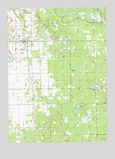
Fennville, MI USGS Topographic Map
Click on map above to begin viewing in our Map Viewer.

This topographic map contains these locations and features:
Feature Name Type Latitude Longitude GNIS ID View Map
American Medical Response FennvilleBuildingN42.5948°W86.1046°2662074View Map
Anderson SchoolSchoolN42.5948°W86.0606°620108View Map
Anna Michen Elementary SchoolSchoolN42.5986°W86.1056°2574348View Map
Apostolica ChurchChurchN42.6014°W86.0953°2105443View Map
Big Dailey BayouGutN42.6136°W86.0317°621310View Map
Big Goose LakeLakeN42.6139°W86.0153°2105450View Map
BravoPopulated PlaceN42.5131°W86.0920°621906View Map
Bravo Christian Reformed ChurchChurchN42.5139°W86.0908°2573893View Map
Bravo Post Office (historical)Post OfficeN42.5131°W86.0919°2573933View Map
City of FennvilleCivilN42.5948°W86.1052°1626274View Map
Clyde Township Fire DepartmentBuildingN42.5417°W86.0925°2636062View Map
Crooked LakeLakeN42.5228°W86.0232°624096View Map
Discovery Elementary SchoolSchoolN42.6100°W86.0944°2574363View Map
Dogwood Manor Mobile Home ParkPopulated PlaceN42.5961°W86.0667°2574358View Map
Ely LakeLakeN42.5319°W86.0374°625549View Map
Ely Lake CampgroundLocaleN42.5744°W86.0333°2105452View Map
FennvillePopulated PlaceN42.5939°W86.1017°625892View Map
Fennville Area Fire DepartmentBuildingN42.5929°W86.1082°2574359View Map
Fennville Assembly of God ChurchChurchN42.5944°W86.1239°2574350View Map
Fennville City HallBuildingN42.5928°W86.1042°2574362View Map
Fennville District LibraryBuildingN42.5942°W86.1069°2574361View Map
Fennville Family MedicineHospitalN42.5964°W86.1042°2574360View Map
Fennville High SchoolSchoolN42.6000°W86.1056°2574349View Map
Fennville Post OfficePost OfficeN42.5942°W86.1042°2574357View Map
Fennville StationLocaleN42.5931°W86.1028°2574352View Map
Fennville United Methodist ChurchChurchN42.5947°W86.1183°2105449View Map
General ChurchChurchN42.5936°W86.0808°2105448View Map
Gidley SchoolSchoolN42.6234°W86.0953°626793View Map
Hemlock Point Gun ClubLocaleN42.6167°W86.0539°1623403View Map
Horsemans CampgroundLocaleN42.5672°W86.0442°2105445View Map
Immanuel Reformed ChurchChurchN42.5939°W86.0997°2574351View Map
Leverich DrainCanalN42.5709°W86.0981°630339View Map
Little Tom LakeLakeN42.5249°W86.0360°630795View Map
Looking Glass LakeLakeN42.6109°W86.0649°632450View Map
Mud LakeLakeN42.5345°W86.0309°632930View Map
Norwood SchoolSchoolN42.5061°W86.0520°633766View Map
Oak Grove CemeteryCemeteryN42.5797°W86.0556°2105446View Map
Open Door Worship CenterChurchN42.5978°W86.0744°2105447View Map
Ottawa Gun ClubLocaleN42.6156°W86.0350°1623550View Map
Ottawa MarshSwampN42.6222°W86.0333°2105451View Map
PearlPopulated PlaceN42.5420°W86.0928°634522View Map
Pearl CemeteryCemeteryN42.5436°W86.0833°2105444View Map
Pearl Post Office (historical)Post OfficeN42.5419°W86.0928°2574116View Map
Pearl StationLocaleN42.5417°W86.0939°2574268View Map
Perch LakeLakeN42.5953°W86.0476°634619View Map
Pine PlainsFlatN42.6028°W86.0342°634977View Map
Round LakeLakeN42.5511°W86.0129°636283View Map
Seventh Day Adventist ChurchChurchN42.5028°W86.0514°2574275View Map
Township of ClydeCivilN42.5499°W86.0726°1626103View Map
Tracy SchoolSchoolN42.5850°W86.0164°1615026View Map
Utter DrainCanalN42.5667°W86.0564°2105453View Map
Valley Township CemeteryCemeteryN42.5864°W86.0158°2574033View Map
Walker SchoolSchoolN42.5206°W86.0142°1615701View Map
Whitmeyer SchoolSchoolN42.5678°W86.0539°1616383View Map

Note: Coordinates in the location and feature list above are referenced to NAD83 datum.


Copyright (C) 2008-2024 Ryan Niemi / Sunset Dynamics ... All Rights Reserved