TopoQuest Logo
Do you find TopoQuest useful?
Help keep TopoQuest running and adding new maps/features by donating!
Bitcoin:  19c7KJd3qBynnjoSw5npx9KScwjBe4ifkT
Litecoin:  LXs6TkuXGGXo1vDsWCkWVdjQX94eUKd6ui
Home View Maps Find Maps Find Places Resources & Links


Hamilton West, Michigan Topographic Map

USGS Map Title: Hamilton West, MI
USGS Map MRC: 42086F1
DRG (GeoTIFF) Download: o42086f1.tif


Neighboring USGS Topographic Map Quads:


  Holland West, MI  
42086G2
 

  Holland East, MI  
42086G1
 

  Hudsonville West, MI  
42085G8
 

  Saugatuck, MI  
42086F2
 

  Hamilton West, MI  
42086F1
 

  Hamilton East, MI  
42085F8
 

  Glenn, MI  
42086E2
 

  Fennville, MI  
42086E1
 

  Millgrove, MI  
42085E8


Map MRC Location:

N43°
W87°
N43°
W86°
H8 H7 H6 H5 H4 H3 H2 H1
G8 G7 G6 G5 G4 G3 G2 G1
F8 F7 F6 F5 F4 F3 F2 F1
E8 E7 E6 E5 E4 E3 E2 E1
D8 D7 D6 D5 D4 D3 D2 D1
C8 C7 C6 C5 C4 C3 C2 C1
B8 B7 B6 B5 B4 B3 B2 B1
A8 A7 A6 A5 A4 A3 A2 A1
N42°
W87°
N42°
W86°

Hamilton West, MI USGS 1:24K Topographic Map Preview:
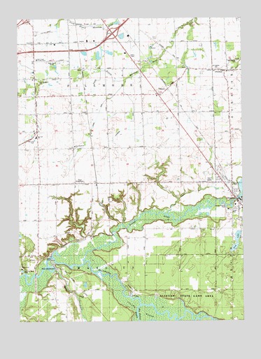
Hamilton West, MI USGS Topographic Map
Click on map above to begin viewing in our Map Viewer.

This topographic map contains these locations and features:
Feature Name Type Latitude Longitude GNIS ID View Map
Blue Star SchoolSchoolN42.7014°W86.1147°2105431View Map
Boyd (historical)LocaleN42.7270°W86.0898°1617456View Map
Colf SchoolSchoolN42.6556°W86.1153°623603View Map
East SaugatuckPopulated PlaceN42.6817°W86.0931°625252View Map
East Saugatuck CemeteryCemeteryN42.7236°W86.1139°2105434View Map
East Saugatuck ChurchChurchN42.6972°W86.0934°625253View Map
East Saugatuck Post Office (historical)Post OfficeN42.6792°W86.0931°2573924View Map
Faith Temple Christian CenterChurchN42.7331°W86.1142°2105435View Map
FillmorePopulated PlaceN42.7211°W86.0414°625950View Map
Fillmore Center Post Office (historical)Post OfficeN42.7211°W86.0414°2573922View Map
Fillmore StationLocaleN42.7217°W86.0417°2574269View Map
HamiltonPopulated PlaceN42.6772°W86.0061°627672View Map
Hamilton Baptist ChurchChurchN42.6881°W86.0175°2574367View Map
Hamilton Christian Reformed ChurchChurchN42.6817°W86.0061°2573904View Map
Hamilton Elementary SchoolSchoolN42.6711°W86.0003°2574230View Map
Hamilton High SchoolSchoolN42.6828°W86.0183°2574372View Map
Hamilton Medical CenterHospitalN42.6739°W86.0028°2573903View Map
Hamilton Middle SchoolSchoolN42.6828°W86.0169°2574371View Map
Hamilton Reformed ChurchChurchN42.6783°W86.0078°2573902View Map
Hamilton StationLocaleN42.6744°W86.0006°2573899View Map
Harvest Christian FellowshipChurchN42.6731°W86.0017°2573901View Map
Haven Reformed ChurchChurchN42.6728°W86.0039°2573900View Map
Interchange 49CrossingN42.7439°W86.0717°2574068View Map
Jaarda DrainCanalN42.7056°W86.0833°2105430View Map
Junction CemeteryCemeteryN42.6486°W86.0344°2574042View Map
Kleinheksel DrainCanalN42.7033°W86.0653°2105429View Map
Little Dailey BayouGutN42.6392°W86.0764°630606View Map
Lohman SchoolSchoolN42.6828°W86.0436°630886View Map
Lugten GullyValleyN42.6726°W86.0378°631206View Map
Manlius CemeteryCemeteryN42.6353°W86.0883°2105427View Map
Mann CreekStreamN42.6459°W86.1067°631400View Map
New Overisel CemeteryCemeteryN42.7319°W86.0022°2105432View Map
New RichmondPopulated PlaceN42.6478°W86.1056°633336View Map
New Richmond Baptist ChurchChurchN42.6469°W86.1039°2574366View Map
New Richmond Post OfficePost OfficeN42.6478°W86.1056°2574123View Map
New Richmond StationLocaleN42.6472°W86.1047°2574267View Map
Old Overisel CemeteryCemeteryN42.7289°W86.0142°2105433View Map
Old Squaw Skin Landing (historical)LocaleN42.6414°W86.0692°1617758View Map
OveriselPopulated PlaceN42.7284°W86.0098°634231View Map
Overisel Historical MarkerParkN42.7278°W86.0083°2562430View Map
Overisel Post Office (historical)Post OfficeN42.7283°W86.0097°2574118View Map
Overisel Reformed ChurchChurchN42.7278°W86.0081°2574080View Map
Overisel Reformed Church Historical MarkerParkN42.7278°W86.0083°2562429View Map
Overisel Township Fire DepartmentBuildingN42.7289°W86.0148°2636255View Map
Phil's Field Airport (historical)AirportN42.7251°W86.0420°1624092View Map
Rabbit RiverStreamN42.6495°W86.0878°635582View Map
Riverside CemeteryCemeteryN42.6814°W86.0042°2105428View Map
Riverview Mobile Home ParkPopulated PlaceN42.6700°W86.0069°2574370View Map
Roelofs GullyValleyN42.6654°W86.0689°636109View Map
Russcher SchoolSchoolN42.7439°W86.0567°636400View Map
School Number 1SchoolN42.6414°W86.0945°637379View Map
School Number 3SchoolN42.6592°W86.0545°637396View Map
School Number 3SchoolN42.7075°W86.0345°637397View Map
School Number 4SchoolN42.7114°W86.0956°637402View Map
School Number 7SchoolN42.6811°W86.0998°637408View Map
Sink Brook Post OfficePost OfficeN42.6722°W86.0017°2574369View Map
Sink LakeLakeN42.6578°W86.0037°638001View Map
Township of FillmoreCivilN42.7178°W86.0706°1626283View Map
Township of ManliusCivilN42.6391°W86.0742°1626670View Map
West Michigan Regional AirportAirportN42.7437°W86.1135°1623961View Map
WWJQ-AM (Zeeland)TowerN42.7322°W86.1017°1625330View Map

Note: Coordinates in the location and feature list above are referenced to NAD83 datum.


Copyright (C) 2008-2024 Ryan Niemi / Sunset Dynamics ... All Rights Reserved