TopoQuest Logo
Do you find TopoQuest useful?
Help keep TopoQuest running and adding new maps/features by donating!
Bitcoin:  19c7KJd3qBynnjoSw5npx9KScwjBe4ifkT
Litecoin:  LXs6TkuXGGXo1vDsWCkWVdjQX94eUKd6ui
Home View Maps Find Maps Find Places Resources & Links


Millgrove, Michigan Topographic Map

USGS Map Title: Millgrove, MI
USGS Map MRC: 42085E8
DRG (GeoTIFF) Download: o42085e8.tif


Neighboring USGS Topographic Map Quads:


  Hamilton West, MI  
42086F1
 

  Hamilton East, MI  
42085F8
 

  Burnips, MI  
42085F7
 

  Fennville, MI  
42086E1
 

  Millgrove, MI  
42085E8
 

  Allegan, MI  
42085E7
 

  Pullman, MI  
42086D1
 

  Bloomingdale, MI  
42085D8
 

  Merson, MI  
42085D7


Map MRC Location:

N43°
W86°
N43°
W85°
H8 H7 H6 H5 H4 H3 H2 H1
G8 G7 G6 G5 G4 G3 G2 G1
F8 F7 F6 F5 F4 F3 F2 F1
E8 E7 E6 E5 E4 E3 E2 E1
D8 D7 D6 D5 D4 D3 D2 D1
C8 C7 C6 C5 C4 C3 C2 C1
B8 B7 B6 B5 B4 B3 B2 B1
A8 A7 A6 A5 A4 A3 A2 A1
N42°
W86°
N42°
W85°

Millgrove, MI USGS 1:24K Topographic Map Preview:
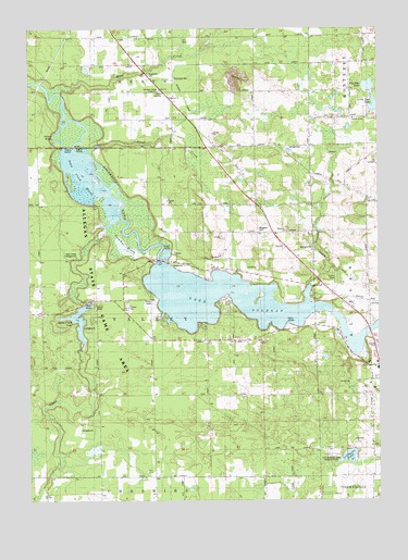
Millgrove, MI USGS Topographic Map
Click on map above to begin viewing in our Map Viewer.

This topographic map contains these locations and features:
Feature Name Type Latitude Longitude GNIS ID View Map
Allegan Cross Country Ski AreaLocaleN42.5289°W85.9833°2574160View Map
Allegan State ForestForestN42.5336°W85.9661°619963View Map
American Indian Gospel ChurchChurchN42.6086°W85.9531°2105436View Map
Babylon SchoolSchoolN42.5525°W85.8784°620406View Map
Bear CreekStreamN42.6081°W85.9886°620826View Map
Big Spec LakeLakeN42.6097°W85.8786°638484View Map
Brookside CemeteryCemeteryN42.6134°W85.9567°622043View Map
Christ Community ChurchChurchN42.5139°W85.8764°2574138View Map
Church of GodChurchN42.5569°W85.8953°2105438View Map
Church of GodChurchN42.6011°W85.8836°2105442View Map
Diamond ChapelChurchN42.5050°W85.9061°624630View Map
Diamond SchoolSchoolN42.5056°W85.9167°624640View Map
Dumont CreekStreamN42.5525°W85.9003°624974View Map
DunningvillePopulated PlaceN42.6128°W85.9486°1617533View Map
Dunningville Post Office (historical)Post OfficeN42.6128°W85.9486°2573925View Map
Dunningville Reformed ChurchChurchN42.6069°W85.9497°2574157View Map
Dunningville Station (historical)LocaleN42.6117°W85.9478°2574272View Map
Emmaus Road Bible ChurchChurchN42.5940°W85.9374°2574146View Map
Hillcrest SchoolSchoolN42.6092°W85.9184°628305View Map
Homecrest Villa Mobile Home ParkPopulated PlaceN42.5350°W85.8772°2574153View Map
Kingdom Hall of Jehovah's WitnessesChurchN42.5819°W85.9200°2574137View Map
Lake AlleganReservoirN42.5511°W85.9194°619964View Map
Little Spec LakeLakeN42.6040°W85.8759°630770View Map
Littlejohn LakeLakeN42.5116°W85.8862°630649View Map
Littlejohn Lake County ParkParkN42.5111°W85.8917°2105437View Map
Michigan Department of Natural Resources Allegan Field OfficeBuildingN42.5491°W85.9960°2636149View Map
MillgrovePopulated PlaceN42.5667°W85.8986°632408View Map
Millgrove CemeteryCemeteryN42.5722°W85.9178°2105440View Map
Millgrove ChurchChurchN42.5714°W85.9083°2105439View Map
Millgrove Post Office (historical)Post OfficeN42.5667°W85.8986°2574127View Map
Millgrove Station (historical)LocaleN42.5667°W85.8986°2574099View Map
Moore SchoolSchoolN42.5448°W85.9128°632651View Map
New Hope Baptist Church of AlleganChurchN42.5672°W85.9083°2574136View Map
Palmer BayouStreamN42.5986°W85.9889°634307View Map
Pine Point CampgroundLocaleN42.5458°W85.9783°2574159View Map
Plainview Lookout TowerTowerN42.5717°W85.9356°1623570View Map
River ChurchChurchN42.5403°W85.8756°2574139View Map
Sand CreekStreamN42.5923°W85.9775°637164View Map
Spec Lake ChapelChurchN42.6011°W85.8831°638485View Map
Spec Lake SchoolSchoolN42.6086°W85.8850°638486View Map
Swan CreekStreamN42.5767°W85.9673°639149View Map
Swan Creek CampgroundLocaleN42.5647°W85.9831°2105441View Map
Swan Creek MarshSwampN42.5859°W85.9814°1623128View Map
Swan Creek PondLakeN42.5479°W85.9824°639151View Map
Township of ValleyCivilN42.5501°W85.9562°1627188View Map

Note: Coordinates in the location and feature list above are referenced to NAD83 datum.


Copyright (C) 2008-2024 Ryan Niemi / Sunset Dynamics ... All Rights Reserved