TopoQuest Logo
Do you find TopoQuest useful?
Help keep TopoQuest running and adding new maps/features by donating!
Bitcoin:  19c7KJd3qBynnjoSw5npx9KScwjBe4ifkT
Litecoin:  LXs6TkuXGGXo1vDsWCkWVdjQX94eUKd6ui
Home View Maps Find Maps Find Places Resources & Links


Hamlet, Indiana Topographic Map

USGS Map Title: Hamlet, IN
USGS Map MRC: 41086D5
DRG (GeoTIFF) Download: o41086d5.tif


Neighboring USGS Topographic Map Quads:


  LaPorte East, IN  
41086E6
 

  Stillwell, IN  
41086E5
 

  North Liberty, IN  
41086E4
 

  Kingsford Heights, IN  
41086D6
 

  Hamlet, IN  
41086D5
 

  Walkerton, IN  
41086D4
 

  Knox West, IN  
41086C6
 

  Knox East, IN  
41086C5
 

  Donaldson, IN  
41086C4


Map MRC Location:

N42°
W87°
N42°
W86°
H8 H7 H6 H5 H4 H3 H2 H1
G8 G7 G6 G5 G4 G3 G2 G1
F8 F7 F6 F5 F4 F3 F2 F1
E8 E7 E6 E5 E4 E3 E2 E1
D8 D7 D6 D5 D4 D3 D2 D1
C8 C7 C6 C5 C4 C3 C2 C1
B8 B7 B6 B5 B4 B3 B2 B1
A8 A7 A6 A5 A4 A3 A2 A1
N41°
W87°
N41°
W86°

Hamlet, IN USGS 1:24K Topographic Map Preview:
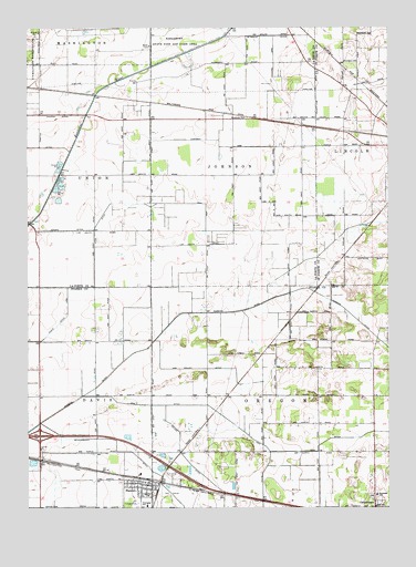
Hamlet, IN USGS Topographic Map
Click on map above to begin viewing in our Map Viewer.

This topographic map contains these locations and features:
Feature Name Type Latitude Longitude GNIS ID View Map
Amy Kelly DitchCanalN41.4112°W86.5631°430150View Map
Benninghoff DitchCanalN41.3798°W86.5770°430819View Map
Chapman ArmCanalN41.4689°W86.5586°432410View Map
Dreessen FieldAirportN41.4504°W86.5065°2676885View Map
Fell ArmCanalN41.4542°W86.5817°446712View Map
Groshans DitchCanalN41.3875°W86.6220°435522View Map
GrovertownPopulated PlaceN41.3750°W86.5047°449664View Map
Hamlet Fire DepartmentBuildingN41.3800°W86.5829°2625626View Map
Hillman DitchCanalN41.4739°W86.6228°436213View Map
Jain DitchCanalN41.3887°W86.5411°436911View Map
Jensen DitchCanalN41.4473°W86.6125°436990View Map
Johanni DitchCanalN41.4775°W86.6186°437014View Map
Keller DitchCanalN41.3809°W86.5603°437209View Map
Kingsbury State Fish and Wildlife AreaParkN41.4981°W86.5700°450445View Map
Kyle DitchCanalN41.4556°W86.5920°437484View Map
Rice DitchCanalN41.3920°W86.5222°441937View Map
Robbins DitchCanalN41.3995°W86.6156°442138View Map
Town of HamletCivilN41.3792°W86.5832°2396983View Map
Township of JohnsonCivilN41.4762°W86.5535°453515View Map
Township of OregonCivilN41.3894°W86.5243°453694View Map

Note: Coordinates in the location and feature list above are referenced to NAD83 datum.


Copyright (C) 2008-2024 Ryan Niemi / Sunset Dynamics ... All Rights Reserved