TopoQuest Logo
Do you find TopoQuest useful?
Help keep TopoQuest running and adding new maps/features by donating!
Bitcoin:  19c7KJd3qBynnjoSw5npx9KScwjBe4ifkT
Litecoin:  LXs6TkuXGGXo1vDsWCkWVdjQX94eUKd6ui
Home View Maps Find Maps Find Places Resources & Links


Walkerton, Indiana Topographic Map

USGS Map Title: Walkerton, IN
USGS Map MRC: 41086D4
DRG (GeoTIFF) Download: o41086d4.tif


Neighboring USGS Topographic Map Quads:


  Stillwell, IN  
41086E5
 

  North Liberty, IN  
41086E4
 

  Lakeville, IN  
41086E3
 

  Hamlet, IN  
41086D5
 

  Walkerton, IN  
41086D4
 

  La Paz, IN  
41086D3
 

  Knox East, IN  
41086C5
 

  Donaldson, IN  
41086C4
 

  Plymouth, IN  
41086C3


Map MRC Location:

N42°
W87°
N42°
W86°
H8 H7 H6 H5 H4 H3 H2 H1
G8 G7 G6 G5 G4 G3 G2 G1
F8 F7 F6 F5 F4 F3 F2 F1
E8 E7 E6 E5 E4 E3 E2 E1
D8 D7 D6 D5 D4 D3 D2 D1
C8 C7 C6 C5 C4 C3 C2 C1
B8 B7 B6 B5 B4 B3 B2 B1
A8 A7 A6 A5 A4 A3 A2 A1
N41°
W87°
N41°
W86°

Walkerton, IN USGS 1:24K Topographic Map Preview:
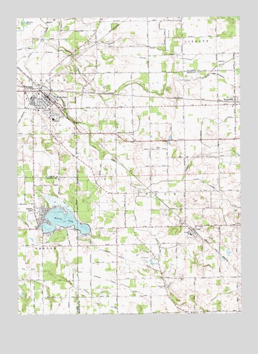
Walkerton, IN USGS Topographic Map
Click on map above to begin viewing in our Map Viewer.

This topographic map contains these locations and features:
Feature Name Type Latitude Longitude GNIS ID View Map
Angeline Lemert DitchCanalN41.3898°W86.4520°430177View Map
Baker ArmCanalN41.4284°W86.4553°430418View Map
Barber CemeteryCemeteryN41.4439°W86.4211°430482View Map
Blissville ChurchChurchN41.3864°W86.4170°431187View Map
Braun FarmsLocaleN41.3914°W86.4603°2634531View Map
Carlson DitchCanalN41.3837°W86.4583°432137View Map
Carmel (historical)Populated PlaceN41.4806°W86.4042°452429View Map
Elmer Kane DitchCanalN41.4984°W86.4186°452592View Map
Hardys LakeLakeN41.4980°W86.4952°452617View Map
Harold C Urey Middle SchoolSchoolN41.4681°W86.4878°452870View Map
J and B Hog FarmLocaleN41.3875°W86.4578°2708911View Map
John Glenn High SchoolSchoolN41.4575°W86.4797°452608View Map
Jordans CreekStreamN41.4848°W86.4692°452844View Map
Koontz LakePopulated PlaceN41.4181°W86.4858°437438View Map
Koontz LakeReservoirN41.4142°W86.4746°437439View Map
Koontz Lake - Oregon Township Volunteer Fire DepartmentBuildingN41.4152°W86.4889°2626275View Map
Koontz Lake Census Designated PlaceCensusN41.4169°W86.4827°2393071View Map
Koontz Lake DamDamN41.4123°W86.4883°448700View Map
Lawrence Pontius DitchCanalN41.3975°W86.4381°437671View Map
Lemert DitchCanalN41.4095°W86.4270°437768View Map
May's StripAirportN41.4468°W86.4736°2676991View Map
Minnow BranchStreamN41.4978°W86.4839°452690View Map
Peter Sarber DitchCanalN41.4298°W86.4233°441052View Map
Polk Township Voluntary Fire Department Station 2BuildingN41.4637°W86.3774°2626304View Map
Polk Township Volunteer Fire Department Station 1BuildingN41.4077°W86.4036°2626325View Map
Sherman Emmons DitchCanalN41.4575°W86.3936°443363View Map
South Branch Pine CreekStreamN41.4312°W86.4078°446944View Map
Stuntz & Hochstetler Pines Airport (historical)AirportN41.4729°W86.4513°449374View Map
Sunny AcresLocaleN41.3889°W86.3761°2708919View Map
TeegardenPopulated PlaceN41.4650°W86.3775°444620View Map
Town of WalkertonCivilN41.4656°W86.4824°2397718View Map
Township of LincolnCivilN41.4791°W86.4866°453573View Map
Township of PolkCivilN41.4270°W86.4085°453755View Map
TynerPopulated PlaceN41.4098°W86.4025°449740View Map
WalkertonPopulated PlaceN41.4667°W86.4831°452831View Map
Walkerton - Polk - Lincoln Emergency Medical ServicesBuildingN41.4667°W86.4838°2719353View Map
Walkerton Elementary SchoolSchoolN41.4612°W86.4878°452869View Map
Walkerton Fire DepartmentBuildingN41.4652°W86.4891°2625623View Map
Walkerton Police DepartmentBuildingN41.4667°W86.4836°2758029View Map
Wendy Hill FarmsLocaleN41.3861°W86.4139°2708914View Map
Yellow Bank CreekStreamN41.4903°W86.4864°452843View Map

Note: Coordinates in the location and feature list above are referenced to NAD83 datum.


Copyright (C) 2008-2024 Ryan Niemi / Sunset Dynamics ... All Rights Reserved