TopoQuest Logo
Do you find TopoQuest useful?
Help keep TopoQuest running and adding new maps/features by donating!
Bitcoin:  19c7KJd3qBynnjoSw5npx9KScwjBe4ifkT
Litecoin:  LXs6TkuXGGXo1vDsWCkWVdjQX94eUKd6ui
Home View Maps Find Maps Find Places Resources & Links


North Liberty, Indiana Topographic Map

USGS Map Title: North Liberty, IN
USGS Map MRC: 41086E4
DRG (GeoTIFF) Download: o41086e4.tif


Neighboring USGS Topographic Map Quads:


  New Carlisle, IN  
41086F5
 

  Lydick, IN  
41086F4
 

  South Bend West, IN  
41086F3
 

  Stillwell, IN  
41086E5
 

  North Liberty, IN  
41086E4
 

  Lakeville, IN  
41086E3
 

  Hamlet, IN  
41086D5
 

  Walkerton, IN  
41086D4
 

  La Paz, IN  
41086D3


Map MRC Location:

N42°
W87°
N42°
W86°
H8 H7 H6 H5 H4 H3 H2 H1
G8 G7 G6 G5 G4 G3 G2 G1
F8 F7 F6 F5 F4 F3 F2 F1
E8 E7 E6 E5 E4 E3 E2 E1
D8 D7 D6 D5 D4 D3 D2 D1
C8 C7 C6 C5 C4 C3 C2 C1
B8 B7 B6 B5 B4 B3 B2 B1
A8 A7 A6 A5 A4 A3 A2 A1
N41°
W87°
N41°
W86°

North Liberty, IN USGS 1:24K Topographic Map Preview:
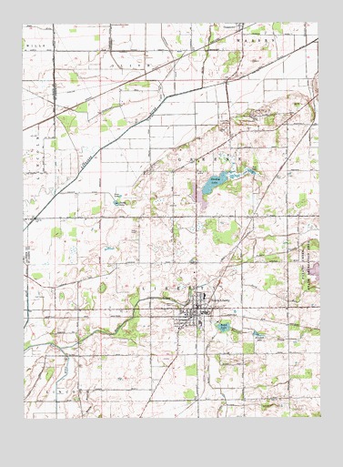
North Liberty, IN USGS Topographic Map
Click on map above to begin viewing in our Map Viewer.

This topographic map contains these locations and features:
Feature Name Type Latitude Longitude GNIS ID View Map
Aldrich DitchCanalN41.5989°W86.3772°452531View Map
County Line DitchCanalN41.6112°W86.4867°433040View Map
CrumstownPopulated PlaceN41.6242°W86.4081°452578View Map
Dine LakeLakeN41.5701°W86.4590°433562View Map
Dixon DitchCanalN41.6128°W86.3936°433584View Map
Dollar LakeLakeN41.5681°W86.4607°433618View Map
Elizabeth LakeLakeN41.5264°W86.4014°452588View Map
Elmer Kane LateralCanalN41.5134°W86.4220°452593View Map
Geyer DitchCanalN41.6150°W86.4222°435050View Map
Kale LakeLakeN41.5780°W86.4036°437154View Map
Kartoffel CreekStreamN41.5420°W86.4225°452646View Map
Laskowski DitchCanalN41.6137°W86.4358°437637View Map
Liberty Township Ambulance ServiceBuildingN41.5327°W86.4307°2719369View Map
Liberty Township Volunteer Fire DepartmentBuildingN41.5335°W86.4277°2626370View Map
Miller DitchCanalN41.5375°W86.4983°452689View Map
Niespodziany DitchCanalN41.6209°W86.4631°440173View Map
North LibertyPopulated PlaceN41.5342°W86.4272°452707View Map
North Liberty Police DeptBuildingN41.5350°W86.4269°2758068View Map
North Liberty SchoolSchoolN41.5389°W86.4236°452868View Map
Old CemeteryCemeteryN41.5349°W86.4312°452715View Map
Potato CreekStreamN41.5220°W86.4845°452743View Map
Roda DitchCanalN41.6242°W86.4936°442237View Map
Rupel LakeLakeN41.5287°W86.4157°452758View Map
Sousley LakeLakeN41.5742°W86.4199°443777View Map
Spud RunStreamN41.5481°W86.4081°452806View Map
Stewarts Green Acres AirportAirportN41.5486°W86.4515°2677096View Map
Town of North LibertyCivilN41.5324°W86.4280°2396821View Map
Township of LibertyCivilN41.5257°W86.4041°453560View Map
Westlawn CemeteryCemeteryN41.5348°W86.4402°452835View Map

Note: Coordinates in the location and feature list above are referenced to NAD83 datum.


Copyright (C) 2008-2024 Ryan Niemi / Sunset Dynamics ... All Rights Reserved