TopoQuest Logo
Do you find TopoQuest useful?
Help keep TopoQuest running and adding new maps/features by donating!
Bitcoin:  19c7KJd3qBynnjoSw5npx9KScwjBe4ifkT
Litecoin:  LXs6TkuXGGXo1vDsWCkWVdjQX94eUKd6ui
Home View Maps Find Maps Find Places Resources & Links


Hancock, Maine Topographic Map

USGS Map Title: Hancock, ME
USGS Map MRC: 44068E3
DRG (GeoTIFF) Download: o44068e3.tif


Neighboring USGS Topographic Map Quads:


  Beech Hill Pond, ME  
44068F4
 

  Eastbrook, ME  
44068F3
 

  Molasses Pond, ME  
44068F2
 

  Ellsworth, ME  
44068E4
 

  Hancock, ME  
44068E3
 

  Sullivan, ME  
44068E2
 

  Newbury Neck, ME  
44068D4
 

  Salsbury Cove, ME  
44068D3
 

  Bar Harbor, ME  
44068D2


Map MRC Location:

N45°
W69°
N45°
W68°
H8 H7 H6 H5 H4 H3 H2 H1
G8 G7 G6 G5 G4 G3 G2 G1
F8 F7 F6 F5 F4 F3 F2 F1
E8 E7 E6 E5 E4 E3 E2 E1
D8 D7 D6 D5 D4 D3 D2 D1
C8 C7 C6 C5 C4 C3 C2 C1
B8 B7 B6 B5 B4 B3 B2 B1
A8 A7 A6 A5 A4 A3 A2 A1
N44°
W69°
N44°
W68°

Hancock, ME USGS 1:24K Topographic Map Preview:
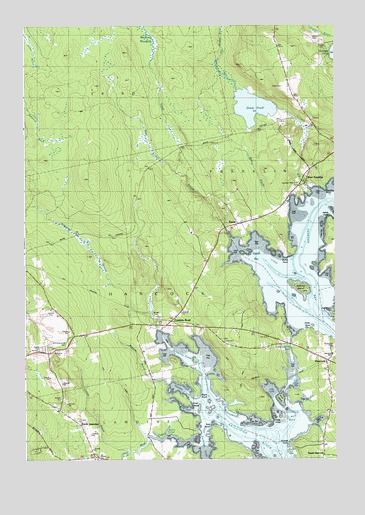
Hancock, ME USGS Topographic Map
Click on map above to begin viewing in our Map Viewer.

This topographic map contains these locations and features:
Feature Name Type Latitude Longitude GNIS ID View Map
Abbott CemeteryCemeteryN44.6215°W68.2581°561051View Map
Archer BrookStreamN44.5020°W68.3334°580565View Map
Burying IslandIslandN44.5495°W68.2636°563283View Map
Butler PointCapeN44.5590°W68.2697°563296View Map
Carrying Place InletBayN44.5290°W68.2661°563622View Map
Cedar PointCapeN44.5381°W68.2611°563731View Map
Church of ChristChurchN44.5309°W68.2600°1911481View Map
Eagle PointCapeN44.5190°W68.3059°580051View Map
EgyptPopulated PlaceN44.5590°W68.2808°579287View Map
Egypt BayBayN44.5601°W68.2837°565815View Map
Egypt StreamStreamN44.5651°W68.2931°565817View Map
Fletchers Landing TownshipCivilN44.6116°W68.3502°2748538View Map
Franklin Memorial ParkParkN44.5790°W68.2639°580048View Map
Franklin RoadPopulated PlaceN44.5395°W68.3184°566537View Map
Great LedgeBarN44.5159°W68.3081°567157View Map
Great PondLakeN44.6016°W68.2828°567169View Map
HancockPopulated PlaceN44.5292°W68.2536°567557View Map
Hancock CountyCivilN44.5629°W68.3682°581290View Map
Hancock Grammar SchoolSchoolN44.5304°W68.2513°580050View Map
Hancock Police DepartmentBuildingN44.5280°W68.2539°2735852View Map
Hancock Volunteer Fire Department Station 1BuildingN44.5290°W68.2527°2553155View Map
Hancock Volunteer Fire Department Station 2BuildingN44.5322°W68.3614°2553159View Map
Hardison PointCapeN44.5784°W68.2545°580047View Map
Hatch PointCapeN44.5684°W68.2522°580049View Map
Hills CoveBayN44.5215°W68.2770°568063View Map
Hills IslandIslandN44.5176°W68.2722°580094View Map
Hyde PointCapeN44.5117°W68.2761°568542View Map
Kilkenny CoveBayN44.5317°W68.3152°569161View Map
Kilkenny StreamStreamN44.5376°W68.3209°569162View Map
Martins BrookStreamN44.5231°W68.3217°580738View Map
Martins CoveBayN44.5209°W68.3122°580219View Map
McFarland Hill CemeteryCemeteryN44.5336°W68.3579°570974View Map
Mill BrookStreamN44.5784°W68.2597°571297View Map
Mill PondLakeN44.5973°W68.2653°571343View Map
Mud CreekStreamN44.5112°W68.3134°580052View Map
North LamoinePopulated PlaceN44.5079°W68.3506°572355View Map
Old Meadow BrookStreamN44.6065°W68.2900°572712View Map
Old PondLakeN44.5242°W68.2672°572722View Map
Partridge CoveBayN44.5051°W68.3045°573030View Map
Riverside CemeteryCemeteryN44.5331°W68.2506°574257View Map
Seal PointCapeN44.5095°W68.2992°575118View Map
South HancockPopulated PlaceN44.5006°W68.2550°575848View Map
Spring BrookStreamN44.5056°W68.3139°576087View Map
Town of HancockCivilN44.5286°W68.2965°582509View Map
Unorganized Territory of Central HancockCivilN44.6081°W68.3494°582401View Map
Urann CoveBayN44.5079°W68.3181°580217View Map
Weir CoveBayN44.5151°W68.3111°580218View Map
West Branch Egypt StreamStreamN44.5829°W68.3136°578051View Map
West BrookStreamN44.5742°W68.2695°578107View Map
West FranklinPopulated PlaceN44.5837°W68.2603°578140View Map
WPRG-FM (Bar Harbor)TowerN44.5481°W68.3142°582041View Map
Youngs BayBayN44.5115°W68.2667°578798View Map
Youngs PointCapeN44.5045°W68.2681°578807View Map

Note: Coordinates in the location and feature list above are referenced to NAD83 datum.


Copyright (C) 2008-2025 Ryan Niemi / Sunset Dynamics ... All Rights Reserved