TopoQuest Logo
Do you find TopoQuest useful?
Help keep TopoQuest running and adding new maps/features by donating!
Bitcoin:  19c7KJd3qBynnjoSw5npx9KScwjBe4ifkT
Litecoin:  LXs6TkuXGGXo1vDsWCkWVdjQX94eUKd6ui
Home View Maps Find Maps Find Places Resources & Links


Hannibal West, Missouri Topographic Map

USGS Map Title: Hannibal West, MO
USGS Map MRC: 39091F4
DRG (GeoTIFF) Download: o39091f4.tif


Neighboring USGS Topographic Map Quads:


  Palmyra, MO  
39091G5
 

  Quincy SW, MO  
39091G4
 

  Marblehead, IL  
39091G3
 

  Rensselaer, MO  
39091F5
 

  Hannibal West, MO  
39091F4
 

  Hannibal East, MO  
39091F3
 

  Center, MO  
39091E5
 

  New London, MO  
39091E4
 

  Hannibal SE, MO  
39091E3


Map MRC Location:

N40°
W92°
N40°
W91°
H8 H7 H6 H5 H4 H3 H2 H1
G8 G7 G6 G5 G4 G3 G2 G1
F8 F7 F6 F5 F4 F3 F2 F1
E8 E7 E6 E5 E4 E3 E2 E1
D8 D7 D6 D5 D4 D3 D2 D1
C8 C7 C6 C5 C4 C3 C2 C1
B8 B7 B6 B5 B4 B3 B2 B1
A8 A7 A6 A5 A4 A3 A2 A1
N39°
W92°
N39°
W91°

Hannibal West, MO USGS 1:24K Topographic Map Preview:
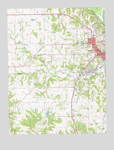
Hannibal West, MO USGS Topographic Map
Click on map above to begin viewing in our Map Viewer.

This topographic map contains these locations and features:
Feature Name Type Latitude Longitude GNIS ID View Map
Barkley CemeteryCemeteryN39.7356°W91.4982°713650View Map
Bay De CharlesLakeN39.7432°W91.3867°735501View Map
Bear Creek CemeteryCemeteryN39.6968°W91.4445°713811View Map
Bear Creek DamDamN39.6834°W91.4218°761625View Map
Bear Creek ReservoirReservoirN39.6845°W91.4229°737870View Map
Blessed Sacrament ChurchChurchN39.7034°W91.3782°732990View Map
Blessed Sacrament SchoolSchoolN39.7031°W91.3785°714367View Map
Bouvet's Mill (historical)LocaleN39.7356°W91.3796°732991View Map
Bowman DamDamN39.6384°W91.4618°760306View Map
Bowmans LakeReservoirN39.6395°W91.4606°760307View Map
Bush CemeteryCemeteryN39.7486°W91.4488°715106View Map
Charles Ransdell LakeReservoirN39.6499°W91.4658°761494View Map
Charles Ransdell LakeReservoirN39.6438°W91.4441°761496View Map
City of HannibalCivilN39.7097°W91.3936°2394287View Map
College HeightsSummitN39.7308°W91.3908°732992View Map
Crooked CreekStreamN39.6840°W91.4447°716512View Map
Crystal Blue LakeReservoirN39.6454°W91.4508°716572View Map
Crystal Blue Lake DamDamN39.6431°W91.4510°760203View Map
Daultons BranchStreamN39.6909°W91.3765°732995View Map
Dimmitt CemeteryCemeteryN39.6542°W91.4265°716908View Map
Grand View Burial ParkCemeteryN39.6682°W91.4145°718678View Map
Hannibal Country Club (historical)LocaleN39.7175°W91.3860°741464View Map
Hannibal Fire Department Station 2BuildingN39.6933°W91.3898°2620521View Map
Hannibal Fire Department Station 3BuildingN39.7192°W91.3924°2620520View Map
Hannibal Regional AirportAirportN39.7261°W91.4457°758710View Map
Hannibal Regional HospitalHospitalN39.7106°W91.4505°2655050View Map
Hannibal Rural Fire Protection DistrictBuildingN39.7049°W91.4156°2621217View Map
Hannibal-LaGrange CollegeSchoolN39.7309°W91.3913°722472View Map
Harrison HillSummitN39.7217°W91.3785°719160View Map
Hatch State Experimental StationLocaleN39.6950°W91.4015°744078View Map
Head CemeteryCemeteryN39.7227°W91.4127°719309View Map
Huck Finn Shopping CenterLocaleN39.7237°W91.3971°719946View Map
Huckleberry ParkParkN39.6956°W91.3924°719949View Map
Hydesburg (historical)Populated PlaceN39.6764°W91.4672°754980View Map
Hydesburg ChurchChurchN39.6737°W91.4679°720064View Map
Hydesburg School (historical)SchoolN39.6684°W91.4696°741467View Map
Jaynes DamDamN39.6434°W91.4435°761495View Map
KGRC-FM (Hannibal)TowerN39.7292°W91.4043°759054View Map
KHMO-AM (Hannibal)TowerN39.6287°W91.3763°754271View Map
LambPopulated PlaceN39.7412°W91.3868°740114View Map
Little Bear CreekStreamN39.6931°W91.4593°721153View Map
Mark Twain Landing Field (historical)AirportN39.6587°W91.4743°743259View Map
Mark Twain SchoolSchoolN39.7073°W91.3846°721878View Map
McKay DamDamN39.7150°W91.4035°761115View Map
McKay LakeReservoirN39.7155°W91.4039°761116View Map
Mills CreekStreamN39.6931°W91.3751°722407View Map
Minnow BranchStreamN39.6959°W91.3763°722444View Map
Minoi-Sandiage CemeteryCemeteryN39.7328°W91.4338°722445View Map
Missouri Department of Conservation Forestry Northeast Regional Field Fire Office HannibalBuildingN39.6997°W91.3945°2620698View Map
Mount Zion CemeteryCemeteryN39.7398°W91.4363°722938View Map
Mount Zion ChurchChurchN39.7434°W91.4543°722963View Map
Mount Zion CommunityPopulated PlaceN39.7434°W91.4529°732994View Map
Nelson CemeteryCemeteryN39.7263°W91.4249°723164View Map
O'Conner PondLakeN39.7384°W91.4677°723550View Map
OakwoodPopulated PlaceN39.6853°W91.3968°735763View Map
Ocean Wave School (historical)SchoolN39.6564°W91.4127°741460View Map
Old School Church (historical)ChurchN39.6970°W91.4443°741466View Map
Port ScipioLocaleN39.7339°W91.3771°741465View Map
Providence ChurchChurchN39.7067°W91.4821°724974View Map
Providence School (historical)SchoolN39.7078°W91.4821°741468View Map
RallsPopulated PlaceN39.6837°W91.4015°740014View Map
Rickey HollowValleyN39.6889°W91.4027°759868View Map
Saint Marys CemeteryCemeteryN39.7245°W91.3879°741463View Map
Saint Thomas SeminarySchoolN39.7059°W91.3838°725910View Map
Steamboat Bend Shopping CenterLocaleN39.7128°W91.3921°742393View Map
Sunnyside School (historical)SchoolN39.6278°W91.4804°741462View Map
Tilden SchoolSchoolN39.6867°W91.3996°732989View Map
Township of ClayCivilN39.6458°W91.4749°767250View Map
Township of MillerCivilN39.7326°W91.4439°767002View Map
Turner SchoolSchoolN39.7095°W91.4210°727907View Map
Turner School (historical)SchoolN39.6987°W91.4446°732988View Map
UvaPopulated PlaceN39.7312°W91.4532°740404View Map
Watson School (historical)SchoolN39.6312°W91.4257°741461View Map
White BearPopulated PlaceN39.6984°W91.4607°741355View Map
Withers MillPopulated PlaceN39.7153°W91.4807°729022View Map
Woollen Lake DamDamN39.6484°W91.4652°761493View Map
Ziegler ChuteStreamN39.7331°W91.3751°729227View Map

Note: Coordinates in the location and feature list above are referenced to NAD83 datum.


Copyright (C) 2008-2024 Ryan Niemi / Sunset Dynamics ... All Rights Reserved