TopoQuest Logo
Do you find TopoQuest useful?
Help keep TopoQuest running and adding new maps/features by donating!
Bitcoin:  19c7KJd3qBynnjoSw5npx9KScwjBe4ifkT
Litecoin:  LXs6TkuXGGXo1vDsWCkWVdjQX94eUKd6ui
Home View Maps Find Maps Find Places Resources & Links


Hannibal SE, Missouri Topographic Map

USGS Map Title: Hannibal SE, MO
USGS Map MRC: 39091E3
DRG (GeoTIFF) Download: o39091e3.tif


Neighboring USGS Topographic Map Quads:


  Hannibal West, MO  
39091F4
 

  Hannibal East, MO  
39091F3
 

  Hull, IL  
39091F2
 

  New London, MO  
39091E4
 

  Hannibal SE, MO  
39091E3
 

  Ashburn, MO  
39091E2
 

  Spencerburg, MO  
39091D4
 

  Frankford, MO  
39091D3
 

  Vera, MO  
39091D2


Map MRC Location:

N40°
W92°
N40°
W91°
H8 H7 H6 H5 H4 H3 H2 H1
G8 G7 G6 G5 G4 G3 G2 G1
F8 F7 F6 F5 F4 F3 F2 F1
E8 E7 E6 E5 E4 E3 E2 E1
D8 D7 D6 D5 D4 D3 D2 D1
C8 C7 C6 C5 C4 C3 C2 C1
B8 B7 B6 B5 B4 B3 B2 B1
A8 A7 A6 A5 A4 A3 A2 A1
N39°
W92°
N39°
W91°

Hannibal SE, MO USGS 1:24K Topographic Map Preview:
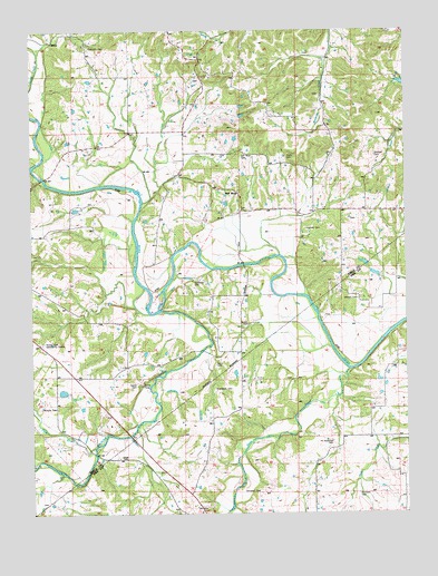
Hannibal SE, MO USGS Topographic Map
Click on map above to begin viewing in our Map Viewer.

This topographic map contains these locations and features:
Feature Name Type Latitude Longitude GNIS ID View Map
Bailey Ford BridgeBridgeN39.5645°W91.3040°741478View Map
Barnard School (historical)SchoolN39.5670°W91.2713°741480View Map
Briscoe CemeteryCemeteryN39.5275°W91.3721°714717View Map
Bueditts DamDamN39.5684°W91.2635°760564View Map
Burditts LakeReservoirN39.5677°W91.2643°760565View Map
Campbell CemeteryCemeteryN39.5056°W91.2993°715304View Map
Daniels LakeReservoirN39.5620°W91.2603°762091View Map
Daniels Lake DamDamN39.5617°W91.2585°762090View Map
Epperson CemeteryCemeteryN39.5600°W91.3207°717616View Map
Epperson IslandIslandN39.5667°W91.3251°737939View Map
Flint Hill CemeteryCemeteryN39.6206°W91.3554°718027View Map
Flint Hill Church (historical)ChurchN39.6206°W91.3557°741482View Map
Flint Hill School (historical)SchoolN39.6228°W91.3676°741479View Map
Gerry CemeteryCemeteryN39.5386°W91.3138°718418View Map
Haden CemeteryCemeteryN39.5489°W91.3026°718965View Map
Haden School (historical)SchoolN39.5417°W91.3060°741477View Map
Haw Creek Post Office (historical)Post OfficeN39.5192°W91.2554°759553View Map
Hawcreek (historical)LocaleN39.5192°W91.2554°740403View Map
Hostetter CemeteryCemeteryN39.5186°W91.2751°719884View Map
Hurleys Lake DamDamN39.5617°W91.2668°760649View Map
JonesLocaleN39.5134°W91.3390°744265View Map
Jones CemeteryCemeteryN39.5142°W91.3440°720411View Map
Kiethley CemeteryCemeteryN39.5734°W91.2832°720575View Map
Matson CemeteryCemeteryN39.5553°W91.2662°721976View Map
Oak Ridge School (historical)SchoolN39.6170°W91.3171°741483View Map
Peno CreekStreamN39.5370°W91.2690°729605View Map
Plum CreekStreamN39.5173°W91.3540°724664View Map
Pritchett CemeteryCemeteryN39.5050°W91.2662°724941View Map
Rocky Point Community CenterBuildingN39.5444°W91.3710°725523View Map
Rocky Point School (historical)SchoolN39.5444°W91.3710°741475View Map
Salt RiverPopulated PlaceN39.5828°W91.3054°741233View Map
Salt River CemeteryCemeteryN39.5925°W91.3046°725980View Map
Salt River School (historical)SchoolN39.5825°W91.3049°741481View Map
Scantland CemeteryCemeteryN39.5323°W91.3140°726086View Map
Sinklear CemeteryCemeteryN39.5925°W91.2599°726487View Map
Spencer CreekStreamN39.5528°W91.3332°726852View Map
Sugar Grove School (historical)SchoolN39.5142°W91.2790°741476View Map
Tapley CemeteryCemeteryN39.5334°W91.3407°727457View Map
Township of SavertonCivilN39.6200°W91.3035°767254View Map
Truitt CemeteryCemeteryN39.5917°W91.2893°727813View Map

Note: Coordinates in the location and feature list above are referenced to NAD83 datum.


Copyright (C) 2008-2024 Ryan Niemi / Sunset Dynamics ... All Rights Reserved