TopoQuest Logo
Do you find TopoQuest useful?
Help keep TopoQuest running and adding new maps/features by donating!
Bitcoin:  19c7KJd3qBynnjoSw5npx9KScwjBe4ifkT
Litecoin:  LXs6TkuXGGXo1vDsWCkWVdjQX94eUKd6ui
Home View Maps Find Maps Find Places Resources & Links


New London, Missouri Topographic Map

USGS Map Title: New London, MO
USGS Map MRC: 39091E4
DRG (GeoTIFF) Download: o39091e4.tif


Neighboring USGS Topographic Map Quads:


  Rensselaer, MO  
39091F5
 

  Hannibal West, MO  
39091F4
 

  Hannibal East, MO  
39091F3
 

  Center, MO  
39091E5
 

  New London, MO  
39091E4
 

  Hannibal SE, MO  
39091E3
 

  Perry NE, MO  
39091D5
 

  Spencerburg, MO  
39091D4
 

  Frankford, MO  
39091D3


Map MRC Location:

N40°
W92°
N40°
W91°
H8 H7 H6 H5 H4 H3 H2 H1
G8 G7 G6 G5 G4 G3 G2 G1
F8 F7 F6 F5 F4 F3 F2 F1
E8 E7 E6 E5 E4 E3 E2 E1
D8 D7 D6 D5 D4 D3 D2 D1
C8 C7 C6 C5 C4 C3 C2 C1
B8 B7 B6 B5 B4 B3 B2 B1
A8 A7 A6 A5 A4 A3 A2 A1
N39°
W92°
N39°
W91°

New London, MO USGS 1:24K Topographic Map Preview:
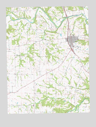
New London, MO USGS Topographic Map
Click on map above to begin viewing in our Map Viewer.

This topographic map contains these locations and features:
Feature Name Type Latitude Longitude GNIS ID View Map
Barkley CemeteryCemeteryN39.5911°W91.3979°713649View Map
Bethel CemeteryCemeteryN39.5684°W91.4826°714032View Map
Bethel ChurchChurchN39.5792°W91.4827°729279View Map
Bethel School (historical)SchoolN39.5792°W91.4818°741486View Map
Big CreekStreamN39.6114°W91.4804°714157View Map
Briggs (historical)BuildingN39.5248°W91.4982°744063View Map
Brush CreekStreamN39.5068°W91.3953°714854View Map
Brush Creek School (historical)SchoolN39.5292°W91.4257°741489View Map
Camp CreekStreamN39.6089°W91.3785°715261View Map
City of New LondonCivilN39.5844°W91.3988°2395205View Map
Crooked CreekStreamN39.5082°W91.3921°729466View Map
Doe Run School (historical)SchoolN39.5862°W91.4457°741485View Map
Flint HillPopulated PlaceN39.6239°W91.3832°740854View Map
Flowerree CemeteryCemeteryN39.5734°W91.4982°718039View Map
Lick CreekStreamN39.6149°W91.5000°721027View Map
Mount Sterling CemeteryCemeteryN39.5256°W91.3954°722896View Map
Mount Sterling Church (historical)ChurchN39.5259°W91.3957°741491View Map
Mud Lake School (historical)SchoolN39.5070°W91.3760°741492View Map
New LondonPopulated PlaceN39.5853°W91.4010°723280View Map
New London CemeteryCemeteryN39.5753°W91.4029°723281View Map
New London Elementary SchoolSchoolN39.5779°W91.3984°2650142View Map
New London Fire DepartmentBuildingN39.5779°W91.4025°2621494View Map
New London Post OfficePost OfficeN39.5858°W91.4013°2782720View Map
New London Rural Fire DepartmentBuildingN39.5780°W91.4025°2620429View Map
Number 276 DamDamN39.5417°W91.4552°761366View Map
OwendaleLocaleN39.5423°W91.4596°741487View Map
Pleasant View CemeteryCemeteryN39.5764°W91.3926°724641View Map
Prairie View School (historical)SchoolN39.5509°W91.4632°741488View Map
Ralls County Sheriff's OfficeBuildingN39.5860°W91.4002°2752544View Map
Ralls JunctionLocaleN39.5709°W91.3977°741484View Map
Salem ChurchChurchN39.5095°W91.4618°729385View Map
Salem School (historical)SchoolN39.5092°W91.4618°741490View Map
Township of SpencerCivilN39.5535°W91.4166°767255View Map
Turkey CreekStreamN39.6000°W91.4215°729404View Map
Watson CemeteryCemeteryN39.5761°W91.4265°728426View Map

Note: Coordinates in the location and feature list above are referenced to NAD83 datum.


Copyright (C) 2008-2024 Ryan Niemi / Sunset Dynamics ... All Rights Reserved