TopoQuest Logo
Do you find TopoQuest useful?
Help keep TopoQuest running and adding new maps/features by donating!
Bitcoin:  19c7KJd3qBynnjoSw5npx9KScwjBe4ifkT
Litecoin:  LXs6TkuXGGXo1vDsWCkWVdjQX94eUKd6ui
Home View Maps Find Maps Find Places Resources & Links


Hanover, Michigan Topographic Map

USGS Map Title: Hanover, MI
USGS Map MRC: 42084A5
DRG (GeoTIFF) Download: o42084a5.tif


Neighboring USGS Topographic Map Quads:


  Southeast Albion, MI  
42084B6
 

  Spring Arbor, MI  
42084B5
 

  Jackson South, MI  
42084B4
 

  Mosherville, MI  
42084A6
 

  Hanover, MI  
42084A5
 

  Somerset Center, MI  
42084A4
 

  Hillsdale, MI  
41084H6
 

  North Adams, MI  
41084H5
 

  Wheatland, MI  
41084H4


Map MRC Location:

N43°
W85°
N43°
W84°
H8 H7 H6 H5 H4 H3 H2 H1
G8 G7 G6 G5 G4 G3 G2 G1
F8 F7 F6 F5 F4 F3 F2 F1
E8 E7 E6 E5 E4 E3 E2 E1
D8 D7 D6 D5 D4 D3 D2 D1
C8 C7 C6 C5 C4 C3 C2 C1
B8 B7 B6 B5 B4 B3 B2 B1
A8 A7 A6 A5 A4 A3 A2 A1
N42°
W85°
N42°
W84°

Hanover, MI USGS 1:24K Topographic Map Preview:
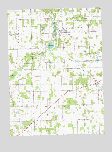
Hanover, MI USGS Topographic Map
Click on map above to begin viewing in our Map Viewer.

This topographic map contains these locations and features:
Feature Name Type Latitude Longitude GNIS ID View Map
Bansill DrainCanalN42.0061°W84.5364°2109938View Map
Bibbons LakeLakeN42.1031°W84.5622°621271View Map
Blackmar CemeteryCemeteryN42.0434°W84.5447°621546View Map
Buck LakeLakeN42.0014°W84.5641°622175View Map
Cavanaugh DrainCanalN42.1164°W84.5186°2112724View Map
Clapp SchoolSchoolN42.0650°W84.5750°623333View Map
Conklin Reed Organ and History MuseumBuildingN42.1189°W84.5475°2632983View Map
Day SchoolSchoolN42.0864°W84.5172°624378View Map
Granger SchoolSchoolN42.0289°W84.6122°627137View Map
HanoverPopulated PlaceN42.1012°W84.5519°627738View Map
Hanover Baptist ChurchChurchN42.1031°W84.5558°2632995View Map
Hanover CemeteryCemeteryN42.1000°W84.5558°2633108View Map
Hanover High School Historical MarkerParkN42.1028°W84.5476°2630742View Map
Hanover Post OfficePost OfficeN42.0994°W84.5556°2632996View Map
Hanover Station (historical)LocaleN42.1011°W84.5569°2632990View Map
Hanover Township Fire Department Station 1 HeadquartersBuildingN42.1026°W84.5547°2636042View Map
Hanover-Horton Elementary SchoolSchoolN42.1033°W84.5461°2632992View Map
Hanover-Horton High SchoolSchoolN42.1144°W84.5197°2112725View Map
Hanover-Horton Middle SchoolSchoolN42.1136°W84.5186°2632988View Map
Hanover-Horton Schools Historical MarkerParkN42.1028°W84.5476°2630743View Map
Hillside ChurchChurchN42.1214°W84.5067°2112726View Map
Horseshoe LakeLakeN42.0889°W84.5676°628606View Map
Jackson District Library-Hanover BranchBuildingN42.1028°W84.5558°2632991View Map
McNair CemeteryCemeteryN42.1008°W84.6128°2112727View Map
McNair SchoolSchoolN42.1009°W84.6127°632003View Map
Michigan and Ohio Railroad Depot Historical MarkerParkN42.0500°W84.5097°2419756View Map
Mill PondReservoirN42.0339°W84.5039°2109939View Map
Milnes SchoolSchoolN42.0139°W84.5941°632431View Map
MoscowPopulated PlaceN42.0495°W84.5100°632741View Map
Moscow CemeteryCemeteryN42.0530°W84.5106°2109940View Map
Moscow Plains CemeteryCemeteryN42.0286°W84.5708°2419744View Map
Moscow Plains ChurchChurchN42.0287°W84.5702°632742View Map
Moscow Post OfficePost OfficeN42.0494°W84.5100°2418307View Map
Moscow Station (historical)LocaleN42.0497°W84.5100°2418308View Map
Moscow Township Fire DepartmentBuildingN42.0509°W84.5064°2419699View Map
Munford SchoolSchoolN42.0431°W84.5555°633118View Map
Pope CemeteryCemeteryN42.0333°W84.6125°2418465View Map
Rustine LakeLakeN42.1104°W84.5626°636418View Map
Scipio Post Office (historical)Post OfficeN42.0683°W84.6056°2418301View Map
Scipio SchoolSchoolN42.0509°W84.6122°637453View Map
Scipio Station (historical)LocaleN42.0683°W84.6056°2418300View Map
Skinner CemeteryCemeteryN42.0720°W84.5163°638060View Map
South Moscow CemeteryCemeteryN42.0458°W84.5072°2418462View Map
Spencer LakeLakeN42.0734°W84.5070°2112723View Map
Spring Valley Estates Mobile Home ParkPopulated PlaceN42.0986°W84.5453°2632997View Map
Stoll CemeteryCemeteryN42.0083°W84.5061°2418463View Map
Stoney PointPopulated PlaceN42.0809°W84.5841°1617873View Map
Stoney Point Station (historical)LocaleN42.0806°W84.5842°2633080View Map
Stonypoint Post Office (historical)Post OfficeN42.0808°W84.5842°2631460View Map
Township of HanoverCivilN42.1161°W84.5365°1626431View Map
Township of MoscowCivilN42.0289°W84.5352°1626769View Map
Village of HanoverCivilN42.1001°W84.5542°2398243View Map

Note: Coordinates in the location and feature list above are referenced to NAD83 datum.


Copyright (C) 2008-2025 Ryan Niemi / Sunset Dynamics ... All Rights Reserved