TopoQuest Logo
Do you find TopoQuest useful?
Help keep TopoQuest running and adding new maps/features by donating!
Bitcoin:  19c7KJd3qBynnjoSw5npx9KScwjBe4ifkT
Litecoin:  LXs6TkuXGGXo1vDsWCkWVdjQX94eUKd6ui
Home View Maps Find Maps Find Places Resources & Links


Hardaway, Alabama Topographic Map

USGS Map Title: Hardaway, AL
USGS Map MRC: 32085C7
DRG (GeoTIFF) Download: o32085c7.tif


Neighboring USGS Topographic Map Quads:


  Shorter, AL  
32085D8
 

  La Place, AL  
32085D7
 

  Tuskegee, AL  
32085D6
 

  Chesson, AL  
32085C8
 

  Hardaway, AL  
32085C7
 

  Davisville, AL  
32085C6
 

  Fitzpatrick, AL  
32085B8
 

  Thompson, AL  
32085B7
 

  Union Springs, AL  
32085B6


Map MRC Location:

N33°
W86°
N33°
W85°
H8 H7 H6 H5 H4 H3 H2 H1
G8 G7 G6 G5 G4 G3 G2 G1
F8 F7 F6 F5 F4 F3 F2 F1
E8 E7 E6 E5 E4 E3 E2 E1
D8 D7 D6 D5 D4 D3 D2 D1
C8 C7 C6 C5 C4 C3 C2 C1
B8 B7 B6 B5 B4 B3 B2 B1
A8 A7 A6 A5 A4 A3 A2 A1
N32°
W86°
N32°
W85°

Hardaway, AL USGS 1:24K Topographic Map Preview:
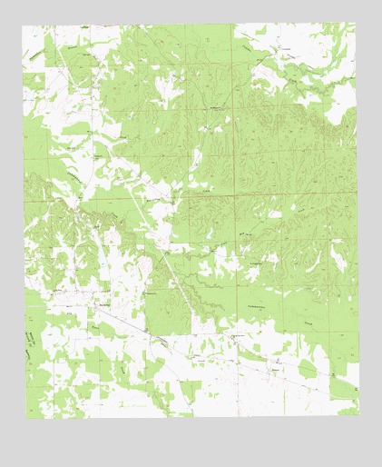
Hardaway, AL USGS Topographic Map
Click on map above to begin viewing in our Map Viewer.

This topographic map contains these locations and features:
Feature Name Type Latitude Longitude GNIS ID View Map
Ambers CemeteryCemeteryN32.3629°W85.8622°163780View Map
Beaverdam CreekStreamN32.3143°W85.8372°113760View Map
Beulah ChurchChurchN32.3107°W85.8488°114182View Map
Cole CemeteryCemeteryN32.3657°W85.8491°116403View Map
Coon Hop CreekStreamN32.3015°W85.8225°116564View Map
Damascus ChurchChurchN32.2899°W85.8297°117034View Map
Damascus School (historical)SchoolN32.2890°W85.8297°148938View Map
Dicks CreekStreamN32.2774°W85.8458°117274View Map
District 3 Volunteer Fire DepartmentBuildingN32.3744°W85.8455°2691262View Map
DownsPopulated PlaceN32.2649°W85.7841°117450View Map
EdwardsLocaleN32.2760°W85.7991°134012View Map
Greater Wesley ChapelChurchN32.2854°W85.8511°134021View Map
Grimm CemeteryCemeteryN32.2590°W85.8038°163788View Map
HardawayPopulated PlaceN32.2865°W85.8488°119711View Map
Hardaway Baptist ChurchChurchN32.2865°W85.8488°137116View Map
Hardaway CemeteryCemeteryN32.2901°W85.8527°137117View Map
Hardaway Post OfficePost OfficeN32.2868°W85.8483°166651View Map
Jack Lacey Number 1 DamDamN32.3735°W85.8700°130494View Map
John Frank Moorer DamDamN32.2985°W85.8450°130386View Map
Laceys Lake Number OneReservoirN32.3736°W85.8689°130495View Map
Lively Hope ChurchChurchN32.2904°W85.8644°121925View Map
LiverpoolPopulated PlaceN32.3668°W85.7783°156623View Map
Moorers LakeReservoirN32.3010°W85.8461°130387View Map
Mount Aaran ChurchChurchN32.2671°W85.7811°134035View Map
Mount Pisgah CemeteryCemeteryN32.2985°W85.7861°123339View Map
Mount Pisgah ChurchChurchN32.2985°W85.7855°148937View Map
Mount Pleasant CemeteryCemeteryN32.3476°W85.8019°154817View Map
Mount Pleasant ChurchChurchN32.3476°W85.8011°152494View Map
Nebraska ChurchChurchN32.3329°W85.8483°123666View Map
Pisgah School (historical)SchoolN32.2993°W85.7855°134049View Map
Sweet Gum ChurchChurchN32.3740°W85.8291°148936View Map
Sweet Gum School (historical)SchoolN32.3735°W85.8308°148935View Map
Union Oak Grove ChurchChurchN32.2751°W85.7975°153798View Map

Note: Coordinates in the location and feature list above are referenced to NAD83 datum.


Copyright (C) 2008-2025 Ryan Niemi / Sunset Dynamics ... All Rights Reserved