TopoQuest Logo
Do you find TopoQuest useful?
Help keep TopoQuest running and adding new maps/features by donating!
Bitcoin:  19c7KJd3qBynnjoSw5npx9KScwjBe4ifkT
Litecoin:  LXs6TkuXGGXo1vDsWCkWVdjQX94eUKd6ui
Home View Maps Find Maps Find Places Resources & Links


Thompson, Alabama Topographic Map

USGS Map Title: Thompson, AL
USGS Map MRC: 32085B7
DRG (GeoTIFF) Download: o32085b7.tif


Neighboring USGS Topographic Map Quads:


  Chesson, AL  
32085C8
 

  Hardaway, AL  
32085C7
 

  Davisville, AL  
32085C6
 

  Fitzpatrick, AL  
32085B8
 

  Thompson, AL  
32085B7
 

  Union Springs, AL  
32085B6
 

  China Grove, AL  
32085A8
 

  Almeria, AL  
32085A7
 

  Aberfoil, AL  
32085A6


Map MRC Location:

N33°
W86°
N33°
W85°
H8 H7 H6 H5 H4 H3 H2 H1
G8 G7 G6 G5 G4 G3 G2 G1
F8 F7 F6 F5 F4 F3 F2 F1
E8 E7 E6 E5 E4 E3 E2 E1
D8 D7 D6 D5 D4 D3 D2 D1
C8 C7 C6 C5 C4 C3 C2 C1
B8 B7 B6 B5 B4 B3 B2 B1
A8 A7 A6 A5 A4 A3 A2 A1
N32°
W86°
N32°
W85°

Thompson, AL USGS 1:24K Topographic Map Preview:
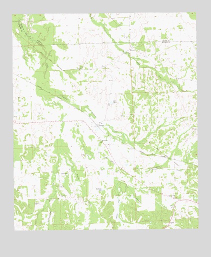
Thompson, AL USGS Topographic Map
Click on map above to begin viewing in our Map Viewer.

This topographic map contains these locations and features:
Feature Name Type Latitude Longitude GNIS ID View Map
Baldwin Chapel ChurchChurchN32.2135°W85.7652°149519View Map
Barnett Pond DamDamN32.2218°W85.8733°130315View Map
Bascom ChapelChurchN32.1551°W85.8380°135196View Map
Beckhams LakeLakeN32.1484°W85.8146°113782View Map
Bowlin CreekStreamN32.1482°W85.8044°114774View Map
CornerstonePopulated PlaceN32.1560°W85.8422°116657View Map
Cornerstone CemeteryCemeteryN32.1451°W85.8433°116658View Map
Cornerstone ChurchChurchN32.1563°W85.8394°135211View Map
Cornerstone School (historical)SchoolN32.1490°W85.8358°155367View Map
Eidson Grove Church (historical)ChurchN32.1707°W85.8530°135216View Map
Fenn Gin (historical)LocaleN32.1835°W85.8238°135218View Map
Franklin FieldAirportN32.1681°W85.8117°129422View Map
Galilee Church (historical)ChurchN32.2024°W85.7947°135221View Map
Haines Chapel CemeteryCemeteryN32.1504°W85.8408°119549View Map
Jackson CemeteryCemeteryN32.1407°W85.8611°151875View Map
Lake LouiseReservoirN32.1986°W85.8081°121321View Map
Leatherbreeches CreekStreamN32.1679°W85.8441°152007View Map
Low Field ChurchChurchN32.1438°W85.7680°152164View Map
Maytag Lake Number TwoReservoirN32.1968°W85.7800°130270View Map
Maytag Number 2 DamDamN32.1968°W85.7800°130271View Map
Moseley Gin (historical)LocaleN32.1471°W85.8305°135242View Map
Mount Hilliard Baptist ChurchChurchN32.2288°W85.7941°123223View Map
Napiers Store (historical)LocaleN32.1579°W85.8219°135254View Map
New Mount Pleasant ChurchChurchN32.1849°W85.8216°135259View Map
Old Town Creek Watershed Dam Number 31DamN32.1785°W85.7850°130240View Map
Old Town Creek Watershed Lake Number Thirty-oneReservoirN32.1785°W85.7850°130239View Map
Paulk CemeteryCemeteryN32.1301°W85.7827°124503View Map
Penile CemeteryCemeteryN32.2188°W85.8283°1805465View Map
Penile Methodist ChurchChurchN32.2182°W85.8280°124585View Map
Saint Mark ChurchChurchN32.1290°W85.7686°126154View Map
Second Baptist ChurchChurchN32.1760°W85.8158°126515View Map
Sedgefield PlantationLocaleN32.1876°W85.7775°135277View Map
Slaughter CreekStreamN32.2076°W85.8527°153467View Map
ThompsonPopulated PlaceN32.1851°W85.8180°127884View Map
Thompson Cornerstone Volunteer Fire DepartmentBuildingN32.1608°W85.8366°2691417View Map
Thompson Junior High School (historical)SchoolN32.1826°W85.8227°165605View Map
Williams CreekStreamN32.2076°W85.8527°155308View Map
Woolforks Lake (historical)LakeN32.1701°W85.7958°135287View Map

Note: Coordinates in the location and feature list above are referenced to NAD83 datum.


Copyright (C) 2008-2025 Ryan Niemi / Sunset Dynamics ... All Rights Reserved