TopoQuest Logo
Do you find TopoQuest useful?
Help keep TopoQuest running and adding new maps/features by donating!
Bitcoin:  19c7KJd3qBynnjoSw5npx9KScwjBe4ifkT
Litecoin:  LXs6TkuXGGXo1vDsWCkWVdjQX94eUKd6ui
Home View Maps Find Maps Find Places Resources & Links


Harristown, Illinois Topographic Map

USGS Map Title: Harristown, IL
USGS Map MRC: 39089G1
DRG (GeoTIFF) Download: o39089g1.tif


Neighboring USGS Topographic Map Quads:


  Latham, IL  
39089H2
 

  Warrensburg, IL  
39089H1
 

  Forsyth, IL  
39088H8
 

  Niantic, IL  
39089G2
 

  Harristown, IL  
39089G1
 

  Decatur, IL  
39088G8
 

  Stonington, IL  
39089F2
 

  Macon West, IL  
39089F1
 

  Macon East, IL  
39088F8


Map MRC Location:

N40°
W90°
N40°
W89°
H8 H7 H6 H5 H4 H3 H2 H1
G8 G7 G6 G5 G4 G3 G2 G1
F8 F7 F6 F5 F4 F3 F2 F1
E8 E7 E6 E5 E4 E3 E2 E1
D8 D7 D6 D5 D4 D3 D2 D1
C8 C7 C6 C5 C4 C3 C2 C1
B8 B7 B6 B5 B4 B3 B2 B1
A8 A7 A6 A5 A4 A3 A2 A1
N39°
W90°
N39°
W89°

Harristown, IL USGS 1:24K Topographic Map Preview:
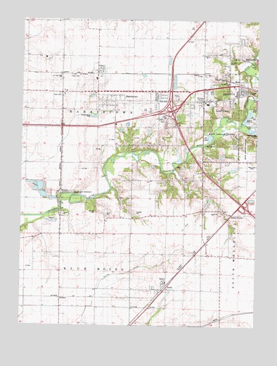
Harristown, IL USGS Topographic Map
Click on map above to begin viewing in our Map Viewer.

This topographic map contains these locations and features:
Feature Name Type Latitude Longitude GNIS ID View Map
Bethel AcademySchoolN39.8353°W89.0487°1721137View Map
Bethlehem ChurchChurchN39.7959°W89.0237°404343View Map
BlacklandPopulated PlaceN39.7614°W89.1040°422471View Map
BoodyPopulated PlaceN39.7664°W89.0492°404693View Map
Boody Census Designated PlaceCensusN39.7655°W89.0472°2628544View Map
Boody Post OfficePost OfficeN39.7629°W89.0502°2788476View Map
Brown CemeteryCemeteryN39.7950°W89.0799°404944View Map
Bulldog CrossingPopulated PlaceN39.7956°W89.0126°422514View Map
Crum CemeteryCemeteryN39.8267°W89.0667°406856View Map
East Park AcademySchoolN39.7678°W89.0481°1721145View Map
Exit 133CrossingN39.8381°W89.0456°1816699View Map
HarristownPopulated PlaceN39.8539°W89.0840°409869View Map
Harristown CemeteryCemeteryN39.8448°W89.0861°1816703View Map
Harristown Christian ChurchChurchN39.8523°W89.0854°1987808View Map
Harristown Elementary SchoolSchoolN39.8509°W89.0856°1816704View Map
Harristown Fire Protection DistrictBuildingN39.8415°W89.0295°2640344View Map
Harristown Post OfficePost OfficeN39.8536°W89.0854°2788562View Map
Holiday Inn HeliportAirportN39.8467°W89.0270°427208View Map
Homestead ParkParkN39.8462°W89.0845°1816702View Map
Hudelson CemeteryCemeteryN39.7957°W89.0643°410646View Map
Lincoln Trail BridgeBridgeN39.7970°W89.1045°425106View Map
Lincoln Trail Homestead State ParkParkN39.8028°W89.1009°412119View Map
Macon County Memorial ParkCemeteryN39.8442°W89.0534°412811View Map
Muirheid CemeteryCemeteryN39.7963°W89.0855°414219View Map
New Life ChurchChurchN39.8536°W89.0156°1816696View Map
Rock SpringSpringN39.8239°W89.0273°416832View Map
Rock Springs CenterParkN39.8281°W89.0184°1721172View Map
Salem CemeteryCemeteryN39.7977°W89.0183°1816701View Map
Salem ChurchChurchN39.7978°W89.0179°417877View Map
Scovill Municipal Golf CourseLocaleN39.8403°W89.0181°1721174View Map
Shady LakeLakeN39.8389°W89.0033°418260View Map
Sharon CemeteryCemeteryN39.8431°W89.0223°1721176View Map
Sharon ChurchChurchN39.8606°W89.0281°418291View Map
Smiths BranchStreamN39.8131°W89.0448°1816700View Map
Stevens CreekStreamN39.8339°W89.0073°419113View Map
Sunnyside ParkParkN39.8573°W89.0148°1816695View Map
Sunnyside Road ChurchChurchN39.8495°W89.0156°1816697View Map
Sunnyside SchoolSchoolN39.8536°W89.0154°419395View Map
Township of Blue MoundCivilN39.7680°W89.0822°428688View Map
Township of HarristownCivilN39.8405°W89.0885°429116View Map
Union ChapelChurchN39.8345°W89.0515°1721179View Map
Union SchoolSchoolN39.8350°W89.0487°420110View Map
Village of HarristownCivilN39.8430°W89.0615°2398254View Map
WDZ-AM (Decatur)TowerN39.8150°W89.0015°427980View Map
Westfield SchoolSchoolN39.8303°W89.1223°420962View Map
Whitley CemeteryCemeteryN39.8045°W89.1015°1816698View Map
WycklesPopulated PlaceN39.8531°W89.0290°423340View Map
Wyckles CornersPopulated PlaceN39.8439°W89.0290°421538View Map
Zion CemeteryCemeteryN39.7579°W89.0568°1721184View Map
Zion ChapelChurchN39.7578°W89.0656°421657View Map

Note: Coordinates in the location and feature list above are referenced to NAD83 datum.


Copyright (C) 2008-2025 Ryan Niemi / Sunset Dynamics ... All Rights Reserved