TopoQuest Logo
Do you find TopoQuest useful?
Help keep TopoQuest running and adding new maps/features by donating!
Bitcoin:  19c7KJd3qBynnjoSw5npx9KScwjBe4ifkT
Litecoin:  LXs6TkuXGGXo1vDsWCkWVdjQX94eUKd6ui
Home View Maps Find Maps Find Places Resources & Links


Stonington, Illinois Topographic Map

USGS Map Title: Stonington, IL
USGS Map MRC: 39089F2
DRG (GeoTIFF) Download: o39089f2.tif


Neighboring USGS Topographic Map Quads:


  Mount Auburn, IL  
39089G3
 

  Niantic, IL  
39089G2
 

  Harristown, IL  
39089G1
 

  Grove City, IL  
39089F3
 

  Stonington, IL  
39089F2
 

  Macon West, IL  
39089F1
 

  Taylorville, IL  
39089E3
 

  Willeys, IL  
39089E2
 

  Assumption, IL  
39089E1


Map MRC Location:

N40°
W90°
N40°
W89°
H8 H7 H6 H5 H4 H3 H2 H1
G8 G7 G6 G5 G4 G3 G2 G1
F8 F7 F6 F5 F4 F3 F2 F1
E8 E7 E6 E5 E4 E3 E2 E1
D8 D7 D6 D5 D4 D3 D2 D1
C8 C7 C6 C5 C4 C3 C2 C1
B8 B7 B6 B5 B4 B3 B2 B1
A8 A7 A6 A5 A4 A3 A2 A1
N39°
W90°
N39°
W89°

Stonington, IL USGS 1:24K Topographic Map Preview:
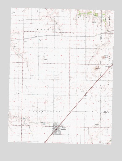
Stonington, IL USGS Topographic Map
Click on map above to begin viewing in our Map Viewer.

This topographic map contains these locations and features:
Feature Name Type Latitude Longitude GNIS ID View Map
Blue MoundSummitN39.7056°W89.1367°1736348View Map
Church of the NazareneChurchN39.6392°W89.1895°1984668View Map
Griswold County Conservation AreaParkN39.7064°W89.1376°1736350View Map
Hall CemeteryCemeteryN39.7314°W89.1334°409657View Map
Holy Trinity Catholic ChurchChurchN39.6370°W89.1890°1984669View Map
Joy Assembly ChurchChurchN39.6378°W89.1917°1984670View Map
Long MoundSummitN39.6953°W89.1445°1747908View Map
Mc Christy AirportAirportN39.6415°W89.1462°427851View Map
Mc Coy AirportAirportN39.7028°W89.2106°427075View Map
McCoy FarmsLocaleN39.7028°W89.2110°2629386View Map
MidwayPopulated PlaceN39.6698°W89.1587°1747914View Map
Mount Zion CemeteryCemeteryN39.6702°W89.2393°414113View Map
Noland RLA AirportAirportN39.7392°W89.1476°427076View Map
StoningtonPopulated PlaceN39.6400°W89.1929°419181View Map
Stonington Elementary SchoolSchoolN39.6400°W89.1840°1747885View Map
Stonington Fire Protection DistrictBuildingN39.6403°W89.1912°2640269View Map
Stonington Police DepartmentBuildingN39.6394°W89.1902°2759054View Map
Stonington Post OfficePost OfficeN39.6398°W89.1898°2788873View Map
Stonington United Methodist ChurchChurchN39.6392°W89.1884°1984671View Map
Township of StoningtonCivilN39.6552°W89.1953°429802View Map
Village of StoningtonCivilN39.6385°W89.1920°2399910View Map

Note: Coordinates in the location and feature list above are referenced to NAD83 datum.


Copyright (C) 2008-2025 Ryan Niemi / Sunset Dynamics ... All Rights Reserved