TopoQuest Logo
Do you find TopoQuest useful?
Help keep TopoQuest running and adding new maps/features by donating!
Bitcoin:  19c7KJd3qBynnjoSw5npx9KScwjBe4ifkT
Litecoin:  LXs6TkuXGGXo1vDsWCkWVdjQX94eUKd6ui
Home View Maps Find Maps Find Places Resources & Links


Niantic, Illinois Topographic Map

USGS Map Title: Niantic, IL
USGS Map MRC: 39089G2
DRG (GeoTIFF) Download: o39089g2.tif


Neighboring USGS Topographic Map Quads:


  Lake Fork, IL  
39089H3
 

  Latham, IL  
39089H2
 

  Warrensburg, IL  
39089H1
 

  Mount Auburn, IL  
39089G3
 

  Niantic, IL  
39089G2
 

  Harristown, IL  
39089G1
 

  Grove City, IL  
39089F3
 

  Stonington, IL  
39089F2
 

  Macon West, IL  
39089F1


Map MRC Location:

N40°
W90°
N40°
W89°
H8 H7 H6 H5 H4 H3 H2 H1
G8 G7 G6 G5 G4 G3 G2 G1
F8 F7 F6 F5 F4 F3 F2 F1
E8 E7 E6 E5 E4 E3 E2 E1
D8 D7 D6 D5 D4 D3 D2 D1
C8 C7 C6 C5 C4 C3 C2 C1
B8 B7 B6 B5 B4 B3 B2 B1
A8 A7 A6 A5 A4 A3 A2 A1
N39°
W90°
N39°
W89°

Niantic, IL USGS 1:24K Topographic Map Preview:
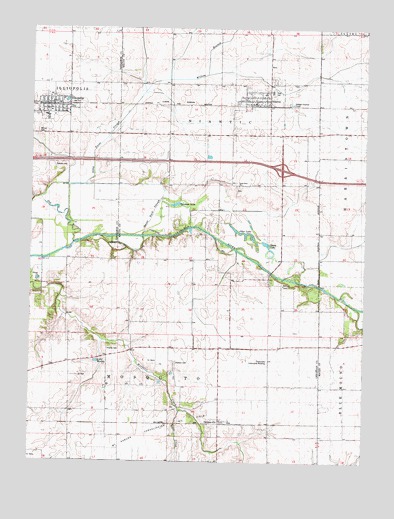
Niantic, IL USGS Topographic Map
Click on map above to begin viewing in our Map Viewer.

This topographic map contains these locations and features:
Feature Name Type Latitude Longitude GNIS ID View Map
Berea Christian CemeteryCemeteryN39.8009°W89.1548°1953211View Map
Berea ChurchChurchN39.8003°W89.1556°404204View Map
Calamus LakeLakeN39.8243°W89.1962°1721141View Map
Calamus Lake Nature PreserveParkN39.8242°W89.1929°2013474View Map
Calvary CemeteryCemeteryN39.8350°W89.2415°405393View Map
Darmer CemeteryCemeteryN39.7662°W89.1965°1953214View Map
Goose Neck SloughStreamN39.8150°W89.2084°1721153View Map
Hunter CemeteryCemeteryN39.7825°W89.2208°410696View Map
IlliopolisPopulated PlaceN39.8537°W89.2420°410774View Map
Illiopolis Fire Protection DistrictBuildingN39.8535°W89.2430°2640196View Map
Illiopolis High SchoolSchoolN39.8495°W89.2445°1747305View Map
Illiopolis Post OfficePost OfficeN39.8523°W89.2424°2788189View Map
Illiopolis Village Police DepartmentBuildingN39.8527°W89.2419°2759036View Map
Interchange 25CrossingN39.8345°W89.1562°1816705View Map
Lake WaddyLakeN39.7789°W89.2250°420357View Map
Long Point CemeteryCemeteryN39.8292°W89.1723°1816706View Map
Long Point ChurchChurchN39.8292°W89.1726°412588View Map
Long Point SloughStreamN39.8191°W89.2286°412594View Map
NianticPopulated PlaceN39.8539°W89.1662°414505View Map
Niantic Fire Protection DistrictBuildingN39.8537°W89.1608°2640398View Map
Niantic Post OfficePost OfficeN39.8532°W89.1674°2788565View Map
Niantic-Harristown High SchoolSchoolN39.8567°W89.1604°1721164View Map
OsbernvillePopulated PlaceN39.7612°W89.1787°415189View Map
Osbernville Community BuildingBuildingN39.7795°W89.1612°1747966View Map
Otter LakeLakeN39.8162°W89.1712°1721166View Map
Sheep LakeLakeN39.8126°W89.1615°1721177View Map
Simmons FarmLocaleN39.7599°W89.1966°2629385View Map
Stafford CemeteryCemeteryN39.7787°W89.1955°419021View Map
Township of MosquitoCivilN39.7565°W89.1983°429397View Map
Township of NianticCivilN39.8638°W89.1793°429446View Map
Village of IlliopolisCivilN39.8514°W89.2477°2398568View Map
Village of NianticCivilN39.8544°W89.1649°2399496View Map
Wilcox CemeteryCemeteryN39.8439°W89.2472°1747338View Map
Willow BranchStreamN39.8687°W89.1843°2559587View Map

Note: Coordinates in the location and feature list above are referenced to NAD83 datum.


Copyright (C) 2008-2025 Ryan Niemi / Sunset Dynamics ... All Rights Reserved