TopoQuest Logo
Do you find TopoQuest useful?
Help keep TopoQuest running and adding new maps/features by donating!
Bitcoin:  19c7KJd3qBynnjoSw5npx9KScwjBe4ifkT
Litecoin:  LXs6TkuXGGXo1vDsWCkWVdjQX94eUKd6ui
Home View Maps Find Maps Find Places Resources & Links


Macon West, Illinois Topographic Map

USGS Map Title: Macon West, IL
USGS Map MRC: 39089F1
DRG (GeoTIFF) Download: o39089f1.tif


Neighboring USGS Topographic Map Quads:


  Niantic, IL  
39089G2
 

  Harristown, IL  
39089G1
 

  Decatur, IL  
39088G8
 

  Stonington, IL  
39089F2
 

  Macon West, IL  
39089F1
 

  Macon East, IL  
39088F8
 

  Willeys, IL  
39089E2
 

  Assumption, IL  
39089E1
 

  Obed, IL  
39088E8


Map MRC Location:

N40°
W90°
N40°
W89°
H8 H7 H6 H5 H4 H3 H2 H1
G8 G7 G6 G5 G4 G3 G2 G1
F8 F7 F6 F5 F4 F3 F2 F1
E8 E7 E6 E5 E4 E3 E2 E1
D8 D7 D6 D5 D4 D3 D2 D1
C8 C7 C6 C5 C4 C3 C2 C1
B8 B7 B6 B5 B4 B3 B2 B1
A8 A7 A6 A5 A4 A3 A2 A1
N39°
W90°
N39°
W89°

Macon West, IL USGS 1:24K Topographic Map Preview:
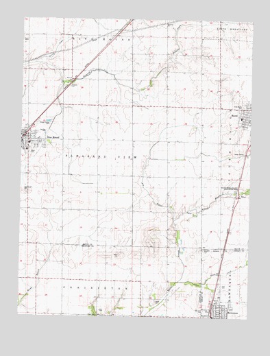
Macon West, IL USGS Topographic Map
Click on map above to begin viewing in our Map Viewer.

This topographic map contains these locations and features:
Feature Name Type Latitude Longitude GNIS ID View Map
Adams CemeteryCemeteryN39.6509°W89.0706°403345View Map
Bethel CemeteryCemeteryN39.7244°W89.0978°1816655View Map
Bethel ChurchChurchN39.7250°W89.0970°404306View Map
Blue MoundPopulated PlaceN39.7012°W89.1231°404595View Map
Blue Mound Community Rural Fire Protection DistrictBuildingN39.7020°W89.1210°2640483View Map
Blue Mound Elementary SchoolSchoolN39.6978°W89.1206°1816656View Map
Blue Mound Post OfficePost OfficeN39.7001°W89.1239°2788773View Map
Cribbet AirportAirportN39.6964°W89.0634°427077View Map
Dry BranchStreamN39.6664°W89.0417°407409View Map
First Baptist ChurchChurchN39.6273°W89.0151°1953857View Map
First Christian ChurchChurchN39.6989°W89.1209°1953856View Map
First United Methodist ChurchChurchN39.6270°W89.0167°1953858View Map
Grace Baptist ChurchChurchN39.6270°W89.0195°1953859View Map
Independent Order of Oddfellows CemeteryCemeteryN39.6384°W89.0148°1725274View Map
Jacobs CemeteryCemeteryN39.6315°W89.0505°411019View Map
Long Grove CreekStreamN39.6412°W89.0365°412567View Map
Macon CemeteryCemeteryN39.7139°W89.0042°1736352View Map
Macon Elementary SchoolSchoolN39.7089°W89.0054°1816654View Map
Meridian Middle SchoolSchoolN39.6950°W89.1217°1736349View Map
Moweaqua Elementary SchoolSchoolN39.6314°W89.0181°1821186View Map
Moweaqua High SchoolSchoolN39.6314°W89.0176°1725298View Map
Moweaqua Police DepartmentBuildingN39.6257°W89.0195°2758912View Map
Pleasant View CemeteryCemeteryN39.6775°W89.1223°415915View Map
Pope CemeteryCemeteryN39.7408°W89.1226°416020View Map
South Macon Fire Protection DistrictBuildingN39.7081°W89.0001°2640811View Map
Spring CreekStreamN39.7334°W89.1148°418939View Map
Township of Pleasant ViewCivilN39.6916°W89.0831°429583View Map
Traughber CemeteryCemeteryN39.6533°W89.0251°419821View Map
Village of Blue MoundCivilN39.7005°W89.1186°2398142View Map
WalkerPopulated PlaceN39.6764°W89.0067°423279View Map
WDZQ-FM (Decatur)TowerN39.6267°W89.0804°428476View Map
Westside CemeteryCemeteryN39.6279°W89.0242°1725346View Map
Willow Branch County Conservation AreaParkN39.6778°W89.0079°1736353View Map

Note: Coordinates in the location and feature list above are referenced to NAD83 datum.


Copyright (C) 2008-2025 Ryan Niemi / Sunset Dynamics ... All Rights Reserved