TopoQuest Logo
Do you find TopoQuest useful?
Help keep TopoQuest running and adding new maps/features by donating!
Bitcoin:  19c7KJd3qBynnjoSw5npx9KScwjBe4ifkT
Litecoin:  LXs6TkuXGGXo1vDsWCkWVdjQX94eUKd6ui
Home View Maps Find Maps Find Places Resources & Links


Harrisville, New York Topographic Map

USGS Map Title: Harrisville, NY
USGS Map MRC: 44075B3
DRG (GeoTIFF) Download: o44075b3.tif


Neighboring USGS Topographic Map Quads:


  Gouverneur, NY  
44075C4
 

  Edwards, NY  
44075C3
 

  South Edwards, NY  
44075C2
 

  Lake Bonaparte, NY  
44075B4
 

  Harrisville, NY  
44075B3
 

  Fine, NY  
44075B2
 

  Natural Bridge, NY  
44075A4
 

  Remington Corners, NY  
44075A3
 

  Oswegatchie SW, NY  
44075A2


Map MRC Location:

N45°
W76°
N45°
W75°
H8 H7 H6 H5 H4 H3 H2 H1
G8 G7 G6 G5 G4 G3 G2 G1
F8 F7 F6 F5 F4 F3 F2 F1
E8 E7 E6 E5 E4 E3 E2 E1
D8 D7 D6 D5 D4 D3 D2 D1
C8 C7 C6 C5 C4 C3 C2 C1
B8 B7 B6 B5 B4 B3 B2 B1
A8 A7 A6 A5 A4 A3 A2 A1
N44°
W76°
N44°
W75°

Harrisville, NY USGS 1:24K Topographic Map Preview:
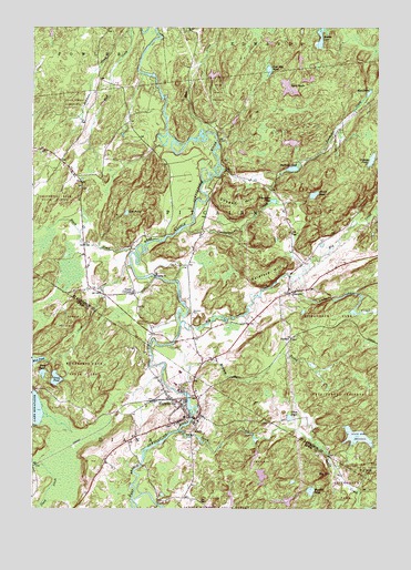
Harrisville, NY USGS Topographic Map
Click on map above to begin viewing in our Map Viewer.

This topographic map contains these locations and features:
Feature Name Type Latitude Longitude GNIS ID View Map
BackusPopulated PlaceN44.1695°W75.2810°975908View Map
Baldface HillSummitN44.1853°W75.2871°975911View Map
Beaver LakeLakeN44.2473°W75.2708°977212View Map
Big CreekStreamN44.1731°W75.3208°975962View Map
Big HillSummitN44.1337°W75.2705°943894View Map
Big Hill PondLakeN44.1298°W75.2740°943897View Map
Black CreekStreamN44.1926°W75.3374°975980View Map
Bowman CreekStreamN44.2492°W75.3391°976005View Map
Bullhead PondLakeN44.2134°W75.2807°976058View Map
Clear CreekStreamN44.1884°W75.3391°976148View Map
Cooper HillSummitN44.2070°W75.3046°976184View Map
Duck PondLakeN44.1602°W75.3710°948753View Map
Garrison CemeteryCemeteryN44.1758°W75.3171°976342View Map
Geers CornersPopulated PlaceN44.1812°W75.3380°976343View Map
Goose PondLakeN44.1490°W75.2817°976350View Map
Graham PondLakeN44.2158°W75.2521°976354View Map
Green PondLakeN44.1589°W75.3664°951721View Map
HarrisvillePopulated PlaceN44.1520°W75.3210°952291View Map
Harrisville Elementary SchoolSchoolN44.1608°W75.3215°2668856View Map
Harrisville Junior - Senior High SchoolSchoolN44.1604°W75.3219°2669032View Map
Harrisville Volunteer Fire DepartmentBuildingN44.1490°W75.3235°2718437View Map
Jenny CreekStreamN44.1853°W75.2813°976494View Map
Lost PondLakeN44.2021°W75.3410°976602View Map
Marshey Road BridgeBridgeN44.1261°W75.3293°2614952View Map
Meadow BrookStreamN44.1676°W75.3252°976653View Map
Mud PondLakeN44.2331°W75.2530°976700View Map
Mud PondLakeN44.1636°W75.3743°970386View Map
Pine Hill PondLakeN44.2375°W75.2910°976821View Map
PitcairnPopulated PlaceN44.1812°W75.2821°976830View Map
Saint Francis Solanus ChurchChurchN44.1523°W75.3210°2616911View Map
Shiner PondLakeN44.2066°W75.2730°976986View Map
South CreekStreamN44.1451°W75.3216°977032View Map
Toothaker CreekStreamN44.1984°W75.3194°977126View Map
Toothaker PondLakeN44.2051°W75.2879°977127View Map
Town of PitcairnCivilN44.1948°W75.2770°979369View Map
Twin PondsLakeN44.2345°W75.2822°977154View Map
Village of HarrisvilleCivilN44.1532°W75.3212°2390884View Map

Note: Coordinates in the location and feature list above are referenced to NAD83 datum.


Copyright (C) 2008-2024 Ryan Niemi / Sunset Dynamics ... All Rights Reserved