TopoQuest Logo
Do you find TopoQuest useful?
Help keep TopoQuest running and adding new maps/features by donating!
Bitcoin:  19c7KJd3qBynnjoSw5npx9KScwjBe4ifkT
Litecoin:  LXs6TkuXGGXo1vDsWCkWVdjQX94eUKd6ui
Home View Maps Find Maps Find Places Resources & Links


Natural Bridge, New York Topographic Map

USGS Map Title: Natural Bridge, NY
USGS Map MRC: 44075A4
DRG (GeoTIFF) Download: o44075a4.tif


Neighboring USGS Topographic Map Quads:


  Antwerp, NY  
44075B5
 

  Lake Bonaparte, NY  
44075B4
 

  Harrisville, NY  
44075B3
 

  North Wilna, NY  
44075A5
 

  Natural Bridge, NY  
44075A4
 

  Remington Corners, NY  
44075A3
 

  Carthage, NY  
43075H5
 

  Croghan, NY  
43075H4
 

  Belfort, NY  
43075H3


Map MRC Location:

N45°
W76°
N45°
W75°
H8 H7 H6 H5 H4 H3 H2 H1
G8 G7 G6 G5 G4 G3 G2 G1
F8 F7 F6 F5 F4 F3 F2 F1
E8 E7 E6 E5 E4 E3 E2 E1
D8 D7 D6 D5 D4 D3 D2 D1
C8 C7 C6 C5 C4 C3 C2 C1
B8 B7 B6 B5 B4 B3 B2 B1
A8 A7 A6 A5 A4 A3 A2 A1
N44°
W76°
N44°
W75°

Natural Bridge, NY USGS 1:24K Topographic Map Preview:
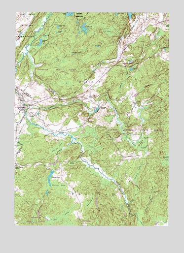
Natural Bridge, NY USGS Topographic Map
Click on map above to begin viewing in our Map Viewer.

This topographic map contains these locations and features:
Feature Name Type Latitude Longitude GNIS ID View Map
Alder CreekStreamN44.0134°W75.4094°942285View Map
Ashcraft PondLakeN44.0241°W75.4703°942628View Map
Bartlett CornersLocaleN44.0720°W75.4027°943095View Map
Beartown SwampSwampN44.0145°W75.4382°943338View Map
Beaver PondLakeN44.0184°W75.4732°943437View Map
Black Ash SwampSwampN44.0456°W75.4649°944070View Map
Blanchard CemeteryCemeteryN44.0749°W75.4413°944221View Map
Blanchard CornersLocaleN44.0692°W75.4308°944222View Map
Blanchard CreekStreamN44.0701°W75.4902°944224View Map
Blanchard PondLakeN44.0681°W75.4336°944227View Map
Blanchard SwampSwampN44.0315°W75.3999°944228View Map
Blue SwampSwampN44.0051°W75.4619°944335View Map
Burnt PondLakeN44.1048°W75.4330°945267View Map
Clark PondLakeN44.1241°W75.4180°946774View Map
Cold SwampSwampN44.1134°W75.4249°947085View Map
Crooked PondLakeN44.1156°W75.4439°947787View Map
Diana CenterPopulated PlaceN44.0756°W75.4408°972381View Map
Doherty PondLakeN44.1134°W75.4664°948546View Map
Fitzgerald PondLakeN44.0961°W75.4072°950191View Map
Fourth CreekStreamN44.0137°W75.4077°950540View Map
Hillside CemeteryCemeteryN44.0732°W75.4851°952853View Map
Hogsback CreekStreamN44.0734°W75.4249°952967View Map
Hogsback PondLakeN44.0919°W75.4059°952968View Map
Indian River FlatsFlatN44.0348°W75.4335°953698View Map
Johnson PondLakeN44.1108°W75.4759°954132View Map
Little Rocks PondsLakeN44.1006°W75.4534°955664View Map
Long SwampSwampN44.0970°W75.4627°955936View Map
Middle HillSummitN44.0095°W75.4227°957105View Map
Natural BridgePopulated PlaceN44.0690°W75.4938°958296View Map
Natural Bridge Census Designated PlaceCensusN44.0718°W75.4999°2389530View Map
Natural Bridge Post OfficePost OfficeN44.0695°W75.4963°2618032View Map
Natural Bridge StationLocaleN44.0648°W75.4844°958298View Map
Natural Bridge Volunteer Fire CompanyBuildingN44.0677°W75.4951°2734736View Map
North Croghan CrossingPopulated PlaceN44.0348°W75.4969°972861View Map
Onjebonge PondLakeN44.1071°W75.4793°959387View Map
Patchin SwampSwampN44.0509°W75.3955°959975View Map
Pine CreekStreamN44.0295°W75.4277°960430View Map
Prittie SwampSwampN44.0462°W75.3996°961149View Map
Punky SwampSwampN44.0367°W75.4535°961985View Map
Quackenbush PondLakeN44.1035°W75.3782°962025View Map
Quarry PondLakeN44.1121°W75.4951°962071View Map
Schoolhouse SwampSwampN44.0231°W75.4644°964613View Map
Second CreekStreamN44.0070°W75.4002°964766View Map
Steam Mill PondLakeN44.1165°W75.4652°966309View Map
Third CreekStreamN44.0151°W75.3888°967367View Map
Weatherhead CreekStreamN44.0487°W75.4538°968960View Map

Note: Coordinates in the location and feature list above are referenced to NAD83 datum.


Copyright (C) 2008-2024 Ryan Niemi / Sunset Dynamics ... All Rights Reserved