TopoQuest Logo
Do you find TopoQuest useful?
Help keep TopoQuest running and adding new maps/features by donating!
Bitcoin:  19c7KJd3qBynnjoSw5npx9KScwjBe4ifkT
Litecoin:  LXs6TkuXGGXo1vDsWCkWVdjQX94eUKd6ui
Home View Maps Find Maps Find Places Resources & Links


Lake Bonaparte, New York Topographic Map

USGS Map Title: Lake Bonaparte, NY
USGS Map MRC: 44075B4
DRG (GeoTIFF) Download: o44075b4.tif


Neighboring USGS Topographic Map Quads:


  Natural Dam, NY  
44075C5
 

  Gouverneur, NY  
44075C4
 

  Edwards, NY  
44075C3
 

  Antwerp, NY  
44075B5
 

  Lake Bonaparte, NY  
44075B4
 

  Harrisville, NY  
44075B3
 

  North Wilna, NY  
44075A5
 

  Natural Bridge, NY  
44075A4
 

  Remington Corners, NY  
44075A3


Map MRC Location:

N45°
W76°
N45°
W75°
H8 H7 H6 H5 H4 H3 H2 H1
G8 G7 G6 G5 G4 G3 G2 G1
F8 F7 F6 F5 F4 F3 F2 F1
E8 E7 E6 E5 E4 E3 E2 E1
D8 D7 D6 D5 D4 D3 D2 D1
C8 C7 C6 C5 C4 C3 C2 C1
B8 B7 B6 B5 B4 B3 B2 B1
A8 A7 A6 A5 A4 A3 A2 A1
N44°
W76°
N44°
W75°

Lake Bonaparte, NY USGS 1:24K Topographic Map Preview:
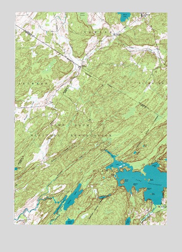
Lake Bonaparte, NY USGS Topographic Map
Click on map above to begin viewing in our Map Viewer.

This topographic map contains these locations and features:
Feature Name Type Latitude Longitude GNIS ID View Map
Abbots SwampSwampN44.2476°W75.4447°975873View Map
Adirondack 1000 Islands CampingLocaleN44.1391°W75.3785°2615177View Map
AlpinaPopulated PlaceN44.1692°W75.4266°972162View Map
BalmatPopulated PlaceN44.2484°W75.3949°975913View Map
Benton PondLakeN44.1677°W75.4007°943711View Map
Bentons PointCapeN44.1478°W75.4024°943714View Map
Birch IslandIslandN44.1515°W75.3899°943999View Map
Bonaparte CreekStreamN44.1390°W75.4796°944415View Map
Bullhead PondLakeN44.1257°W75.4068°945157View Map
Bullrock PointCapeN44.1465°W75.3916°945166View Map
Burnt PondLakeN44.1412°W75.4272°945268View Map
Clark CreekStreamN44.1373°W75.3805°946756View Map
Deerlick CreekStreamN44.1312°W75.4927°948246View Map
Dobson CreekStreamN44.1370°W75.3846°948513View Map
Hitchcock BayBayN44.1603°W75.3843°952896View Map
Indian LakeLakeN44.1415°W75.4513°953671View Map
Indian PondLakeN44.1265°W75.4550°953690View Map
Kellogg CornersLocaleN44.2373°W75.4183°976513View Map
Lake BonapartePopulated PlaceN44.1381°W75.3794°954896View Map
Lake BonaparteLakeN44.1515°W75.3938°944416View Map
Marsh PondLakeN44.1537°W75.4169°956562View Map
Mud LakeReservoirN44.1690°W75.4258°958042View Map
Narrow LakeLakeN44.1402°W75.4538°958267View Map
Rices CornersLocaleN44.2178°W75.4463°976885View Map
Rock IslandIslandN44.1434°W75.3880°962707View Map
Round IslandIslandN44.1506°W75.4113°962970View Map
Snake PondLakeN44.1714°W75.3946°965565View Map

Note: Coordinates in the location and feature list above are referenced to NAD83 datum.


Copyright (C) 2008-2024 Ryan Niemi / Sunset Dynamics ... All Rights Reserved