TopoQuest Logo
Do you find TopoQuest useful?
Help keep TopoQuest running and adding new maps/features by donating!
Bitcoin:  19c7KJd3qBynnjoSw5npx9KScwjBe4ifkT
Litecoin:  LXs6TkuXGGXo1vDsWCkWVdjQX94eUKd6ui
Home View Maps Find Maps Find Places Resources & Links


Edwards, New York Topographic Map

USGS Map Title: Edwards, NY
USGS Map MRC: 44075C3
DRG (GeoTIFF) Download: o44075c3.tif


Neighboring USGS Topographic Map Quads:


  Richville, NY  
44075D4
 

  Bigelow, NY  
44075D3
 

  Hermon, NY  
44075D2
 

  Gouverneur, NY  
44075C4
 

  Edwards, NY  
44075C3
 

  South Edwards, NY  
44075C2
 

  Lake Bonaparte, NY  
44075B4
 

  Harrisville, NY  
44075B3
 

  Fine, NY  
44075B2


Map MRC Location:

N45°
W76°
N45°
W75°
H8 H7 H6 H5 H4 H3 H2 H1
G8 G7 G6 G5 G4 G3 G2 G1
F8 F7 F6 F5 F4 F3 F2 F1
E8 E7 E6 E5 E4 E3 E2 E1
D8 D7 D6 D5 D4 D3 D2 D1
C8 C7 C6 C5 C4 C3 C2 C1
B8 B7 B6 B5 B4 B3 B2 B1
A8 A7 A6 A5 A4 A3 A2 A1
N44°
W76°
N44°
W75°

Edwards, NY USGS 1:24K Topographic Map Preview:
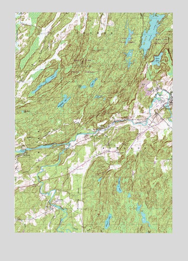
Edwards, NY USGS Topographic Map
Click on map above to begin viewing in our Map Viewer.

This topographic map contains these locations and features:
Feature Name Type Latitude Longitude GNIS ID View Map
Bennett BrookStreamN44.2531°W75.3397°975954View Map
Bonner LakeLakeN44.2567°W75.3010°976000View Map
Cedar LakeLakeN44.3482°W75.2622°976097View Map
Chub LakeLakeN44.3367°W75.3491°976136View Map
Clear LakeLakeN44.2765°W75.2924°976149View Map
EdwardsPopulated PlaceN44.3245°W75.2510°976283View Map
Edwards Census Designated PlaceCensusN44.3233°W75.2519°2761297View Map
Edwards Volunteer Fire DepartmentBuildingN44.3242°W75.2550°2735275View Map
EmeryvillePopulated PlaceN44.2951°W75.3674°976298View Map
Fairview CemeteryCemeteryN44.3253°W75.2583°976302View Map
FullervillePopulated PlaceN44.2681°W75.3419°976332View Map
Fullerville ChurchChurchN44.2640°W75.3460°976333View Map
Fullerville FallsFallsN44.2653°W75.3424°2788112View Map
Fullerville SandsSummitN44.2709°W75.3244°976334View Map
Gulf CemeteryCemeteryN44.2771°W75.3590°976384View Map
Hall CreekStreamN44.2509°W75.3402°976396View Map
Huckleberry LakeLakeN44.3233°W75.3368°976461View Map
Little Mud PondLakeN44.3188°W75.3686°976568View Map
Moon LakeLakeN44.3328°W75.3205°976670View Map
Mott CreekStreamN44.2528°W75.3033°976686View Map
Pork CreekStreamN44.3065°W75.3110°976849View Map
Riverside CemeteryCemeteryN44.3262°W75.2521°976890View Map
TalcvillePopulated PlaceN44.3098°W75.3060°977094View Map
Town of EdwardsCivilN44.2973°W75.2651°978927View Map
Trout LakeLakeN44.3641°W75.2674°977139View Map
Village of EdwardsCivilN44.3228°W75.2519°2391658View Map
West Branch Oswegatchie RiverStreamN44.3009°W75.3324°977254View Map
Wolf LakeLakeN44.3352°W75.3128°977295View Map

Note: Coordinates in the location and feature list above are referenced to NAD83 datum.


Copyright (C) 2008-2024 Ryan Niemi / Sunset Dynamics ... All Rights Reserved