TopoQuest Logo
Do you find TopoQuest useful?
Help keep TopoQuest running and adding new maps/features by donating!
Bitcoin:  19c7KJd3qBynnjoSw5npx9KScwjBe4ifkT
Litecoin:  LXs6TkuXGGXo1vDsWCkWVdjQX94eUKd6ui
Home View Maps Find Maps Find Places Resources & Links


Hartford East, Wisconsin Topographic Map

USGS Map Title: Hartford East, WI
USGS Map MRC: 43088C3
DRG (GeoTIFF) Download: o43088c3.tif


Neighboring USGS Topographic Map Quads:


  Nenno, WI  
43088D4
 

  Allenton, WI  
43088D3
 

  West Bend, WI  
43088D2
 

  Hartford West, WI  
43088C4
 

  Hartford East, WI  
43088C3
 

  Jackson, WI  
43088C2
 

  Stonebank, WI  
43088B4
 

  Merton, WI  
43088B3
 

  Sussex, WI  
43088B2


Map MRC Location:

N44°
W89°
N44°
W88°
H8 H7 H6 H5 H4 H3 H2 H1
G8 G7 G6 G5 G4 G3 G2 G1
F8 F7 F6 F5 F4 F3 F2 F1
E8 E7 E6 E5 E4 E3 E2 E1
D8 D7 D6 D5 D4 D3 D2 D1
C8 C7 C6 C5 C4 C3 C2 C1
B8 B7 B6 B5 B4 B3 B2 B1
A8 A7 A6 A5 A4 A3 A2 A1
N43°
W89°
N43°
W88°

Hartford East, WI USGS 1:24K Topographic Map Preview:
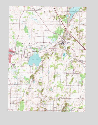
Hartford East, WI USGS Topographic Map
Click on map above to begin viewing in our Map Viewer.

This topographic map contains these locations and features:
Feature Name Type Latitude Longitude GNIS ID View Map
AckervillePopulated PlaceN43.3100°W88.2582°1560674View Map
Aurora Medical CenterHospitalN43.3184°W88.3624°1840967View Map
Becker FarmsLocaleN43.3292°W88.3653°2706437View Map
Cedar LakePopulated PlaceN43.3539°W88.2926°1562855View Map
Diefenbach CornersPopulated PlaceN43.3536°W88.2607°1563979View Map
Ehmke FarmsLocaleN43.2758°W88.3139°2706436View Map
Emmanuel ChurchChurchN43.2769°W88.3409°1564628View Map
Fox HillSummitN43.3719°W88.2543°1565208View Map
Friess Lake SchoolSchoolN43.2532°W88.2603°1565339View Map
Gehring FarmsLocaleN43.3686°W88.3297°2706433View Map
Gehring View FarmsLocaleN43.3625°W88.3556°2706439View Map
Hartford Millpond 32ReservoirN43.3185°W88.3736°1793502View Map
Heartfield FarmLocaleN43.3519°W88.3411°2706461View Map
Highland AcresLocaleN43.2875°W88.3183°2706435View Map
Interchange 64CrossingN43.3244°W88.2508°2356997View Map
Interchange 66CrossingN43.3475°W88.2819°2356996View Map
Interchange 68CrossingN43.3694°W88.3000°2356995View Map
Kettle Hills FarmLocaleN43.2803°W88.3144°2706463View Map
Kratz FarmsLocaleN43.3114°W88.2547°2706426View Map
Lepien Farview FarmLocaleN43.2944°W88.3283°2706465View Map
Log House FarmLocaleN43.2744°W88.3394°2706467View Map
Lohr PondLakeN43.2844°W88.3333°2761845View Map
Mayer FarmsLocaleN43.2944°W88.2833°2706478View Map
Misty MeadowsLocaleN43.3108°W88.2839°2706477View Map
Mud LakeLakeN43.3178°W88.2852°1569911View Map
Mueller LakeLakeN43.3638°W88.2810°1570010View Map
Old Saint Peter CemeteryCemeteryN43.3336°W88.2820°2781237View Map
Pike LakeLakeN43.3107°W88.3326°1571379View Map
Pike LakePopulated PlaceN43.3139°W88.3420°1571384View Map
Pike Lake 13ReservoirN43.3217°W88.3334°1792820View Map
Pike Lake 2WP1323 DamDamN43.3217°W88.3334°1792819View Map
Pike Lake State ParkParkN43.3200°W88.3148°1571388View Map
Rossman Elementary SchoolSchoolN43.3240°W88.3701°1840956View Map
Saint Augustine SchoolSchoolN43.2550°W88.3006°1572852View Map
Saint Johns ChurchChurchN43.2956°W88.2809°1573083View Map
Saint LawrencePopulated PlaceN43.3697°W88.3329°1573207View Map
Saint Lawrence Volunteer Fire DepartmentBuildingN43.3714°W88.3353°2697620View Map
Saint Paul Little Learners PreschoolSchoolN43.3274°W88.2713°2716650View Map
Saint Pauls ChurchChurchN43.3044°W88.2506°1573476View Map
Saint Peter Catholic SchoolSchoolN43.3331°W88.2832°1840973View Map
Saint Peters Catholic ChurchChurchN43.3336°W88.2837°1840974View Map
Schwendimann FarmLocaleN43.3400°W88.3322°2706470View Map
SlingerPopulated PlaceN43.3336°W88.2862°1574278View Map
Slinger Elementary SchoolSchoolN43.3307°W88.2868°1840977View Map
Slinger Fire DepartmentBuildingN43.3339°W88.2878°2697676View Map
Slinger High SchoolSchoolN43.3306°W88.2868°1840978View Map
Slinger High SchoolSchoolN43.3305°W88.2850°1840979View Map
Slinger Middle SchoolSchoolN43.3309°W88.2667°2716886View Map
Slinger Police DepartmentBuildingN43.3279°W88.2798°2759606View Map
Slinger Wastewater Treatment FacilityLocaleN43.3336°W88.2978°2723892View Map
Strupp Dairy FarmLocaleN43.3547°W88.3461°2706472View Map
ThompsonPopulated PlaceN43.2586°W88.3707°1575375View Map
Town of HartfordCivilN43.3265°W88.3567°1583360View Map
Union CemeteryCemeteryN43.3397°W88.2823°1575874View Map
Village of SlingerCivilN43.3318°W88.2798°1584168View Map
Werner PondLakeN43.2968°W88.3094°2761852View Map
Zuern FarmLocaleN43.3347°W88.3408°2706473View Map

Note: Coordinates in the location and feature list above are referenced to NAD83 datum.


Copyright (C) 2008-2024 Ryan Niemi / Sunset Dynamics ... All Rights Reserved