TopoQuest Logo
Do you find TopoQuest useful?
Help keep TopoQuest running and adding new maps/features by donating!
Bitcoin:  19c7KJd3qBynnjoSw5npx9KScwjBe4ifkT
Litecoin:  LXs6TkuXGGXo1vDsWCkWVdjQX94eUKd6ui
Home View Maps Find Maps Find Places Resources & Links


Stonebank, Wisconsin Topographic Map

USGS Map Title: Stonebank, WI
USGS Map MRC: 43088B4
DRG (GeoTIFF) Download: o43088b4.tif


Neighboring USGS Topographic Map Quads:


  Hustisford, WI  
43088C5
 

  Hartford West, WI  
43088C4
 

  Hartford East, WI  
43088C3
 

  Ixonia, WI  
43088B5
 

  Stonebank, WI  
43088B4
 

  Merton, WI  
43088B3
 

  Oconomowoc West, WI  
43088A5
 

  Oconomowoc East, WI  
43088A4
 

  Hartland, WI  
43088A3


Map MRC Location:

N44°
W89°
N44°
W88°
H8 H7 H6 H5 H4 H3 H2 H1
G8 G7 G6 G5 G4 G3 G2 G1
F8 F7 F6 F5 F4 F3 F2 F1
E8 E7 E6 E5 E4 E3 E2 E1
D8 D7 D6 D5 D4 D3 D2 D1
C8 C7 C6 C5 C4 C3 C2 C1
B8 B7 B6 B5 B4 B3 B2 B1
A8 A7 A6 A5 A4 A3 A2 A1
N43°
W89°
N43°
W88°

Stonebank, WI USGS 1:24K Topographic Map Preview:
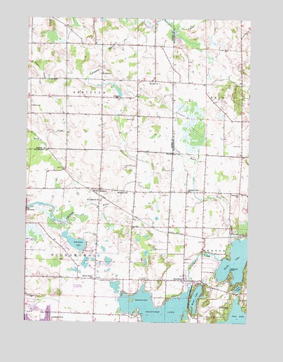
Stonebank, WI USGS Topographic Map
Click on map above to begin viewing in our Map Viewer.

This topographic map contains these locations and features:
Feature Name Type Latitude Longitude GNIS ID View Map
AlderleyPopulated PlaceN43.2175°W88.4498°1560746View Map
Alderley MillpondReservoirN43.2200°W88.4490°1792680View Map
Alderly Mill 1866c-71 DamDamN43.2167°W88.4484°1792679View Map
Ashippun CemeteryCemeteryN43.2139°W88.4979°1560979View Map
Ashippun LakeReservoirN43.1576°W88.4718°1560980View Map
Ashippun Volunteer Fire Department Station 2BuildingN43.2181°W88.4592°2698011View Map
Cornell LakeLakeN43.1390°W88.3804°1563407View Map
Crystal LakeLakeN43.1300°W88.4925°2764592View Map
Culleden FarmLocaleN43.2103°W88.3850°2706434View Map
Kettle Moraine United Presbyterian ChurchChurchN43.1425°W88.4054°1850371View Map
MapletonPopulated PlaceN43.1789°W88.4601°1569008View Map
Mapleton SchoolSchoolN43.1783°W88.4487°1569009View Map
Mason CreekStreamN43.1597°W88.3820°1569115View Map
McDowell IslandIslandN43.1339°W88.4395°1569211View Map
Meadow View Elementary SchoolSchoolN43.1480°W88.4634°1562267View Map
MontereyPopulated PlaceN43.1711°W88.4995°1569675View Map
Monterey DamDamN43.1717°W88.4984°1792080View Map
Monterey Millpond 34ReservoirN43.1735°W88.4937°1792081View Map
Moose LakeLakeN43.1351°W88.4040°1569711View Map
Mount Hope CemeteryCemeteryN43.2247°W88.4834°1569811View Map
North LakeLakeN43.1503°W88.3820°1930545View Map
North LakeLakeN43.1503°W88.3834°1570455View Map
Oconomowoc AirportAirportN43.1389°W88.4723°1582116View Map
Oconomowoc Town CemeteryCemeteryN43.1417°W88.4503°2096614View Map
Oconomowoc Town Police DepartmentBuildingN43.1431°W88.4602°2759639View Map
Okauchee Lake 85ReservoirN43.1258°W88.4268°1792083View Map
Pleasant View SchoolSchoolN43.1794°W88.4095°1571671View Map
Roskopf FarmsLocaleN43.2242°W88.4072°2706511View Map
Saint Catherine ChurchChurchN43.1750°W88.4584°1572883View Map
Saint Catherines Catholic CemeteryCemeteryN43.1753°W88.4575°2096612View Map
Saint Joan of Arc CemeteryCemeteryN43.1419°W88.4512°1572992View Map
Saint Johns Evangelical Lutheran ChurchChurchN43.1442°W88.4109°1850335View Map
Saint Johns Lutheran CemeteryCemeteryN43.1445°W88.4113°2096598View Map
Saint Olaf ChurchChurchN43.2242°W88.4284°1573391View Map
Saint Paul ChurchChurchN43.2278°W88.4579°1573441View Map
Stone Bank Presbyterian CemeteryCemeteryN43.1427°W88.4005°2096601View Map
Stone Bank SchoolSchoolN43.1443°W88.4160°1850352View Map
Stone Bank Volunteer Fire DepartmentBuildingN43.1478°W88.4117°2697864View Map
Stone Ridge FarmsLocaleN43.2133°W88.3903°2706471View Map
StonebankPopulated PlaceN43.1425°W88.4107°1574934View Map
Tamarack LakeLakeN43.1396°W88.4489°1577400View Map
Tamarack SchoolSchoolN43.1781°W88.3804°1575246View Map
Town of AshippunCivilN43.2390°W88.4776°1582722View Map
Town of OconomowocCivilN43.1554°W88.4763°1583848View Map
Twilight FarmsLocaleN43.2350°W88.4128°2706474View Map
Wildwood PointCapeN43.1475°W88.3845°1576751View Map

Note: Coordinates in the location and feature list above are referenced to NAD83 datum.


Copyright (C) 2008-2025 Ryan Niemi / Sunset Dynamics ... All Rights Reserved