TopoQuest Logo
Do you find TopoQuest useful?
Help keep TopoQuest running and adding new maps/features by donating!
Bitcoin:  19c7KJd3qBynnjoSw5npx9KScwjBe4ifkT
Litecoin:  LXs6TkuXGGXo1vDsWCkWVdjQX94eUKd6ui
Home View Maps Find Maps Find Places Resources & Links


Hartshorne SW, Oklahoma Topographic Map

USGS Map Title: Hartshorne SW, OK
USGS Map MRC: 34095G6
DRG (GeoTIFF) Download: o34095g6.tif


Neighboring USGS Topographic Map Quads:


  McAlester, OK  
34095H7
 

  Krebs, OK  
34095H6
 

  Adamson, OK  
34095H5
 

  Savanna, OK  
34095G7
 

  Hartshorne SW, OK  
34095G6
 

  Hartshorne, OK  
34095G5
 

  Pittsburg, OK  
34095F7
 

  Ti, OK  
34095F6
 

  Counts, OK  
34095F5


Map MRC Location:

N35°
W96°
N35°
W95°
H8 H7 H6 H5 H4 H3 H2 H1
G8 G7 G6 G5 G4 G3 G2 G1
F8 F7 F6 F5 F4 F3 F2 F1
E8 E7 E6 E5 E4 E3 E2 E1
D8 D7 D6 D5 D4 D3 D2 D1
C8 C7 C6 C5 C4 C3 C2 C1
B8 B7 B6 B5 B4 B3 B2 B1
A8 A7 A6 A5 A4 A3 A2 A1
N34°
W96°
N34°
W95°

Hartshorne SW, OK USGS 1:24K Topographic Map Preview:
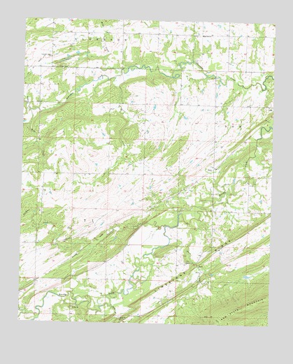
Hartshorne SW, OK USGS Topographic Map
Click on map above to begin viewing in our Map Viewer.

This topographic map contains these locations and features:
Feature Name Type Latitude Longitude GNIS ID View Map
Anderson CreekStreamN34.8373°W95.7464°1089624View Map
ArchPopulated PlaceN34.7745°W95.6611°1100181View Map
Arch BranchStreamN34.7579°W95.7044°1089689View Map
BondPopulated PlaceN34.8143°W95.6544°1100220View Map
Brier CreekStreamN34.8515°W95.7050°1090492View Map
Brushy ChurchChurchN34.7562°W95.7233°1090566View Map
Brushy Indian Baptist CemeteryCemeteryN34.7562°W95.7241°1947732View Map
County District 11CivilN34.8078°W95.6770°2418887View Map
CraigPopulated PlaceN34.8404°W95.6275°1100331View Map
Gardner CreekStreamN34.7907°W95.6775°1093115View Map
High Hill ChurchChurchN34.8690°W95.6614°1093733View Map
High Hill Volunteer Fire AssociationBuildingN34.8692°W95.6636°2657184View Map
Lime Arch BridgeArchN34.7515°W95.6994°1095753View Map
Miller CreekStreamN34.8537°W95.7019°1095415View Map
New State MountainSummitN34.7609°W95.6278°1095841View Map
Peaceable Valley ChurchChurchN34.8598°W95.7369°1096492View Map
Short CreekStreamN34.7987°W95.6603°1098019View Map
Ti CreekStreamN34.7515°W95.7414°1098882View Map
Wolf CreekStreamN34.8315°W95.7467°1099944View Map

Note: Coordinates in the location and feature list above are referenced to NAD83 datum.


Copyright (C) 2008-2024 Ryan Niemi / Sunset Dynamics ... All Rights Reserved