TopoQuest Logo
Do you find TopoQuest useful?
Help keep TopoQuest running and adding new maps/features by donating!
Bitcoin:  19c7KJd3qBynnjoSw5npx9KScwjBe4ifkT
Litecoin:  LXs6TkuXGGXo1vDsWCkWVdjQX94eUKd6ui
Home View Maps Find Maps Find Places Resources & Links


Haskins Valley, California Topographic Map

USGS Map Title: Haskins Valley, CA
USGS Map MRC: 39121G2
DRG (GeoTIFF) Download: o39121g2.tif


Neighboring USGS Topographic Map Quads:


  Storrie, CA  
39121H3
 

  Bucks Lake, CA  
39121H2
 

  Meadow Valley, CA  
39121H1
 

  Soapstone Hill, CA  
39121G3
 

  Haskins Valley, CA  
39121G2
 

  Dogwood Peak, CA  
39121G1
 

  Brush Creek, CA  
39121F3
 

  Cascade, CA  
39121F2
 

  American House, CA  
39121F1


Map MRC Location:

N40°
W122°
N40°
W121°
H8 H7 H6 H5 H4 H3 H2 H1
G8 G7 G6 G5 G4 G3 G2 G1
F8 F7 F6 F5 F4 F3 F2 F1
E8 E7 E6 E5 E4 E3 E2 E1
D8 D7 D6 D5 D4 D3 D2 D1
C8 C7 C6 C5 C4 C3 C2 C1
B8 B7 B6 B5 B4 B3 B2 B1
A8 A7 A6 A5 A4 A3 A2 A1
N39°
W122°
N39°
W121°

Haskins Valley, CA USGS 1:24K Topographic Map Preview:
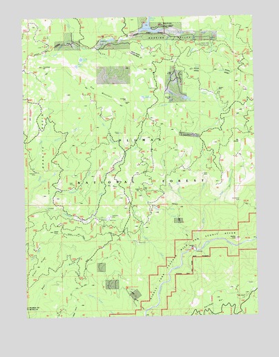
Haskins Valley, CA USGS Topographic Map
Click on map above to begin viewing in our Map Viewer.

This topographic map contains these locations and features:
Feature Name Type Latitude Longitude GNIS ID View Map
Arkansas RavineValleyN39.7918°W121.2136°256318View Map
Axford RavineValleyN39.8068°W121.2416°1723903View Map
Buckhorn CreekStreamN39.8243°W121.2389°257612View Map
Bucks LakePopulated PlaceN39.8707°W121.1844°1853378View Map
Bucks Lake Census Designated PlaceCensusN39.8701°W121.1593°2407918View Map
Bucks Lake Fire DepartmentBuildingN39.8681°W121.1739°2622280View Map
Bucks Lake Guard StationLocaleN39.8738°W121.1733°257637View Map
Bull FlatFlatN39.8032°W121.1855°1666489View Map
Catrell CreekStreamN39.7821°W121.1586°258085View Map
Cedar FlatFlatN39.8516°W121.1877°258126View Map
China GulchValleyN39.7968°W121.1613°258307View Map
China Gulch (historical)Populated PlaceN39.8166°W121.1763°1723904View Map
Coldwater CreekStreamN39.7957°W121.2383°258577View Map
Coquette CreekStreamN39.7971°W121.2475°258710View Map
Dan Beebe CampgroundLocaleN39.7779°W121.1608°1666491View Map
Daniels CreekStreamN39.8688°W121.1580°259041View Map
Darby MeadowFlatN39.8649°W121.2069°1666493View Map
Eagle MineMineN39.8052°W121.2241°1666494View Map
Faggs Debris DamDamN39.8332°W121.1677°1664699View Map
Faggs Debris PondReservoirN39.8409°W121.1630°1666495View Map
Faggs RanchLocaleN39.8546°W121.1738°260017View Map
Faggs ReservoirReservoirN39.8414°W121.1859°260018View Map
Frazier CreekStreamN39.7977°W121.2497°266724View Map
Frenchman HillSummitN39.8541°W121.2397°1658584View Map
Glazer PointSummitN39.7854°W121.2358°1666498View Map
Glazer RidgeRidgeN39.7854°W121.2358°266750View Map
Gravel Range CreekStreamN39.7688°W121.2022°260816View Map
Greenbower MineMineN39.7974°W121.1338°260870View Map
Greens FlatFlatN39.8027°W121.1902°1666499View Map
Grizzly Creek CampgroundLocaleN39.8671°W121.2072°1666501View Map
Grizzly LakeLakeN39.8575°W121.2193°1666503View Map
Grubbs Cow CampLocaleN39.8629°W121.2241°1666504View Map
Hardquartz MineMineN39.7918°W121.2033°261088View Map
Hartman BarBarN39.7782°W121.1600°261122View Map
Haskins BayBayN39.8704°W121.1836°1666506View Map
Haskins CreekStreamN39.8696°W121.1769°261137View Map
Haskins ValleyValleyN39.8660°W121.1944°261138View Map
Hose MineMineN39.8093°W121.1525°261545View Map
Hunters RavineValleyN39.7518°W121.1869°274735View Map
Little California MineMineN39.7943°W121.1255°262558View Map
Little Grizzly CreekStreamN39.8668°W121.2227°262621View Map
Marble ConeCliffN39.7829°W121.1358°263188View Map
Martin MineMineN39.8268°W121.1991°1666514View Map
Mosquito CreekStreamN39.8421°W121.1688°1666516View Map
Mosquito FlatFlatN39.8410°W121.1725°1666517View Map
Mount AraratSummitN39.8202°W121.1319°256302View Map
Mount Ararat CreekStreamN39.7924°W121.1547°1666518View Map
Ohio RavineValleyN39.8046°W121.2072°264312View Map
Ontop MineMineN39.8252°W121.1597°264379View Map
Oxford CreekStreamN39.8066°W121.2416°264427View Map
Paulson PlacePopulated PlaceN39.8443°W121.1455°1666520View Map
Pigtail RavineValleyN39.7807°W121.1838°264725View Map
Red MountainSummitN39.8393°W121.1961°1667859View Map
Robinson MineMineN39.8104°W121.2433°265466View Map
Rock CreekStreamN39.7993°W121.1669°1666521View Map
Rogers LakeLakeN39.8546°W121.2218°1666525View Map
Scotch CreekStreamN39.7696°W121.1716°265934View Map
South Fork Haskins CreekStreamN39.8685°W121.1488°267461View Map
Willow CreekStreamN39.7774°W121.1561°269138View Map

Note: Coordinates in the location and feature list above are referenced to NAD83 datum.


Copyright (C) 2008-2025 Ryan Niemi / Sunset Dynamics ... All Rights Reserved