TopoQuest Logo
Do you find TopoQuest useful?
Help keep TopoQuest running and adding new maps/features by donating!
Bitcoin:  19c7KJd3qBynnjoSw5npx9KScwjBe4ifkT
Litecoin:  LXs6TkuXGGXo1vDsWCkWVdjQX94eUKd6ui
Home View Maps Find Maps Find Places Resources & Links


American House, California Topographic Map

USGS Map Title: American House, CA
USGS Map MRC: 39121F1
DRG (GeoTIFF) Download: o39121f1.tif


Neighboring USGS Topographic Map Quads:


  Haskins Valley, CA  
39121G2
 

  Dogwood Peak, CA  
39121G1
 

  Onion Valley, CA  
39120G8
 

  Cascade, CA  
39121F2
 

  American House, CA  
39121F1
 

  La Porte, CA  
39120F8
 

  Clipper Mills, CA  
39121E2
 

  Strawberry Valley, CA  
39121E1
 

  Goodyears Bar, CA  
39120E8


Map MRC Location:

N40°
W122°
N40°
W121°
H8 H7 H6 H5 H4 H3 H2 H1
G8 G7 G6 G5 G4 G3 G2 G1
F8 F7 F6 F5 F4 F3 F2 F1
E8 E7 E6 E5 E4 E3 E2 E1
D8 D7 D6 D5 D4 D3 D2 D1
C8 C7 C6 C5 C4 C3 C2 C1
B8 B7 B6 B5 B4 B3 B2 B1
A8 A7 A6 A5 A4 A3 A2 A1
N39°
W122°
N39°
W121°

American House, CA USGS 1:24K Topographic Map Preview:
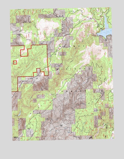
American House, CA USGS Topographic Map
Click on map above to begin viewing in our Map Viewer.

This topographic map contains these locations and features:
Feature Name Type Latitude Longitude GNIS ID View Map
American HouseLocaleN39.6521°W121.0233°256223View Map
American House RavineValleyN39.6396°W121.0125°256224View Map
Bear CreekStreamN39.6932°W121.0616°256632View Map
Big PeakSummitN39.7321°W121.1019°1658057View Map
Big Peak RavineValleyN39.7410°W121.1108°256978View Map
Black Rock CampgroundLocaleN39.7293°W121.0105°275969View Map
Black Rock CreekStreamN39.7293°W121.0077°257158View Map
Boehme RanchLocaleN39.6366°W121.1041°257317View Map
Browns Hill MineMineN39.7257°W121.1175°257509View Map
Camel PeakSummitN39.7203°W121.1015°257838View Map
Davis CreekStreamN39.7018°W121.0961°259081View Map
Devils GapGapN39.6860°W121.0488°259309View Map
Diamond RavineValleyN39.6263°W121.0427°259350View Map
Diamond SpringsSpringN39.6315°W121.0544°259351View Map
Diamond Springs HillSummitN39.6338°W121.0505°1658416View Map
Harrison RidgeRidgeN39.6404°W121.0611°261115View Map
Ice CreekStreamN39.7238°W121.0094°261674View Map
Lexington HillSummitN39.6788°W121.0100°1658956View Map
Little Grass ValleyValleyN39.7242°W121.0193°262608View Map
Little Grass Valley 63-003 DamDamN39.7216°W121.0227°1663502View Map
Little PeakSummitN39.7297°W121.1097°1658976View Map
Lumpkin RidgeRidgeN39.7068°W121.0752°227840View Map
McKintosh RanchLocaleN39.6385°W121.0677°263398View Map
McNair SaddleGapN39.7074°W121.0722°263411View Map
Mooreville RidgeRidgeN39.6766°W121.0602°263807View Map
Post CreekStreamN39.6993°W121.0580°264982View Map
Rocky CreekStreamN39.6404°W121.0877°265532View Map
Sanborn MineLocaleN39.6679°W121.0777°265807View Map
South Fork Diversion 63-004 DamDamN39.6466°W121.1194°1663503View Map
Steward RavineValleyN39.7171°W121.0780°267741View Map
Tamarack FlatFlatN39.7466°W121.0466°268078View Map
Valley CreekStreamN39.6574°W121.0541°268655View Map
Valley Creek Special Interest AreaAreaN39.6618°W121.0213°275968View Map
Willow CreekStreamN39.7474°W121.0911°269148View Map

Note: Coordinates in the location and feature list above are referenced to NAD83 datum.


Copyright (C) 2008-2025 Ryan Niemi / Sunset Dynamics ... All Rights Reserved