TopoQuest Logo
Do you find TopoQuest useful?
Help keep TopoQuest running and adding new maps/features by donating!
Bitcoin:  19c7KJd3qBynnjoSw5npx9KScwjBe4ifkT
Litecoin:  LXs6TkuXGGXo1vDsWCkWVdjQX94eUKd6ui
Home View Maps Find Maps Find Places Resources & Links


Hayden, Idaho Topographic Map

USGS Map Title: Hayden, ID
USGS Map MRC: 47116G7
DRG (GeoTIFF) Download: o47116g7.tif


Neighboring USGS Topographic Map Quads:


  Spirit Lake West, ID  
47116H8
 

  Spirit Lake East, ID  
47116H7
 

  Athol, ID  
47116H6
 

  Rathdrum, ID  
47116G8
 

  Hayden, ID  
47116G7
 

  Hayden Lake, ID  
47116G6
 

  Post Falls, ID  
47116F8
 

  Coeur D'Alene, ID  
47116F7
 

  Fernan Lake, ID  
47116F6


Map MRC Location:

N48°
W117°
N48°
W116°
H8 H7 H6 H5 H4 H3 H2 H1
G8 G7 G6 G5 G4 G3 G2 G1
F8 F7 F6 F5 F4 F3 F2 F1
E8 E7 E6 E5 E4 E3 E2 E1
D8 D7 D6 D5 D4 D3 D2 D1
C8 C7 C6 C5 C4 C3 C2 C1
B8 B7 B6 B5 B4 B3 B2 B1
A8 A7 A6 A5 A4 A3 A2 A1
N47°
W117°
N47°
W116°

Hayden, ID USGS 1:24K Topographic Map Preview:
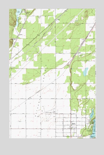
Hayden, ID USGS Topographic Map
Click on map above to begin viewing in our Map Viewer.

This topographic map contains these locations and features:
Feature Name Type Latitude Longitude GNIS ID View Map
Alpine LakeLakeN47.8139°W116.7656°401202View Map
Alpine Lake Wildlife Habitat Area (historical)ReserveN47.8141°W116.7624°401203View Map
Avondale LakeReservoirN47.7730°W116.7561°376784View Map
Bozanta Tavern BayBayN47.7668°W116.7535°378171View Map
City of HaydenCivilN47.7680°W116.8039°2410721View Map
City of Hayden LakeCivilN47.7638°W116.7559°2410722View Map
Coeur D Alene Gun ClubLocaleN47.7666°W116.8110°394282View Map
Coeur D'Alene - Pappy Boyington FieldAirportN47.7766°W116.8299°400795View Map
GarwoodPopulated PlaceN47.8318°W116.7774°396533View Map
Garwood Elementary SchoolSchoolN47.8310°W116.8069°401341View Map
Hawk Haven AirportAirportN47.7563°W116.8602°400791View Map
HaydenPopulated PlaceN47.7660°W116.7866°396630View Map
Hayden LakePopulated PlaceN47.7588°W116.7569°396631View Map
Hayden Lake Country ClubLocaleN47.7621°W116.7607°400265View Map
Hayden Lake DamDamN47.7502°W116.7582°398862View Map
Hayden Lake Elementary SchoolSchoolN47.7596°W116.7857°400633View Map
Hayden Post OfficePost OfficeN47.7524°W116.7884°2766821View Map
Honeysuckle BayBayN47.7521°W116.7555°383288View Map
Honeysuckle Bay Picnic AreaLocaleN47.7532°W116.7571°394283View Map
Honeysuckle BeachBeachN47.7535°W116.7557°383289View Map
North Idaho Christian SchoolSchoolN47.7669°W116.7901°401007View Map
Northern Lakes Fire Protection District Station 1BuildingN47.7595°W116.7882°2618993View Map
Northern Lakes Fire Protection District Station 3BuildingN47.8307°W116.7761°2619180View Map
Northern Lakes Fire Protection District Station 4BuildingN47.8716°W116.8518°2619182View Map
Northern Lakes Fire Protection District Station 7BuildingN47.8246°W116.7874°2619183View Map
Pine Grove CemeteryCemeteryN47.8182°W116.8735°388516View Map
Purcell TrenchValleyN47.7513°W116.8427°394130View Map
RamseyPopulated PlaceN47.8643°W116.8083°397082View Map
Ranch Aero AirportAirportN47.8289°W116.7827°400833View Map
Rathdrum PrairieFlatN47.7685°W116.8416°389124View Map
Rimrock CemeteryCemeteryN47.8246°W116.7645°389389View Map
SturgeonPopulated PlaceN47.8496°W116.8608°397218View Map
Twin Lakes DamDamN47.8573°W116.8664°398758View Map
Twin Lakes StationLocaleN47.8716°W116.8508°392534View Map

Note: Coordinates in the location and feature list above are referenced to NAD83 datum.


Copyright (C) 2008-2024 Ryan Niemi / Sunset Dynamics ... All Rights Reserved