TopoQuest Logo
Do you find TopoQuest useful?
Help keep TopoQuest running and adding new maps/features by donating!
Bitcoin:  19c7KJd3qBynnjoSw5npx9KScwjBe4ifkT
Litecoin:  LXs6TkuXGGXo1vDsWCkWVdjQX94eUKd6ui
Home View Maps Find Maps Find Places Resources & Links


Post Falls, Idaho Topographic Map

USGS Map Title: Post Falls, ID
USGS Map MRC: 47116F8
DRG (GeoTIFF) Download: o47116f8.tif


Neighboring USGS Topographic Map Quads:


  Newman Lake, WA  
47117G1
 

  Rathdrum, ID  
47116G8
 

  Hayden, ID  
47116G7
 

  Liberty Lake, WA  
47117F1
 

  Post Falls, ID  
47116F8
 

  Coeur D'Alene, ID  
47116F7
 

  Mica Peak, WA  
47117E1
 

  Rockford Bay, ID  
47116E8
 

  Mica Bay, ID  
47116E7


Map MRC Location:

N48°
W117°
N48°
W116°
H8 H7 H6 H5 H4 H3 H2 H1
G8 G7 G6 G5 G4 G3 G2 G1
F8 F7 F6 F5 F4 F3 F2 F1
E8 E7 E6 E5 E4 E3 E2 E1
D8 D7 D6 D5 D4 D3 D2 D1
C8 C7 C6 C5 C4 C3 C2 C1
B8 B7 B6 B5 B4 B3 B2 B1
A8 A7 A6 A5 A4 A3 A2 A1
N47°
W117°
N47°
W116°

Post Falls, ID USGS 1:24K Topographic Map Preview:
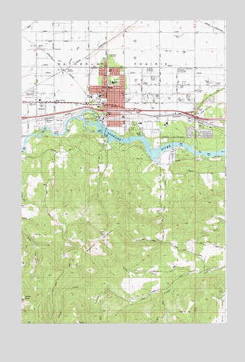
Post Falls, ID USGS Topographic Map
Click on map above to begin viewing in our Map Viewer.

This topographic map contains these locations and features:
Feature Name Type Latitude Longitude GNIS ID View Map
Berean ChurchChurchN47.7238°W116.9258°395096View Map
Black BayBayN47.7027°W116.9271°371564View Map
Blossom MountainSummitN47.6591°W116.9638°371606View Map
Cedar CreekStreamN47.6871°W116.9105°395187View Map
City of Post FallsCivilN47.7202°W116.9399°2411475View Map
Cloverleaf GrangeLocaleN47.7380°W116.9810°372066View Map
Corbin ParkParkN47.7041°W116.9905°372125View Map
East Greenacres East DitchCanalN47.7388°W116.9538°396432View Map
East Greenacres SchoolSchoolN47.7457°W116.9810°372567View Map
Evergreen CemeteryCemeteryN47.7352°W116.9460°372640View Map
Falls Christian AcademySchoolN47.7271°W116.9210°401470View Map
Ford RockSummitN47.7068°W116.9321°372745View Map
Frederick Post Kinder CenterSchoolN47.7158°W116.9501°401324View Map
Grand JunctionPopulated PlaceN47.7291°W116.9738°376158View Map
Hubofs HeliportAirportN47.7330°W116.9999°400904View Map
Hy Line DitchCanalN47.7185°W116.8857°395503View Map
Immaculate Conception AcademySchoolN47.7118°W116.9396°401499View Map
KCDA-FM (Coeur D'Alene)TowerN47.6596°W116.9544°401772View Map
KETB-FM (Coeur D'Alene)TowerN47.6638°W116.9002°401771View Map
Kootenai County Fire and Rescue Station 1BuildingN47.7120°W116.9365°2618977View Map
Kootenai County Fire and Rescue Station 3BuildingN47.7227°W116.8967°2619156View Map
Lenz CreekStreamN47.6366°W116.9441°373554View Map
McGuirePopulated PlaceN47.7124°W116.9913°396869View Map
McGuire SchoolSchoolN47.7213°W116.9980°373879View Map
McGuire-Wesleyan ChurchChurchN47.7163°W116.9796°395681View Map
McGuiresLocaleN47.7096°W116.9808°373880View Map
Mullan Trail Elementary SchoolSchoolN47.7188°W116.9521°394940View Map
North Fork Cougar CreekStreamN47.6449°W116.8971°374192View Map
North ParkParkN47.7293°W116.9474°394835View Map
Northern Idaho Advanced Care HospitalHospitalN47.7136°W116.9038°2721863View Map
Northwest Specialty HospitalHospitalN47.7154°W116.9245°2721864View Map
Otterson Ranch Airport (historical)AirportN47.7402°W116.9983°400902View Map
Ponderosa Elementary SchoolSchoolN47.7026°W116.9016°401061View Map
Post FallsPopulated PlaceN47.7180°W116.9516°397061View Map
Post Falls City PoliceBuildingN47.7150°W116.9207°2722398View Map
Post Falls DamDamN47.7088°W116.9535°398818View Map
Post Falls High SchoolSchoolN47.7290°W116.9094°394939View Map
Post Falls Post OfficePost OfficeN47.7096°W116.9172°2781771View Map
Post Falls Square Shopping CenterLocaleN47.7160°W116.9374°394941View Map
Rich HillSummitN47.6296°W116.8991°397098View Map
River ParkParkN47.7018°W116.9483°395004View Map
Ross PointCliffN47.7110°W116.8935°374792View Map
Ross Point Bird FarmLocaleN47.7099°W116.8771°401167View Map
Schetkwe' (historical)BendN47.7000°W116.9097°2081988View Map
Seltice Elementary SchoolSchoolN47.7185°W116.9577°401178View Map
Shasta ButteSummitN47.6346°W116.9977°374970View Map

Note: Coordinates in the location and feature list above are referenced to NAD83 datum.


Copyright (C) 2008-2024 Ryan Niemi / Sunset Dynamics ... All Rights Reserved