TopoQuest Logo
Do you find TopoQuest useful?
Help keep TopoQuest running and adding new maps/features by donating!
Bitcoin:  19c7KJd3qBynnjoSw5npx9KScwjBe4ifkT
Litecoin:  LXs6TkuXGGXo1vDsWCkWVdjQX94eUKd6ui
Home View Maps Find Maps Find Places Resources & Links


Spirit Lake West, Idaho Topographic Map

USGS Map Title: Spirit Lake West, ID
USGS Map MRC: 47116H8
DRG (GeoTIFF) Download: o47116h8.tif


Neighboring USGS Topographic Map Quads:


  Tweedie, WA  
48117A1
 

  Blanchard, ID  
48116A8
 

  Edgemere, ID  
48116A7
 

  Mount Spokane, WA  
47117H1
 

  Spirit Lake West, ID  
47116H8
 

  Spirit Lake East, ID  
47116H7
 

  Newman Lake, WA  
47117G1
 

  Rathdrum, ID  
47116G8
 

  Hayden, ID  
47116G7


Map MRC Location:

N48°
W117°
N48°
W116°
H8 H7 H6 H5 H4 H3 H2 H1
G8 G7 G6 G5 G4 G3 G2 G1
F8 F7 F6 F5 F4 F3 F2 F1
E8 E7 E6 E5 E4 E3 E2 E1
D8 D7 D6 D5 D4 D3 D2 D1
C8 C7 C6 C5 C4 C3 C2 C1
B8 B7 B6 B5 B4 B3 B2 B1
A8 A7 A6 A5 A4 A3 A2 A1
N47°
W117°
N47°
W116°

Spirit Lake West, ID USGS 1:24K Topographic Map Preview:
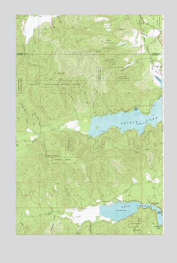
Spirit Lake West, ID USGS Topographic Map
Click on map above to begin viewing in our Map Viewer.

This topographic map contains these locations and features:
Feature Name Type Latitude Longitude GNIS ID View Map
Birch CreekStreamN47.9424°W116.9333°371555View Map
Blister Rust CreekStreamN47.9321°W116.9802°371604View Map
Breakfast CreekStreamN47.9368°W116.9469°371685View Map
Butterworth DrawValleyN47.9743°W116.8941°371825View Map
Dinner CreekStreamN47.9352°W116.9694°372414View Map
Echo BeachPopulated PlaceN47.8877°W116.8766°397677View Map
Excelsior BeachPopulated PlaceN47.8802°W116.8769°397690View Map
Fir GrovePopulated PlaceN47.8943°W116.9102°399486View Map
Fish CreekStreamN47.8866°W116.9280°381752View Map
Larch MountainSummitN47.9660°W116.9605°397849View Map
Miller CreekStreamN47.8874°W116.8985°397915View Map
Miller CreekStreamN47.8830°W116.9958°397916View Map
Pitz MountainSummitN47.9907°W116.9099°400042View Map
Shove CreekStreamN47.8855°W116.9324°390389View Map
Silver BeachPopulated PlaceN47.9482°W116.8921°398129View Map
Silver Sands BeachPopulated PlaceN47.8921°W116.8846°398132View Map
Spirit LakeLakeN47.9414°W116.8998°391117View Map
Spirit Pines Church CampLocaleN47.9846°W116.9108°394220View Map
Spring CreekStreamN47.9882°W116.8952°391164View Map
Strong DrawValleyN47.9963°W116.9705°375308View Map
Swansons ChuteValleyN47.8866°W116.9666°391741View Map
Twin Bridge CreekStreamN47.9363°W116.9774°375616View Map
Twin LakesReservoirN47.8908°W116.8934°400194View Map
Twin Lakes AccessLocaleN47.8916°W116.8838°394647View Map
West Fork Birch CreekStreamN47.9491°W116.9346°375805View Map
Youngs DrawValleyN47.8810°W116.9360°393775View Map

Note: Coordinates in the location and feature list above are referenced to NAD83 datum.


Copyright (C) 2008-2025 Ryan Niemi / Sunset Dynamics ... All Rights Reserved