TopoQuest Logo
Do you find TopoQuest useful?
Help keep TopoQuest running and adding new maps/features by donating!
Bitcoin:  19c7KJd3qBynnjoSw5npx9KScwjBe4ifkT
Litecoin:  LXs6TkuXGGXo1vDsWCkWVdjQX94eUKd6ui
Home View Maps Find Maps Find Places Resources & Links


Axson, Georgia Topographic Map

USGS Map Title: Axson, GA
USGS Map MRC: 31082C6
DRG (GeoTIFF) Download: o31082c6.tif


Neighboring USGS Topographic Map Quads:


  Douglas South, GA  
31082D7
 

  Wilsonville, GA  
31082D6
 

  Beach, GA  
31082D5
 

  Pearson, GA  
31082C7
 

  Axson, GA  
31082C6
 

  Talmo, GA  
31082C5
 

  Sandy Bottom, GA  
31082B7
 

  Cogdell, GA  
31082B6
 

  Pine Valley, GA  
31082B5


Map MRC Location:

N32°
W83°
N32°
W82°
H8 H7 H6 H5 H4 H3 H2 H1
G8 G7 G6 G5 G4 G3 G2 G1
F8 F7 F6 F5 F4 F3 F2 F1
E8 E7 E6 E5 E4 E3 E2 E1
D8 D7 D6 D5 D4 D3 D2 D1
C8 C7 C6 C5 C4 C3 C2 C1
B8 B7 B6 B5 B4 B3 B2 B1
A8 A7 A6 A5 A4 A3 A2 A1
N31°
W83°
N31°
W82°

Axson, GA USGS 1:24K Topographic Map Preview:
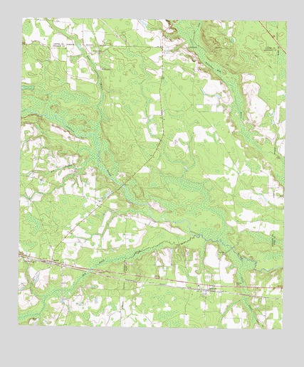
Axson, GA USGS Topographic Map
Click on map above to begin viewing in our Map Viewer.

This topographic map contains these locations and features:
Feature Name Type Latitude Longitude GNIS ID View Map
Atkinson County Volunteer Fire Department Station 1BuildingN31.2769°W82.7331°2603939View Map
AxsonPopulated PlaceN31.2763°W82.7343°354419View Map
Axson ChurchChurchN31.2677°W82.7296°354420View Map
Axson DivisionCivilN31.2871°W82.7211°1936095View Map
Axson Post OfficePost OfficeN31.2760°W82.7351°345787View Map
Bennett CemeteryCemeteryN31.2685°W82.6471°311082View Map
Big BranchStreamN31.3174°W82.7129°311305View Map
Cat CreekStreamN31.3652°W82.6685°312418View Map
Coon BranchStreamN31.2558°W82.6388°312937View Map
First Born ChurchChurchN31.2769°W82.7435°314137View Map
Little Red Bluff CreekStreamN31.2533°W82.7496°317156View Map
MillwoodPopulated PlaceN31.2658°W82.6604°332394View Map
Millwood ChurchChurchN31.2677°W82.6563°357693View Map
Mount Zion ChurchChurchN31.2766°W82.7432°318943View Map
Perch CreekStreamN31.2780°W82.6443°320382View Map
Red Bluff CreekStreamN31.2877°W82.6668°321365View Map
Smut BranchStreamN31.3283°W82.7146°323172View Map
StokesvillePopulated PlaceN31.3613°W82.7135°333131View Map
Stokesville ChurchChurchN31.3549°W82.7113°323640View Map
Utah CemeteryCemeteryN31.3016°W82.7115°345794View Map
Utah ChurchChurchN31.3010°W82.7113°324640View Map
Ware County Fire Rescue Station 7 MillwoodBuildingN31.2650°W82.6594°2604978View Map
White CemeteryCemeteryN31.2530°W82.7432°325142View Map

Note: Coordinates in the location and feature list above are referenced to NAD83 datum.


Copyright (C) 2008-2025 Ryan Niemi / Sunset Dynamics ... All Rights Reserved