TopoQuest Logo
Do you find TopoQuest useful?
Help keep TopoQuest running and adding new maps/features by donating!
Bitcoin:  19c7KJd3qBynnjoSw5npx9KScwjBe4ifkT
Litecoin:  LXs6TkuXGGXo1vDsWCkWVdjQX94eUKd6ui
Home View Maps Find Maps Find Places Resources & Links


Healing Springs, Virginia Topographic Map

USGS Map Title: Healing Springs, VA
USGS Map MRC: 37079H7
DRG (GeoTIFF) Download: o37079h7.tif


Neighboring USGS Topographic Map Quads:


  Mountain Grove, VA  
38079A8
 

  Warm Springs, VA  
38079A7
 

  Bath Alum, VA  
38079A6
 

  Falling Spring, VA  
37079H8
 

  Healing Springs, VA  
37079H7
 

  Nimrod Hall, VA  
37079H6
 

  Covington, VA  
37079G8
 

  Clifton Forge, VA  
37079G7
 

  Longdale Furnace, VA  
37079G6


Map MRC Location:

N38°
W80°
N38°
W79°
H8 H7 H6 H5 H4 H3 H2 H1
G8 G7 G6 G5 G4 G3 G2 G1
F8 F7 F6 F5 F4 F3 F2 F1
E8 E7 E6 E5 E4 E3 E2 E1
D8 D7 D6 D5 D4 D3 D2 D1
C8 C7 C6 C5 C4 C3 C2 C1
B8 B7 B6 B5 B4 B3 B2 B1
A8 A7 A6 A5 A4 A3 A2 A1
N37°
W80°
N37°
W79°

Healing Springs, VA USGS 1:24K Topographic Map Preview:
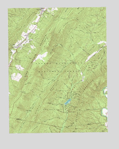
Healing Springs, VA USGS Topographic Map
Click on map above to begin viewing in our Map Viewer.

This topographic map contains these locations and features:
Feature Name Type Latitude Longitude GNIS ID View Map
AshwoodPopulated PlaceN37.9726°W79.8503°1495205View Map
Ashwood Elementary SchoolSchoolN37.9735°W79.8520°1673634View Map
Backway HollowValleyN37.9085°W79.7986°1481388View Map
Bald KnobSummitN37.9243°W79.8520°1495223View Map
Bald Knob FS Repeater SiteLocaleN37.9257°W79.8514°1488579View Map
Bald Knob LookoutLocaleN37.9243°W79.8523°1488584View Map
Bath Community HospitalHospitalN37.9929°W79.8320°1983485View Map
Bay Lick HollowValleyN37.9202°W79.7926°1481496View Map
Bear Loop BranchStreamN37.9632°W79.8106°1481522View Map
Beards GapGapN37.8973°W79.7873°1481538View Map
Beards Gap HollowValleyN37.8947°W79.8021°1481539View Map
Beards Gap TrailTrailN37.8954°W79.7951°1481540View Map
Beards MountainSummitN37.9312°W79.7559°1495246View Map
Bible CampLocaleN37.9140°W79.7506°1481688View Map
Big HollowValleyN37.9089°W79.7953°1481733View Map
Big RidgeRidgeN37.9507°W79.8501°1481769View Map
Blue Suck FallsFallsN37.9047°W79.8213°1481871View Map
Blue Suck HollowValleyN37.9030°W79.8050°1481872View Map
Blue Suck TrailTrailN37.9054°W79.8189°1481873View Map
Bridle TrailTrailN37.9896°W79.8309°1488587View Map
Brown HollowValleyN37.9266°W79.7946°1482036View Map
Brushy HollowValleyN37.8811°W79.8050°1482063View Map
Brushy Hollow TrailTrailN37.8810°W79.8014°1482064View Map
Brushy MountainSummitN37.9785°W79.8045°1482071View Map
Brushy RidgeRidgeN37.9673°W79.7903°1482077View Map
Brushy Ridge TrailTrailN37.9654°W79.7923°1482082View Map
Buck HollowValleyN37.9039°W79.7991°1482111View Map
Buck Lick TrailTrailN37.9012°W79.7939°1482118View Map
Buckhorn KnobSummitN37.8787°W79.7917°1495326View Map
Cabin Lick HollowValleyN37.8781°W79.8097°1482212View Map
Camp KannataLocaleN37.9137°W79.7503°1673643View Map
Cascades Golf ClubLocaleN37.9557°W79.8695°1491118View Map
Chestnut RidgeRidgeN37.9590°W79.7684°1482499View Map
Claylick DraftValleyN37.8977°W79.7572°1482556View Map
Claylick RunStreamN37.8985°W79.7570°1482558View Map
Deeds School (historical)SchoolN37.9487°W79.7712°1673645View Map
Douthat DamDamN37.9026°W79.8030°1489211View Map
Douthat LakeReservoirN37.9059°W79.8003°1483077View Map
Douthat State ParkParkN37.8973°W79.8084°1483078View Map
Dry RunStreamN37.9315°W79.7800°1483135View Map
Dry Run RidgeRidgeN37.9465°W79.7614°1483149View Map
George TrailTrailN37.9965°W79.8551°1483603View Map
Gillam RunStreamN37.9598°W79.7550°1483625View Map
Gillam Run TrailTrailN37.9407°W79.7578°1483626View Map
Gilliam Run TrailTrailN37.9257°W79.7670°1488583View Map
Healing SpringsPopulated PlaceN37.9610°W79.8626°1495671View Map
Hobby Horse FarmLocaleN37.9387°W79.8623°1673650View Map
Homested HotelBuildingN37.9935°W79.8301°1488578View Map
Hot SpringsPopulated PlaceN37.9996°W79.8317°1495720View Map
Hot Springs Presbyterian ChurchChurchN37.9948°W79.8326°1690843View Map
Huffs TrailTrailN37.9079°W79.8062°1484266View Map
Ingalls FieldAirportN37.9531°W79.8352°1498700View Map
Left Prong Wilson CreekStreamN37.9454°W79.7914°1484771View Map
Lick Block RunStreamN37.9298°W79.8145°1484799View Map
Little Mare MountainSummitN37.9935°W79.7856°1484926View Map
Little MountainRangeN37.9659°W79.8684°1484934View Map
Lower Brushy GapGapN37.8762°W79.7956°1485114View Map
Middle Hollow TrailTrailN37.9112°W79.8034°1485372View Map
Middle MountainSummitN37.9082°W79.8312°1495936View Map
Middle Mountain TrailTrailN37.9257°W79.8126°1485380View Map
MidwayPopulated PlaceN37.9843°W79.8384°1495943View Map
Mount Olive Baptist ChurchChurchN37.9671°W79.8484°1485610View Map
Mountain Side TrailTrailN37.9060°W79.7856°1485687View Map
Mountain Top TrailTrailN37.9079°W79.7809°1485690View Map
Mountain Top TrailTrailN37.9898°W79.8476°1485691View Map
Oak Grove ChurchChurchN37.9601°W79.7545°1485936View Map
Open TrailTrailN37.9887°W79.8589°1488512View Map
Pine Tree TrailTrailN37.9096°W79.8159°1486238View Map
Polecat HollowValleyN37.9372°W79.7769°1486317View Map
Poplar HollowValleyN37.9215°W79.7944°1486353View Map
Porters Mill CreekStreamN37.9573°W79.7587°1486372View Map
Ross Camp HollowValleyN37.9105°W79.7957°1486776View Map
Ross Camp TrailTrailN37.9123°W79.7887°1486777View Map
Sacred Heart Catholic ChurchChurchN37.9940°W79.8292°1690845View Map
Saint Luke Episcopal ChurchChurchN37.9962°W79.8320°1690844View Map
Salt HollowValleyN37.9171°W79.7621°1486900View Map
Salt Pond RidgeRidgeN37.9743°W79.7689°1486903View Map
Salt Pond Ridge TrailTrailN37.9815°W79.7864°1486904View Map
Salt Stump HollowValleyN37.9185°W79.7962°1486905View Map
Salt Stump TrailTrailN37.9162°W79.8131°1486906View Map
Sand SpringsSpringN37.8977°W79.8498°1486923View Map
Sandy GapGapN37.9165°W79.8589°1486936View Map
Sandy Gap TrailTrailN37.9143°W79.8445°1486937View Map
Sawmill HollowValleyN37.9401°W79.7757°1487745View Map
Second HollowValleyN37.9069°W79.8007°1486991View Map
Slim RidgeRidgeN37.9421°W79.7662°1487316View Map
Slim Ridge BranchStreamN37.9510°W79.7684°1487317View Map
Slim Ridge HollowValleyN37.9423°W79.7733°1487318View Map
Stony RunStreamN37.8818°W79.8067°1487631View Map
Stony Run TrailTrailN37.8907°W79.8173°1487641View Map
Stouts CreekStreamN37.9876°W79.7500°1481252View Map
The PillarsBuildingN37.9951°W79.8301°1690846View Map
TinkertownPopulated PlaceN37.9415°W79.8745°1496318View Map
Tobacco House Ridge TrailTrailN37.8982°W79.8067°1487936View Map
Trappers LodgeLocaleN37.9896°W79.8026°1487980View Map
Upper Brushy GapGapN37.8846°W79.7917°1488070View Map
Valley Elementary SchoolSchoolN37.9731°W79.8523°1488096View Map
Valley Springs DistrictCivilN37.9453°W79.8588°1927546View Map
Warm Springs MountainSummitN37.9937°W79.8076°1496373View Map
Warm Springs ValleyValleyN37.9569°W79.8655°1488198View Map
Warm Springs Work CenterLocaleN37.9735°W79.8462°1488577View Map
Wilson Creek TrailTrailN37.9010°W79.8006°1488418View Map
WWES-AM (Hot Springs)TowerN37.9796°W79.8387°1498941View Map
WXCF-FM (Clifton Forge)TowerN37.9035°W79.8706°1498977View Map

Note: Coordinates in the location and feature list above are referenced to NAD83 datum.


Copyright (C) 2008-2024 Ryan Niemi / Sunset Dynamics ... All Rights Reserved