TopoQuest Logo
Do you find TopoQuest useful?
Help keep TopoQuest running and adding new maps/features by donating!
Bitcoin:  19c7KJd3qBynnjoSw5npx9KScwjBe4ifkT
Litecoin:  LXs6TkuXGGXo1vDsWCkWVdjQX94eUKd6ui
Home View Maps Find Maps Find Places Resources & Links


Bath Alum, Virginia Topographic Map

USGS Map Title: Bath Alum, VA
USGS Map MRC: 38079A6
DRG (GeoTIFF) Download: o38079a6.tif


Neighboring USGS Topographic Map Quads:


  Sunrise, VA  
38079B7
 

  Burnsville, VA  
38079B6
 

  Williamsville, VA  
38079B5
 

  Warm Springs, VA  
38079A7
 

  Bath Alum, VA  
38079A6
 

  Green Valley, VA  
38079A5
 

  Healing Springs, VA  
37079H7
 

  Nimrod Hall, VA  
37079H6
 

  Millboro, VA  
37079H5


Map MRC Location:

N39°
W80°
N39°
W79°
H8 H7 H6 H5 H4 H3 H2 H1
G8 G7 G6 G5 G4 G3 G2 G1
F8 F7 F6 F5 F4 F3 F2 F1
E8 E7 E6 E5 E4 E3 E2 E1
D8 D7 D6 D5 D4 D3 D2 D1
C8 C7 C6 C5 C4 C3 C2 C1
B8 B7 B6 B5 B4 B3 B2 B1
A8 A7 A6 A5 A4 A3 A2 A1
N38°
W80°
N38°
W79°

Bath Alum, VA USGS 1:24K Topographic Map Preview:
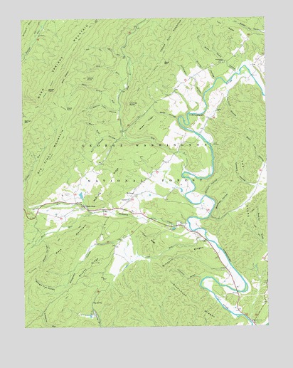
Bath Alum, VA USGS Topographic Map
Click on map above to begin viewing in our Map Viewer.

This topographic map contains these locations and features:
Feature Name Type Latitude Longitude GNIS ID View Map
Aviation, Golf and Farm Club DamDamN38.0518°W79.7198°1489214View Map
Bath AlumPopulated PlaceN38.0487°W79.7187°1481491View Map
Bath Alum AirportAirportN38.0526°W79.7289°1498835View Map
Bath Alum Camp (historical)LocaleN38.0471°W79.7431°1673637View Map
Bath CountyCivilN38.0587°W79.7411°1673638View Map
Bear Hole RunStreamN38.0907°W79.6998°1481518View Map
Bear Rock TrailTrailN38.1204°W79.7159°1481527View Map
Bear RocksPillarN38.1015°W79.7278°1481528View Map
Big Piney MountainSummitN38.0740°W79.7312°1481761View Map
Big SpringSpringN38.0102°W79.7145°1481788View Map
Black RockSummitN38.0879°W79.7250°1492584View Map
Blackies HollowValleyN38.0437°W79.6495°1481834View Map
Bluegrass HollowValleyN38.0341°W79.7121°1481877View Map
Brushy RidgeRidgeN38.0243°W79.7162°1482078View Map
Camp KannataLocaleN38.0732°W79.6528°1482262View Map
Chimney RocksPillarN38.0907°W79.6956°1482522View Map
Clark RidgeRidgeN38.0351°W79.6859°1482547View Map
Cub RunStreamN38.0965°W79.6973°1482869View Map
Deep HollowValleyN38.0842°W79.6697°1482968View Map
Dickenson RidgesRidgeN38.0096°W79.6628°1483001View Map
Donley HollowValleyN38.1001°W79.6500°1483062View Map
Dry RunStreamN38.0626°W79.6670°1483144View Map
Fayette County Hunting and Fishing ClubLocaleN38.0057°W79.7150°1673646View Map
Guys RunStreamN38.0348°W79.6559°1483874View Map
Hickman DraftValleyN38.0204°W79.6594°1484056View Map
Hickory HollowValleyN38.0531°W79.6563°1484064View Map
House RockSummitN38.0962°W79.7362°1484247View Map
Jordan RunStreamN38.0465°W79.7131°1484512View Map
Lake of the PinesReservoirN38.0518°W79.7198°1489215View Map
Lick RidgeRidgeN38.1190°W79.6489°1484826View Map
Mare RunStreamN38.0465°W79.7131°1485186View Map
Mays MountainSummitN38.1068°W79.6773°1493262View Map
McClungPopulated PlaceN38.0532°W79.6928°1485261View Map
McClung RidgeRidgeN38.0573°W79.7075°1485263View Map
Middle KnobSummitN38.1010°W79.7162°1485374View Map
Mikes RidgeRidgeN38.0818°W79.6864°1485395View Map
Porter HollowValleyN38.0361°W79.7405°1486366View Map
Red SwampStreamN38.0768°W79.7087°1486544View Map
ShilohPopulated PlaceN38.0873°W79.6506°1673656View Map
Shiloh United Methodist ChurchChurchN38.0873°W79.6500°1487197View Map
Shingle Tree HollowValleyN38.0173°W79.7285°1487203View Map
Simpson RidgesRidgeN38.0298°W79.6687°1487254View Map
South Piney Mountain TrailTrailN38.0612°W79.7414°1487418View Map
Tancroft HollowValleyN38.0959°W79.6440°1487770View Map
The SpursRidgeN38.0546°W79.6362°1487854View Map
Thompson CreekStreamN38.0393°W79.6639°1487882View Map
Turkeypen HollowValleyN38.0936°W79.6566°1488034View Map
Venable HollowValleyN38.0570°W79.6296°1488121View Map
Walnut Tree HollowValleyN38.0878°W79.7002°1488177View Map
Warm Springs Mountain TrailTrailN38.0871°W79.7450°1488196View Map
Westminister ChapelChurchN38.1068°W79.6467°1488260View Map
Wide Draft HollowValleyN38.1034°W79.6395°1488350View Map
Williamsville DistrictCivilN38.0891°W79.6612°1927571View Map
Windy Cove Presbyterian ChurchChurchN38.0021°W79.6331°1488426View Map
Wolf Run HollowValleyN38.0767°W79.6979°1488451View Map
Woodland Presbyterian ChurchChurchN38.0515°W79.6953°1488474View Map

Note: Coordinates in the location and feature list above are referenced to NAD83 datum.


Copyright (C) 2008-2025 Ryan Niemi / Sunset Dynamics ... All Rights Reserved