TopoQuest Logo
Do you find TopoQuest useful?
Help keep TopoQuest running and adding new maps/features by donating!
Bitcoin:  19c7KJd3qBynnjoSw5npx9KScwjBe4ifkT
Litecoin:  LXs6TkuXGGXo1vDsWCkWVdjQX94eUKd6ui
Home View Maps Find Maps Find Places Resources & Links


Mountain Grove, Virginia Topographic Map

USGS Map Title: Mountain Grove, VA
USGS Map MRC: 38079A8
DRG (GeoTIFF) Download: o38079a8.tif


Neighboring USGS Topographic Map Quads:


  Marlinton, WV  
38080B1
 

  Minnehaha Springs, WV  
38079B8
 

  Sunrise, VA  
38079B7
 

  Lake Sherwood, WV  
38080A1
 

  Mountain Grove, VA  
38079A8
 

  Warm Springs, VA  
38079A7
 

  Rucker Gap, VA  
37080H1
 

  Falling Spring, VA  
37079H8
 

  Healing Springs, VA  
37079H7


Map MRC Location:

N39°
W80°
N39°
W79°
H8 H7 H6 H5 H4 H3 H2 H1
G8 G7 G6 G5 G4 G3 G2 G1
F8 F7 F6 F5 F4 F3 F2 F1
E8 E7 E6 E5 E4 E3 E2 E1
D8 D7 D6 D5 D4 D3 D2 D1
C8 C7 C6 C5 C4 C3 C2 C1
B8 B7 B6 B5 B4 B3 B2 B1
A8 A7 A6 A5 A4 A3 A2 A1
N38°
W80°
N38°
W79°

Mountain Grove, VA USGS 1:24K Topographic Map Preview:
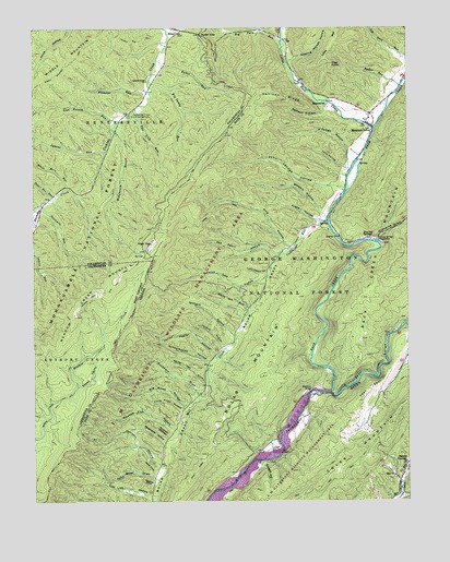
Mountain Grove, VA USGS Topographic Map
Click on map above to begin viewing in our Map Viewer.

This topographic map contains these locations and features:
Feature Name Type Latitude Longitude GNIS ID View Map
Ash Cabin HollowValleyN38.0654°W79.9170°1481347View Map
Ayers HollowValleyN38.0744°W79.9048°1481366View Map
Back CreekStreamN38.0285°W79.9003°1481374View Map
Big Piney HollowValleyN38.0254°W79.9489°1481759View Map
Big Sandy RunStreamN38.1110°W79.9609°1550342View Map
Big Turn RunStreamN38.1215°W79.9164°1481794View Map
Blowing SpringsSpringN38.0698°W79.8880°1481850View Map
Blowing Springs CampgroundLocaleN38.0690°W79.8845°1481851View Map
Boiling Spring CampLocaleN38.0448°W79.8801°1673639View Map
Bolar MountainSummitN38.0610°W79.9034°1481913View Map
Buckeye HollowValleyN38.0095°W79.9230°1482128View Map
Buckhorn DraftValleyN38.0287°W79.9460°1482133View Map
Buckhorn QuartersValleyN38.0178°W79.9542°1482135View Map
Clay Lick HollowValleyN38.0014°W79.9612°1482553View Map
Cochran Creek ChurchChurchN38.1110°W79.9617°1550751View Map
Coles MountainSummitN38.0029°W79.9056°1482642View Map
Combs TrailTrailN38.0776°W79.9373°1482665View Map
Cummings RunStreamN38.0735°W79.9009°1482880View Map
Dean SpurRidgeN38.0290°W79.8876°1482960View Map
Divide TrailTrailN38.0937°W79.9942°1550930View Map
Doelick CoveValleyN38.0049°W79.9604°1483051View Map
Eden United Methodist ChurchChurchN38.0057°W79.8795°1483238View Map
Flagg KnobSummitN38.1157°W79.8992°1483431View Map
Gathright Wildlife Management AreaReserveN38.0626°W79.9373°1477058View Map
Hamilton Lick RunStreamN38.0779°W79.9978°1551335View Map
High TopSummitN38.0679°W79.9601°1495686View Map
High Top Lookout TowerTowerN38.0679°W79.9603°1488602View Map
John Bolar DraftValleyN38.0062°W79.9597°1484457View Map
John Landes HollowValleyN38.0827°W79.8980°1484461View Map
Johnson HollowValleyN38.0101°W79.9581°1484482View Map
Kellison HollowValleyN38.1034°W79.9016°1484534View Map
Kellison RidgeRidgeN38.1065°W79.9153°1484535View Map
Landes HollowValleyN38.0408°W79.9371°1484648View Map
Laurel RunStreamN38.0923°W79.9753°1551722View Map
Laurel RunStreamN38.0923°W79.9753°1551746View Map
Lemon Hollow Work CampLocaleN38.0012°W79.9734°1488609View Map
Little Back CreekStreamN38.0987°W79.8853°1484866View Map
Little Piney HollowValleyN38.0237°W79.9503°1484957View Map
Lost Bottom RunStreamN38.1004°W79.9709°1551939View Map
Lucy Cabin HollowValleyN38.0608°W79.9215°1485128View Map
McClintic BridgeBridgeN38.0282°W79.9073°1485259View Map
McClintic Point Primitive CampgroundLocaleN38.0140°W79.9201°1488608View Map
Meadow Lick HollowValleyN38.0191°W79.9536°1485344View Map
Meva CoveValleyN38.0076°W79.9593°1485360View Map
MooretownPopulated PlaceN38.1043°W79.9012°1495964View Map
Mountain GrovePopulated PlaceN38.0987°W79.8867°1495979View Map
Mountain Grove CemeteryCemeteryN38.0985°W79.8879°2571174View Map
Mountain Grove Elementary School (historical)SchoolN38.0979°W79.8864°1673653View Map
Mountain Grove Volunteer Fire DepartmentBuildingN38.0974°W79.8867°2721188View Map
Necholas RunStreamN38.1082°W79.9606°1552283View Map
O'Farrell HollowValleyN38.0930°W79.8940°1485932View Map
O'Roarke DraftValleyN38.0693°W79.8843°1485933View Map
Orchard HollowValleyN38.0431°W79.9326°1485986View Map
Pine HollowValleyN38.0675°W79.9139°1486214View Map
Pocahontas Picnic and CampgroundLocaleN38.1021°W79.9664°1552517View Map
Pond HollowValleyN38.0882°W79.8958°1486325View Map
Revercomb HollowValleyN38.0156°W79.9562°1486573View Map
Richardson GorgeValleyN38.0287°W79.9009°1486597View Map
RimelPopulated PlaceN38.1235°W79.9514°1552668View Map
Ryder GapGapN38.1237°W79.9431°1486834View Map
Ryder HollowValleyN38.1237°W79.9346°1486835View Map
Ryder RunStreamN38.1096°W79.8764°1486836View Map
Ryder RunStreamN38.1165°W79.9581°1552762View Map
Sapling Woods HollowValleyN38.1168°W79.9132°1486942View Map
Schoolhouse HollowValleyN38.0366°W79.9419°1486964View Map
Sevenmile RunStreamN38.0779°W79.9973°1552838View Map
Shanklin (historical)Populated PlaceN38.0173°W79.9187°1690046View Map
Snake ValleyValleyN38.0304°W79.9845°1552950View Map
South River Number 19 DamDamN38.0135°W79.9698°1489191View Map
Stewart HollowValleyN38.0762°W79.9035°1487567View Map
Sugar Haul RunStreamN38.0801°W79.9928°1553117View Map
Sweet Acorn TrailTrailN38.0110°W79.9426°1487753View Map
TM Gathright Wildlife Management AreaParkN38.0201°W79.9437°1488523View Map
Two Lick RunStreamN38.1029°W79.9659°1553301View Map
Vance Lick HollowValleyN38.0588°W79.9223°1488107View Map
White Mare RunStreamN38.0823°W79.9898°1553423View Map
White Oak CoveValleyN38.0320°W79.9428°1488290View Map
White Oak RunStreamN38.0498°W79.9276°1488299View Map
Widemouth RunStreamN38.0987°W79.9734°1553444View Map
Yellow Poplar HollowValleyN38.0391°W79.9390°1487116View Map

Note: Coordinates in the location and feature list above are referenced to NAD83 datum.


Copyright (C) 2008-2024 Ryan Niemi / Sunset Dynamics ... All Rights Reserved