TopoQuest Logo
Do you find TopoQuest useful?
Help keep TopoQuest running and adding new maps/features by donating!
Bitcoin:  19c7KJd3qBynnjoSw5npx9KScwjBe4ifkT
Litecoin:  LXs6TkuXGGXo1vDsWCkWVdjQX94eUKd6ui
Home View Maps Find Maps Find Places Resources & Links


Heath Springs, South Carolina Topographic Map

USGS Map Title: Heath Springs, SC
USGS Map MRC: 34080E6
DRG (GeoTIFF) Download: o34080e6.tif


Neighboring USGS Topographic Map Quads:


  Lancaster, SC  
34080F7
 

  Antioch, SC  
34080F6
 

  Taxahaw, SC  
34080F5
 

  Lancaster SE, SC  
34080E7
 

  Heath Springs, SC  
34080E6
 

  Kershaw, SC  
34080E5
 

  Liberty Hill, SC  
34080D7
 

  White Oak Creek, SC  
34080D6
 

  Westville, SC  
34080D5


Map MRC Location:

N35°
W81°
N35°
W80°
H8 H7 H6 H5 H4 H3 H2 H1
G8 G7 G6 G5 G4 G3 G2 G1
F8 F7 F6 F5 F4 F3 F2 F1
E8 E7 E6 E5 E4 E3 E2 E1
D8 D7 D6 D5 D4 D3 D2 D1
C8 C7 C6 C5 C4 C3 C2 C1
B8 B7 B6 B5 B4 B3 B2 B1
A8 A7 A6 A5 A4 A3 A2 A1
N34°
W81°
N34°
W80°

Heath Springs, SC USGS 1:24K Topographic Map Preview:
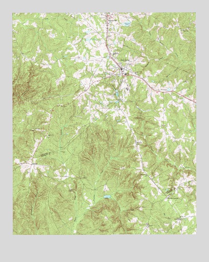
Heath Springs, SC USGS Topographic Map
Click on map above to begin viewing in our Map Viewer.

This topographic map contains these locations and features:
Feature Name Type Latitude Longitude GNIS ID View Map
Anvil RockPopulated PlaceN34.5732°W80.7167°1231007View Map
Beaver Creek CemeteryCemeteryN34.5557°W80.7253°1241596View Map
Beaver Creek CemeteryCemeteryN34.5221°W80.6428°1235007View Map
Beaver Creek ChurchChurchN34.5227°W80.6437°1245010View Map
Beaver Creek ChurchChurchN34.5563°W80.7254°1245011View Map
Beckham BranchStreamN34.6024°W80.6428°1220455View Map
Brewer GullyValleyN34.5145°W80.6973°1235032View Map
Brewers Pond Dam D-1752DamN34.5218°W80.6865°1239188View Map
Bridges Pond Dam D-1773DamN34.6102°W80.6815°1239199View Map
Cedar FallsFallsN34.5404°W80.6854°1235054View Map
Coats CrossroadPopulated PlaceN34.5085°W80.6365°1247329View Map
Dye Mill BranchStreamN34.5015°W80.6417°1220099View Map
Flint Ridge ChurchChurchN34.6154°W80.6331°1247784View Map
Flint Ridge School (historical)SchoolN34.6154°W80.6345°1241651View Map
Hammond CemeteryCemeteryN34.5468°W80.7140°1223007View Map
Hanging RockPillarN34.5657°W80.6623°1241667View Map
Hanging Rock BattlegroundLocaleN34.5660°W80.6620°1245898View Map
Heath SpringsPopulated PlaceN34.5932°W80.6753°1245936View Map
Heath Springs Baptist ChurchChurchN34.5910°W80.6745°1241671View Map
Heath Springs City HallBuildingN34.5938°W80.6756°1241672View Map
Heath Springs DivisionCivilN34.5739°W80.7489°1938294View Map
Heath Springs Fire Department Station 9BuildingN34.5943°W80.6749°2578474View Map
Heath Springs High School (historical)SchoolN34.5904°W80.6726°1241673View Map
Heath Springs Post OfficePost OfficeN34.5924°W80.6749°1252257View Map
Hillside High SchoolSchoolN34.6021°W80.6806°1245997View Map
Honkers Lake Dam D-3183DamN34.6035°W80.6281°1240000View Map
Little Lynches CreekStreamN34.5977°W80.6326°1224016View Map
Mobley BranchStreamN34.5974°W80.6326°1224609View Map
Mobley CemeteryCemeteryN34.5882°W80.7065°1241711View Map
Mount Zion ChurchChurchN34.5521°W80.6656°1249726View Map
Mount Zion Church (historical)ChurchN34.5326°W80.7037°1235155View Map
Oak Ridge School (historical)SchoolN34.6188°W80.7337°1241726View Map
OakhurstPopulated PlaceN34.5802°W80.6467°1241728View Map
Oakhurst ChurchChurchN34.5860°W80.6312°1249926View Map
Oakhurst School (historical)SchoolN34.5718°W80.6459°1241729View Map
Pleasant Grove ChurchChurchN34.5090°W80.6359°1250160View Map
Pleasant Grove School (historical)SchoolN34.5107°W80.6359°1235184View Map
Pleasant HillPopulated PlaceN34.6199°W80.6848°1250165View Map
Pleasant Hill ChurchChurchN34.5913°W80.6656°1250173View Map
Pleasant Hill Fire Department Station 13BuildingN34.6127°W80.6848°2578268View Map
Pleasant Hill Fire Department Station 13BuildingN34.6127°W80.6848°2578811View Map
Pool JReservoirN34.6002°W80.6315°1240002View Map
Pool J Dam D-3182DamN34.6002°W80.6315°1240001View Map
Robinson CrossroadPopulated PlaceN34.5207°W80.6451°1227973View Map
Rock Hill CemeteryCemeteryN34.5324°W80.7028°1225928View Map
Rock Hill Church (historical)ChurchN34.5315°W80.7087°1235196View Map
Salem United Methodist ChurchChurchN34.5921°W80.6748°1241754View Map
Second Calvary ChurchChurchN34.5335°W80.6584°1250822View Map
South Carolina Noname 29002 D-1774 DamDamN34.6179°W80.6701°1237685View Map
Springs-Stevens State Fish HatcheryLocaleN34.5793°W80.6790°1241768View Map
StoneboroPopulated PlaceN34.5401°W80.7370°1251052View Map
Stoneboro School (historical)SchoolN34.5404°W80.7381°1235219View Map
Stoneboro School (historical)SchoolN34.5426°W80.7359°1235220View Map
Sunrise LakeReservoirN34.6190°W80.6719°1226968View Map
Thorn Hill ChurchChurchN34.5054°W80.6584°1251159View Map
Town of Heath SpringsCivilN34.5933°W80.6750°2405812View Map
Tranham CreekStreamN34.5099°W80.7062°1227194View Map

Note: Coordinates in the location and feature list above are referenced to NAD83 datum.


Copyright (C) 2008-2025 Ryan Niemi / Sunset Dynamics ... All Rights Reserved