TopoQuest Logo
Do you find TopoQuest useful?
Help keep TopoQuest running and adding new maps/features by donating!
Bitcoin:  19c7KJd3qBynnjoSw5npx9KScwjBe4ifkT
Litecoin:  LXs6TkuXGGXo1vDsWCkWVdjQX94eUKd6ui
Home View Maps Find Maps Find Places Resources & Links


Lancaster SE, South Carolina Topographic Map

USGS Map Title: Lancaster SE, SC
USGS Map MRC: 34080E7
DRG (GeoTIFF) Download: o34080e7.tif


Neighboring USGS Topographic Map Quads:


  Fort Lawn, SC  
34080F8
 

  Lancaster, SC  
34080F7
 

  Antioch, SC  
34080F6
 

  Great Falls, SC  
34080E8
 

  Lancaster SE, SC  
34080E7
 

  Heath Springs, SC  
34080E6
 

  Flint Hill, SC  
34080D8
 

  Liberty Hill, SC  
34080D7
 

  White Oak Creek, SC  
34080D6


Map MRC Location:

N35°
W81°
N35°
W80°
H8 H7 H6 H5 H4 H3 H2 H1
G8 G7 G6 G5 G4 G3 G2 G1
F8 F7 F6 F5 F4 F3 F2 F1
E8 E7 E6 E5 E4 E3 E2 E1
D8 D7 D6 D5 D4 D3 D2 D1
C8 C7 C6 C5 C4 C3 C2 C1
B8 B7 B6 B5 B4 B3 B2 B1
A8 A7 A6 A5 A4 A3 A2 A1
N34°
W81°
N34°
W80°

Lancaster SE, SC USGS 1:24K Topographic Map Preview:
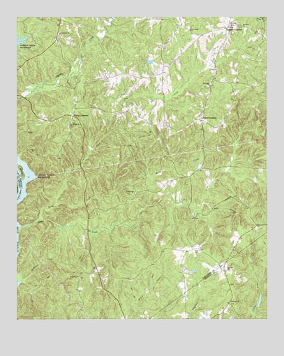
Lancaster SE, SC USGS Topographic Map
Click on map above to begin viewing in our Map Viewer.

This topographic map contains these locations and features:
Feature Name Type Latitude Longitude GNIS ID View Map
Allowance Hall School (historical)SchoolN34.6246°W80.8070°1241585View Map
Bell BranchStreamN34.5474°W80.7826°1220474View Map
Belltown Fire Department Station 2BuildingN34.6227°W80.8537°2578564View Map
Blakley CrossroadsPopulated PlaceN34.5840°W80.8467°1231062View Map
Bowater Camp Creek Pond Dam D-1764DamN34.6068°W80.8098°1239198View Map
Bowden IslandIslandN34.5615°W80.8729°1220908View Map
Camp Creek CemeteryCemeteryN34.6176°W80.8531°1241609View Map
Camp Creek ChurchChurchN34.6182°W80.8529°1247123View Map
Carmel Methodist Church (historical)ChurchN34.6190°W80.7887°1241613View Map
Cauthens CrossroadsPopulated PlaceN34.6201°W80.7695°1247193View Map
Cedar CreekStreamN34.5385°W80.8731°1221439View Map
Cedar Creek ChurchChurchN34.5524°W80.8162°1247207View Map
Cedar Creek DamDamN34.5401°W80.8415°1237712View Map
Cedar Creek School (historical)SchoolN34.5515°W80.8154°1241615View Map
Cedar Rock ChurchChurchN34.5074°W80.7681°1247218View Map
Cedar Rock School (historical)SchoolN34.5076°W80.7681°1235055View Map
Dry CreekStreamN34.6015°W80.8437°1222111View Map
Dry Creek School (historical)SchoolN34.6149°W80.7862°1241633View Map
Duncan CemeteryCemeteryN34.5146°W80.7684°1235074View Map
Gar CreekStreamN34.5471°W80.8545°1222642View Map
Gethsemane ChurchChurchN34.5179°W80.8434°1247890View Map
Hudson CemeteryCemeteryN34.5446°W80.8012°1241676View Map
Kingsbury (historical)Populated PlaceN34.5379°W80.8729°1241688View Map
Kingsbury CemeteryCemeteryN34.5346°W80.8704°1241689View Map
Mackey Walker CemeteryCemeteryN34.5801°W80.7734°1241706View Map
McDowell CreekStreamN34.5138°W80.8742°1246589View Map
Montgomery School (historical)SchoolN34.5190°W80.8406°1241712View Map
Mount Carmel Camp Meeting GroundLocaleN34.5965°W80.7790°1241714View Map
Mount Carmel CemeteryCemeteryN34.5963°W80.7798°1241715View Map
Mount Carmel CemeteryCemeteryN34.6199°W80.7878°1224696View Map
Mount Carmel ChurchChurchN34.5968°W80.7787°1249561View Map
Mount Carmel School (historical)SchoolN34.5971°W80.7784°1241716View Map
New Hope ChurchChurchN34.6210°W80.7612°1249828View Map
New Hope ChurchChurchN34.6215°W80.7670°1249829View Map
Pitmon CrossroadPopulated PlaceN34.5824°W80.7820°1227963View Map
Rock and Cedar Creek ReservoirReservoirN34.5401°W80.8415°1237713View Map
Rock Hill CemeteryCemeteryN34.5285°W80.7856°1250418View Map
Rock Hill ChurchChurchN34.5207°W80.7695°1250425View Map
Rock Hill Church (historical)ChurchN34.5340°W80.7865°1241750View Map
Rocky CreekStreamN34.5418°W80.8631°1225972View Map
Saint Pauls ChurchChurchN34.5807°W80.8470°1250672View Map
Tank School (historical)SchoolN34.5899°W80.8434°1241777View Map
Tank School (historical)SchoolN34.5815°W80.8473°1241778View Map
Warrens Old Muster GroundLocaleN34.5190°W80.7706°1235236View Map
WarringtonPopulated PlaceN34.5204°W80.7712°1235237View Map

Note: Coordinates in the location and feature list above are referenced to NAD83 datum.


Copyright (C) 2008-2025 Ryan Niemi / Sunset Dynamics ... All Rights Reserved