TopoQuest Logo
Do you find TopoQuest useful?
Help keep TopoQuest running and adding new maps/features by donating!
Bitcoin:  19c7KJd3qBynnjoSw5npx9KScwjBe4ifkT
Litecoin:  LXs6TkuXGGXo1vDsWCkWVdjQX94eUKd6ui
Home View Maps Find Maps Find Places Resources & Links


Westville, South Carolina Topographic Map

USGS Map Title: Westville, SC
USGS Map MRC: 34080D5
DRG (GeoTIFF) Download: o34080d5.tif


Neighboring USGS Topographic Map Quads:


  Heath Springs, SC  
34080E6
 

  Kershaw, SC  
34080E5
 

  Mount Pisgah, SC  
34080E4
 

  White Oak Creek, SC  
34080D6
 

  Westville, SC  
34080D5
 

  Bethune NW, SC  
34080D4
 

  Rabon Crossroads, SC  
34080C6
 

  Camden North, SC  
34080C5
 

  Cassatt, SC  
34080C4


Map MRC Location:

N35°
W81°
N35°
W80°
H8 H7 H6 H5 H4 H3 H2 H1
G8 G7 G6 G5 G4 G3 G2 G1
F8 F7 F6 F5 F4 F3 F2 F1
E8 E7 E6 E5 E4 E3 E2 E1
D8 D7 D6 D5 D4 D3 D2 D1
C8 C7 C6 C5 C4 C3 C2 C1
B8 B7 B6 B5 B4 B3 B2 B1
A8 A7 A6 A5 A4 A3 A2 A1
N34°
W81°
N34°
W80°

Westville, SC USGS 1:24K Topographic Map Preview:
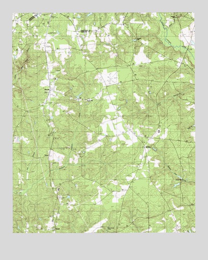
Westville, SC USGS Topographic Map
Click on map above to begin viewing in our Map Viewer.

This topographic map contains these locations and features:
Feature Name Type Latitude Longitude GNIS ID View Map
Barfield MillPopulated PlaceN34.4840°W80.5298°1231026View Map
Baron DeKalb High School (historical)SchoolN34.3996°W80.5937°1235005View Map
Baron DeKalb SchoolSchoolN34.4002°W80.5934°1244968View Map
Belmont Baptist ChurchChurchN34.4535°W80.5984°1235012View Map
Bethany ChurchChurchN34.4624°W80.5942°1246767View Map
Bowers PondReservoirN34.4827°W80.5012°1239425View Map
Bowers Pond Dam D-2499DamN34.4852°W80.5015°1239424View Map
Campbells Mill (historical)LocaleN34.4113°W80.5990°1235047View Map
Campbells Plantation (historical)LocaleN34.4113°W80.5990°1235048View Map
Church of GodChurchN34.4340°W80.5459°1235061View Map
ClyburnPopulated PlaceN34.4188°W80.5992°1221652View Map
Damascus ChurchChurchN34.4488°W80.6054°1235072View Map
DekalbPopulated PlaceN34.3774°W80.5959°1247505View Map
Dekalb Baptist ChurchChurchN34.3774°W80.5976°1235073View Map
Gaston MillPopulated PlaceN34.4513°W80.5795°1231308View Map
Gates Ford BranchStreamN34.4902°W80.5181°1247878View Map
George West PondReservoirN34.4852°W80.5931°1239462View Map
George West Pond Dam D-1332DamN34.4852°W80.5931°1239461View Map
Houghs BridgeBridgeN34.4790°W80.5051°1235108View Map
Jordan MillPopulated PlaceN34.4071°W80.5076°1231438View Map
Kershaw Airport (historical)AirportN34.4865°W80.5973°1253356View Map
Kershaw County Fire Department North Central StationBuildingN34.4286°W80.5303°2578806View Map
Kershaw County Fire Department WestvilleBuildingN34.4565°W80.5984°2578424View Map
Kirkley MillPopulated PlaceN34.4979°W80.5123°1246261View Map
Lindenzwiegs PondReservoirN34.4993°W80.5717°1239209View Map
Lockhart Church (historical)ChurchN34.3988°W80.5465°1253357View Map
Lockhart Oil FieldPopulated PlaceN34.4235°W80.5345°1246449View Map
Lockhart SchoolSchoolN34.3988°W80.5448°1224093View Map
Long Branch ChurchChurchN34.3902°W80.5315°1224161View Map
McLeans Branch CemeteryCemeteryN34.4063°W80.5123°1235147View Map
North Central High SchoolSchoolN34.4327°W80.5248°1235162View Map
Oak Ridge ChurchChurchN34.4932°W80.5484°1253359View Map
Oakridge SchoolSchoolN34.4940°W80.5434°1225147View Map
Refuge ChurchChurchN34.4182°W80.5356°1235194View Map
Truesdale SchoolSchoolN34.4271°W80.6248°1227222View Map
WestvillePopulated PlaceN34.4568°W80.5990°1227511View Map
Westville Lookout TowerTowerN34.4665°W80.5940°1235244View Map
Westville School (historical)SchoolN34.4454°W80.6042°1235245View Map

Note: Coordinates in the location and feature list above are referenced to NAD83 datum.


Copyright (C) 2008-2025 Ryan Niemi / Sunset Dynamics ... All Rights Reserved