TopoQuest Logo
Do you find TopoQuest useful?
Help keep TopoQuest running and adding new maps/features by donating!
Bitcoin:  19c7KJd3qBynnjoSw5npx9KScwjBe4ifkT
Litecoin:  LXs6TkuXGGXo1vDsWCkWVdjQX94eUKd6ui
Home View Maps Find Maps Find Places Resources & Links


Helena, Ohio Topographic Map

USGS Map Title: Helena, OH
USGS Map MRC: 41083C3
DRG (GeoTIFF) Download: o41083c3.tif


Neighboring USGS Topographic Map Quads:


  Pemberville, OH  
41083D4
 

  Elmore, OH  
41083D3
 

  Lindsey, OH  
41083D2
 

  Bradner, OH  
41083C4
 

  Helena, OH  
41083C3
 

  Fremont West, OH  
41083C2
 

  Fostoria, OH  
41083B4
 

  Bascom, OH  
41083B3
 

  Tiffin North, OH  
41083B2


Map MRC Location:

N42°
W84°
N42°
W83°
H8 H7 H6 H5 H4 H3 H2 H1
G8 G7 G6 G5 G4 G3 G2 G1
F8 F7 F6 F5 F4 F3 F2 F1
E8 E7 E6 E5 E4 E3 E2 E1
D8 D7 D6 D5 D4 D3 D2 D1
C8 C7 C6 C5 C4 C3 C2 C1
B8 B7 B6 B5 B4 B3 B2 B1
A8 A7 A6 A5 A4 A3 A2 A1
N41°
W84°
N41°
W83°

Helena, OH USGS 1:24K Topographic Map Preview:
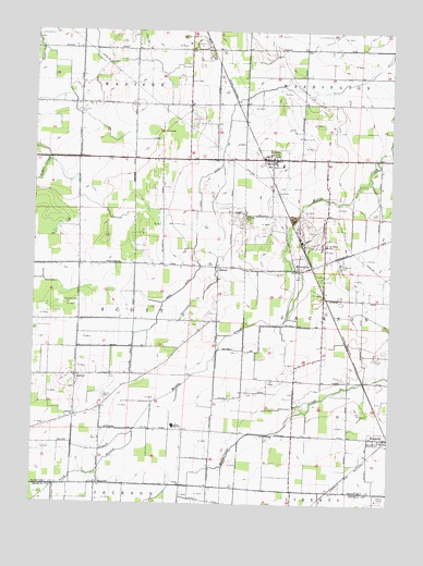
Helena, OH USGS Topographic Map
Click on map above to begin viewing in our Map Viewer.

This topographic map contains these locations and features:
Feature Name Type Latitude Longitude GNIS ID View Map
BurgoonPopulated PlaceN41.2676°W83.2516°1056740View Map
Burgoon Post OfficePost OfficeN41.2681°W83.2513°2044075View Map
Burgoon United Methodist ChurchChurchN41.2676°W83.2513°1067695View Map
Canaan ChurchChurchN41.2551°W83.3230°1038788View Map
Flechtner DitchCanalN41.3039°W83.3185°1070748View Map
GirtonPopulated PlaceN41.2837°W83.3596°1048786View Map
Girton Church of GodChurchN41.2834°W83.3599°1073214View Map
Girton Post Office (historical)Post OfficeN41.2834°W83.3596°2056986View Map
Gries DitchCanalN41.3189°W83.3191°1041184View Map
HelenaPopulated PlaceN41.3412°W83.2916°1065690View Map
Helena Community Volunteer Fire DepartmentBuildingN41.3415°W83.2946°2549633View Map
Helena Post OfficePost OfficeN41.3417°W83.2916°2044078View Map
Lakota High SchoolSchoolN41.2703°W83.3258°1042402View Map
Metzgar CemeteryCemeteryN41.3262°W83.3019°1043241View Map
MillersvillePopulated PlaceN41.3120°W83.2813°1048977View Map
Millersville Post OfficePost OfficeN41.3126°W83.2819°2044080View Map
Mud Creek PrairieAreaN41.2820°W83.3194°1067210View Map
North Branch Muddy CreekStreamN41.2689°W83.3396°1066112View Map
Ottawa PrairieAreaN41.2667°W83.3499°1067212View Map
Pfizer State ParkParkN41.3703°W83.3171°1056112View Map
Quinshan CemeteryCemeteryN41.3536°W83.3597°1044832View Map
Ritter Wildlife AreaParkN41.3201°W83.3035°1960344View Map
Saint Marys Catholic ChurchChurchN41.3187°W83.2724°1067694View Map
Saint Marys CemeteryCemeteryN41.3125°W83.2674°1045658View Map
Saint Marys SchoolSchoolN41.3184°W83.2727°1045688View Map
Scott Township HallBuildingN41.3034°W83.3594°1073217View Map
Shiloh United Methodist ChurchChurchN41.3414°W83.2916°1067693View Map
Smith CemeteryCemeteryN41.2890°W83.2550°1046370View Map
South Branch Muddy CreekStreamN41.2692°W83.3396°1037291View Map
SquiresPopulated PlaceN41.2553°W83.3516°1049205View Map
Squires Post Office (historical)Post OfficeN41.2556°W83.3513°2057002View Map
TinneyPopulated PlaceN41.3128°W83.3113°1061691View Map
Tinney Post Office (historical)Post OfficeN41.3126°W83.3110°2057006View Map
Township of MadisonCivilN41.3739°W83.3586°1086913View Map
Township of ScottCivilN41.2978°W83.3601°1086917View Map
Trinity CemeteryCemeteryN41.2775°W83.3502°1047150View Map
Trinity ChurchChurchN41.2731°W83.3602°1047158View Map
Village of BurgoonCivilN41.2675°W83.2514°2397498View Map
Village of HelenaCivilN41.3404°W83.2920°2398484View Map
White Star Quarry (historical)MineN41.3714°W83.3175°2564637View Map

Note: Coordinates in the location and feature list above are referenced to NAD83 datum.


Copyright (C) 2008-2025 Ryan Niemi / Sunset Dynamics ... All Rights Reserved